How a startup easily adopted EIVA’s survey software for their autonomous offshore USV
‘The combination of sensors and software on our USV yielded really nice multibeam echo sounder and LiDAR data. The sea trials went well – from the patch test to the final data results,’
Douglas Nemes
TideWise
Did you know that unmanned surface vehicle (USV) manufacturers can quickly adopt EIVA’s hydrographic survey software NaviSuite Kuda thanks to its intuitive design and modular architecture?
Up to the challenge of providing a startup with extended survey capabilities
Recently, Brazilian startup company TideWise was looking to equip their USV Tupan with advanced sensors. Their goal was to increase efficiency of underwater inspections, as well as to enable highly accurate seabed surface positioning and coverage – so users of their USV can meet IHO S-44 Special Order requirements. TideWise turned to EIVA for all they needed to give their autonomous USV these extended survey capabilities and it was smooth sailing from there!
In this case study, you can learn about TideWise’s successful startup journey; how they avoided large investments before they were ready, as well as how they prepared for and performed sea trials in Brazil collecting and displaying MBE and LiDAR data in NaviSuite Kuda Core + Processing.
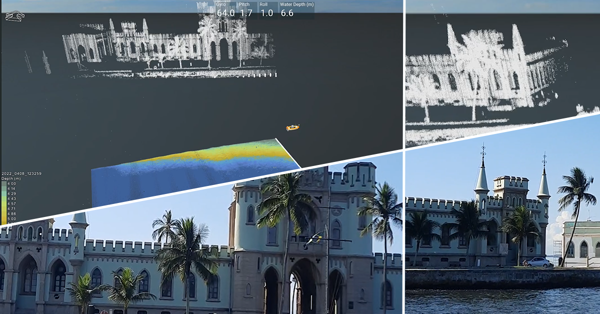
Check out video footage and software views from TideWise’s sea trials of NaviSuite Kuda Core onboard their Tupan USV
TideWise leveraged EIVA’s cost-effective software and hardware offerings
As a startup USV manufacturer, it’s a big commitment to select the software and equipment with which to equip your USV. With EIVA’s help, TideWise has been able to avoid making large investments before they are ready – while retaining the ability to later scale up within the same software suite.
Saving on the cost of a sensor payload
TideWise leveraged the EIVA team’s expertise in integrating total hardware/software solutions by renting the sensor payload from EIVA. Rental on a project basis makes sense for startups who would rather focus their energy and funds on developing their own products or remain sensor agnostic (meaning the vessel is open to supporting different sensor setups based on the customers’ needs).
TideWise equipped the Tupan USV with a multi-beam echo sounder from Norbit (w/Narrow Transmit) and a LiDAR from Velodyne. By ordering the total solution of software and sensor payload from EIVA, TideWise could be certain that it all works together smoothly from the get-go.
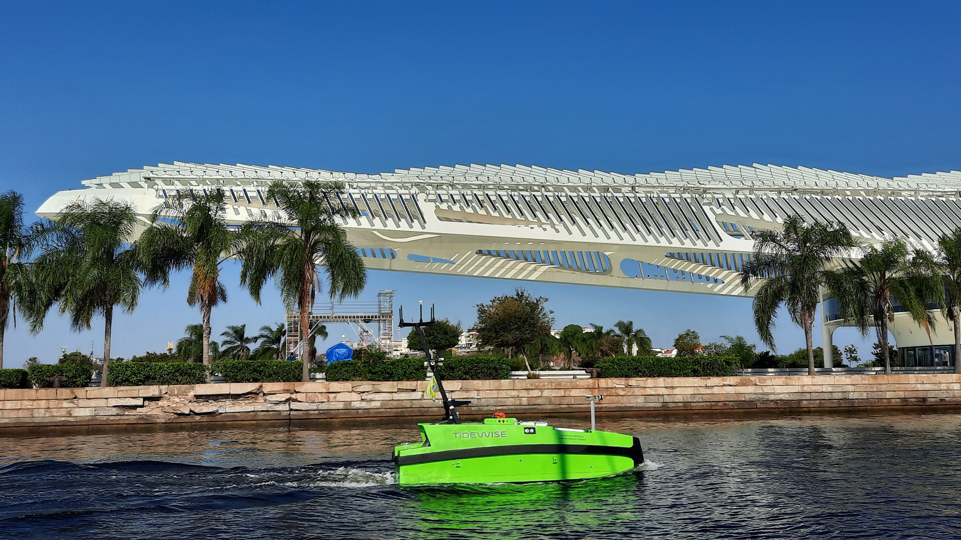
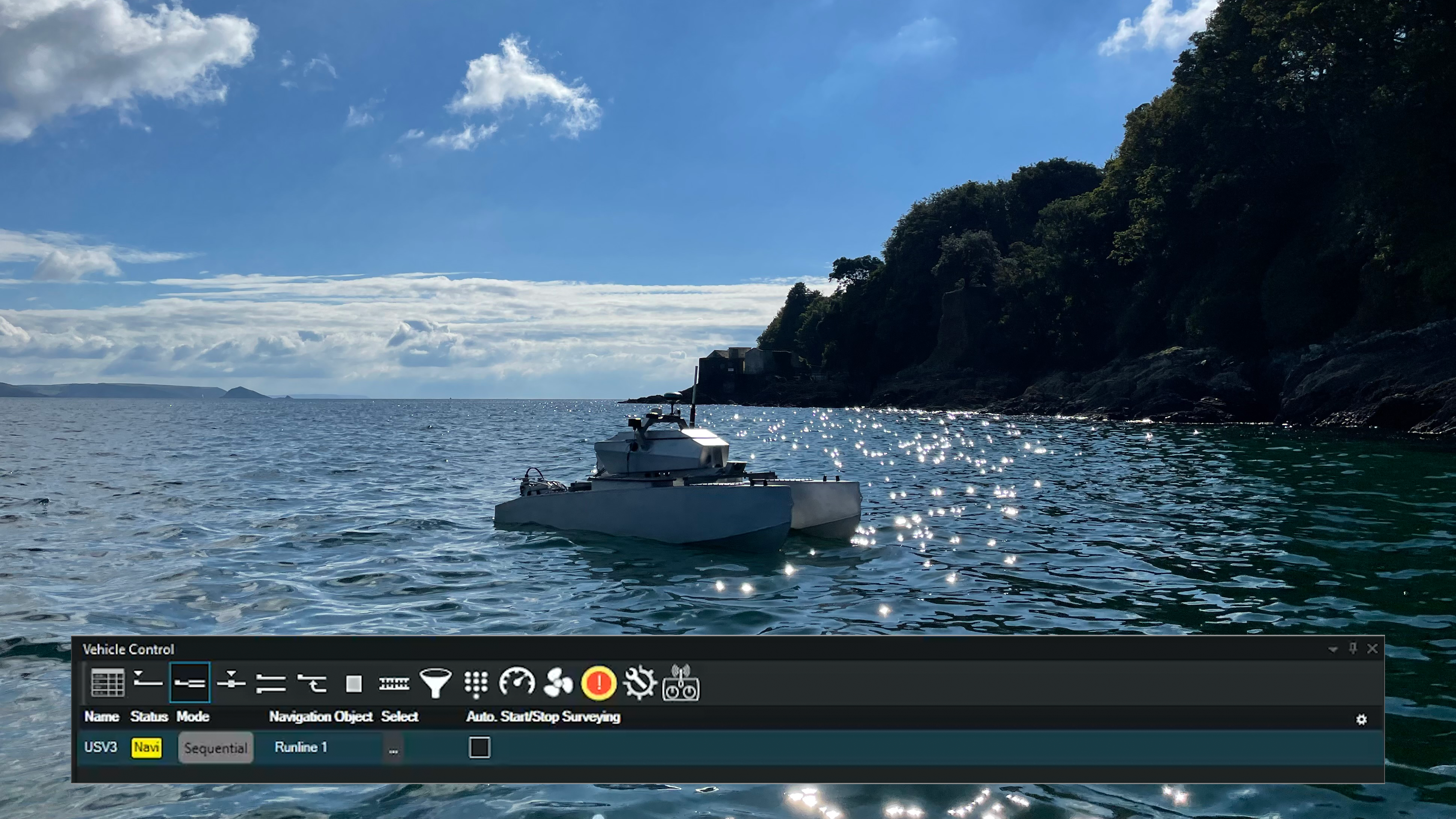
The Tupan USV during sea trials of NaviSuite Kuda Core survey software
Try before you buy – Free for startups for the first year
Before choosing NaviSuite as the survey software provided onboard their USV, TideWise was able to try out the software with a free startup licence. EIVA provides this opportunity to help accelerate the development of new advanced solutions, like TideWise’s USV, by offering a boost: free access to advanced software capabilities designed to assist autonomous operations.
TideWise set sail into the waters of NaviSuite Kuda Core software solution
TideWise’s sea trials were performed by an experienced surveyor at TideWise, Douglas Nemes. Douglas Nemes was able to update his knowledge of the newest version of NaviSuite Kuda, so he could perform the sea trials himself – thanks to EIVA’s eLearning portal and a 1-2 hour training session with EIVA’s survey support and training consultant, Maria Ribeiro.
‘I found the setup configuration user-friendly and easy to adjust as required. It’s very intuitive,’ Douglas Nemes noted when learning to navigate the NaviSuite Kuda Core software. Learn more about this user-friendly interface in a guest blog with another experienced surveyor.
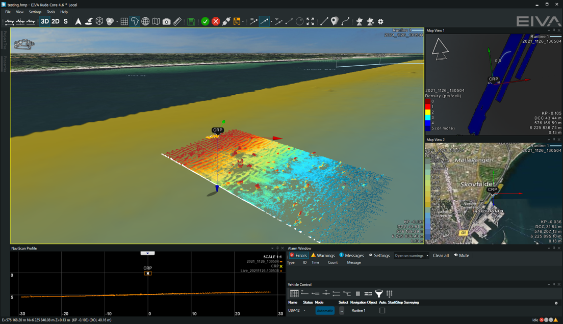
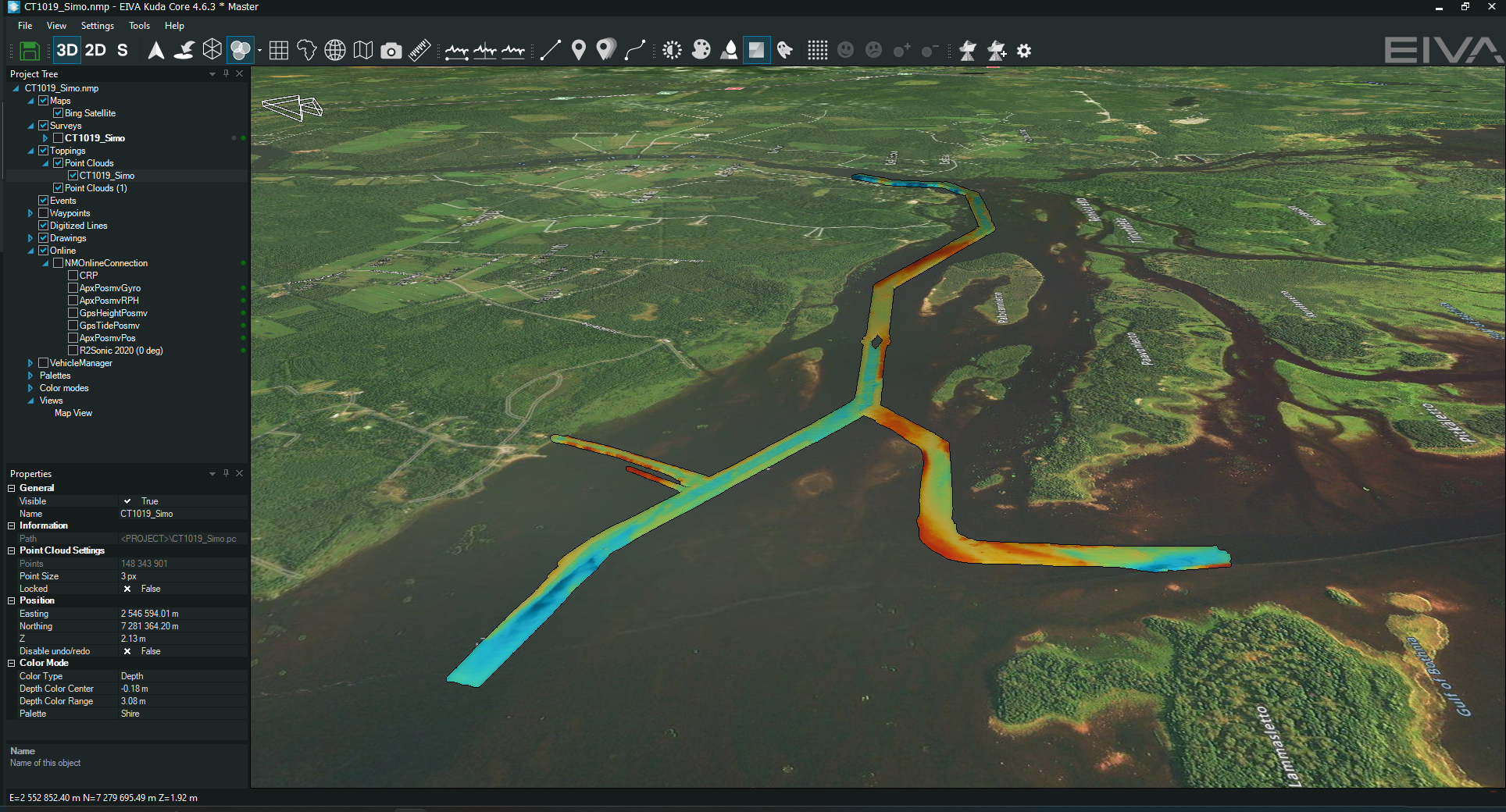
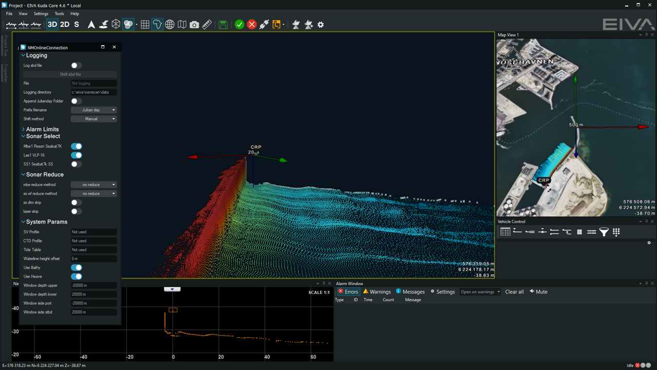
NaviSuite Kuda Core in a customised user interface showing several real-time data views, such as a map, profile and QC view
Benefit for surveyors: Real-time data displays
For optimal operations, remote or otherwise, it is vital to see data displayed in real-time, preferably along with quality control (QC) displays. These displays reveal important details, such as any gaps in the data – so they can be dealt with immediately, conserving time and fuel.
‘One of the things we really like about NaviSuite Kuda Core is the ability to easily make real-time 3D data displays – which enhance the perspective of operators of our USV. NaviSuite’s online interface allows surveyors to immediately view the results – and from any angle.’ Douglas Nemes explained about the benefits of this survey software.
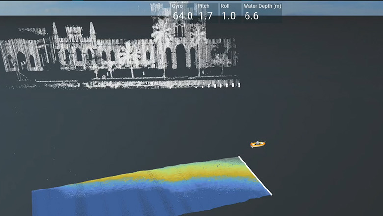
Watch some of NaviSuite Kuda’s software capabilities displayed in action during TideWise’s sea trials in Rio de Janeiro
A common challenge for real-time displays during remote surveys is that many areas have low-bandwidth connection. This was the case during the sea trials, so NaviSuite Kuda’s sonar data compression settings were adjusted to display the results optimally in real time.
In NaviSuite Kuda, data compression settings are highly customisable – the software allows you to choose how much to compress the displayed data both along and across each scanned line, so you can find the right combination for your survey. Of course, the software still logs all data for data processing later – it only compressed the data displayed remotely in real time.
Sonar compression in NaviSuite
Benefit for surveyors: High-end data processing
Through the availability of different variants of NaviSuite Kuda, users get a solution tailored to their needs and budget. TideWise chose NaviSuite Kuda Core + Processing, a variant which provides data processing capabilities for users of their USV. These capabilities are provided in the form of NaviModel, EIVA’s popular 3D modelling and visualisation software, and NaviEdit, EIVA’s data editing software.
‘Data processing in NaviModel is far faster than in any other survey software I’ve used’ – Douglas Nemes, TideWise
Data processing features included in NaviSuite Kuda Core + Processing:
- EC-3D automatic data cleaning
- Workflow Manager for automating data processing steps
- Backscatter mosaicking
- Volume, difference and distance analysis
- Sensor data editing
- Export to GIS and videos
- And more
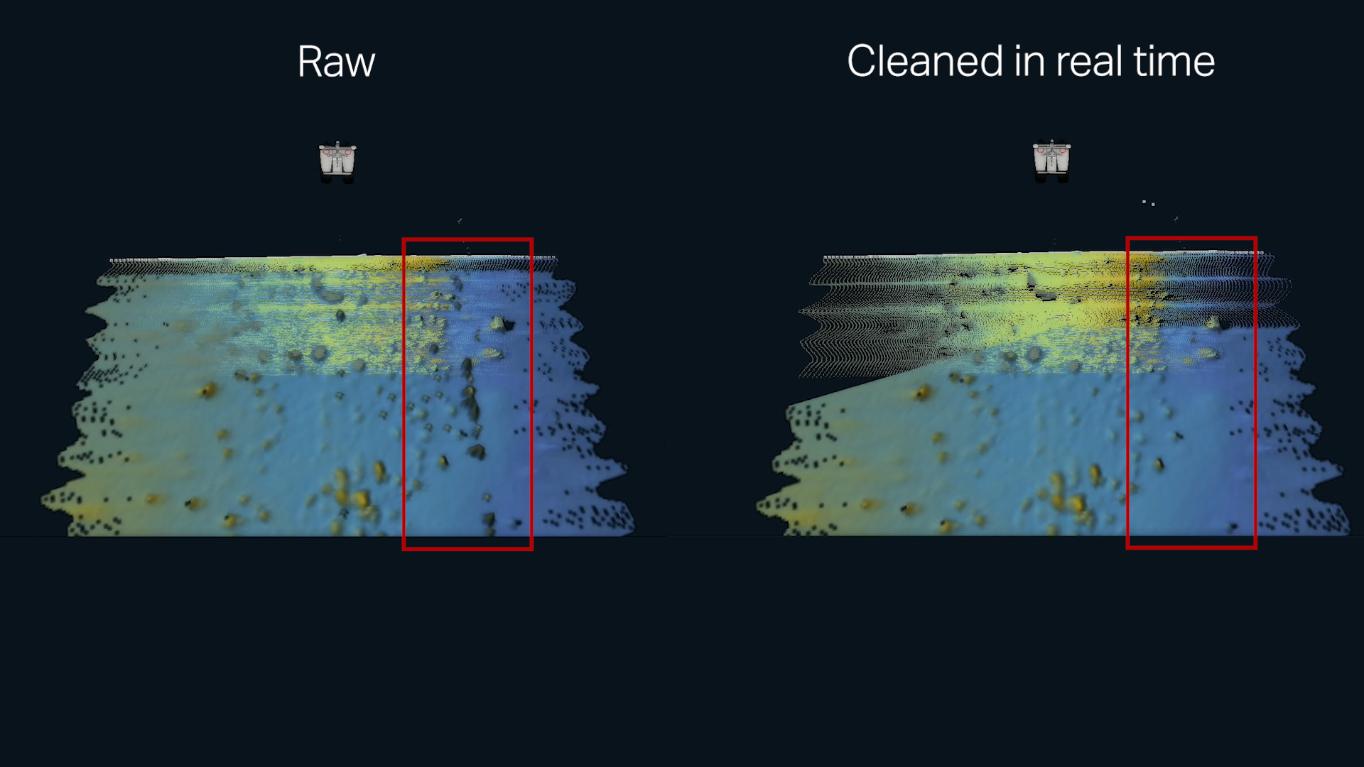
Watch NaviSuite Kuda provide real-time data cleaning of a DTM with EC-3D
Benefit for surveyors: NaviSuite scales up with your growth
Autonomous inspections are an area in rapid growth, so while TideWise is now using the simplified variant of NaviSuite Kuda, it’s possible that they may one day choose to upgrade their USV system – in which case, they will be able to easily upgrade the software to follow that transition.
This could for example be if they were attaching a remotely operated towed vehicle (ROTV) such as EIVA’s small ViperFish ROTV for UXO surveys (in development at the time of writing). In this case, TideWise would simply upgrade their NaviSuite Kuda Core licence to a Pro licence – unlocking the option to also track a subsea object like an ROTV, ROV or AUV via USBL.
Where the resulting USV setup sailed from there
‘The combination of sensors and software on our USV yielded really nice multibeam echo sounder and LiDAR data. The sea trials went well – from the patch test to the final data results,’ – Douglas Nemes, TideWise
TideWise is the first unmanned vessel operator to be registered in the Brazilian Navy Hydrography Center and to get permission to do special-order hydrographic surveys there, allowing collected data to be used to update nautical documents.
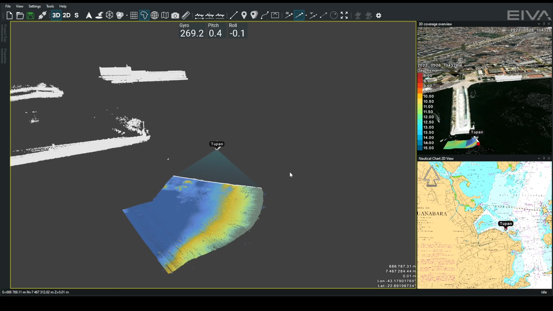
After TideWise performed sea trials in Brazil with success, the Tupan USV was sent on its first demonstration of its capabilities for autonomous offshore asset inspections in support of the offshore wind renewable energy industry! TideWise used the USV solution to successfully survey both cables to and a platform at the MOG offshore power outlet of Elia Group, a European transmission system operator.
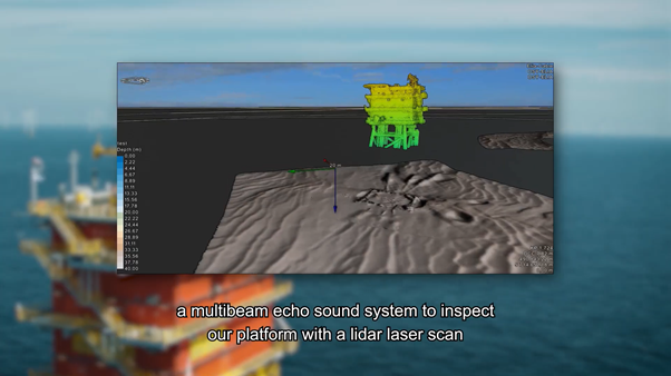
Check out this video on the offshore energy asset inspection project for which TideWise used their Tupan USV with NaviSuite Kuda Core + Processing
Products in play
- NaviSuite Kuda Core + Processing
Software bundle supporting hydrographic surveys all the way from planning and acquisition to data processing and delivery, while enabling automation and remote operations – available in several variants for different budgets and survey setup - Free startup licence
- EIVA eLearning
- Rental sensors: Multi-beam echo sounder (w/Narrow Transmit) and LiDAR
- Tupan USV
.png?mode=crop)