To use this site, please enable javascript
To use this site, please enable javascript
When EIVA released our new entry-level hydrographic software variant, NaviSuite Kuda Core, we reached out to freelance surveyor and consultant, Rich Lear, to ask him to try it out. The EIVA crew works with customers’ feedback as our compass – so we can develop solutions that match real-life requirements.
In this article, Rich shares his thoughts on NaviSuite Kuda Core – diving into the impact of the new simplified user interface, the capabilities of the software and the pricing options.
Rich Lear is a super-user of NaviSuite, EIVA’s advanced, multipurpose suite of software products for virtually any sonar and sensor survey or engineering operation carried out by offshore and shallow water professionals.
His experience comes both from his 20 years of experience working with underwater acoustic solutions at Teledyne Reson, as well as his eight years at DOF Subsea providing internal training in surveying with NaviSuite – on topics ranging from basic geodesy to advanced data processing.
Two years ago, Rich Lear left DOF Subsea to work as a consultant and freelance surveyor. His opinions on NaviSuite Kuda Core therefore come both from his perspective as an expert NaviSuite software user, but also a freelance surveyor with a single, small vessel setup – the kind that NaviSuite Kuda Core is optimised for.
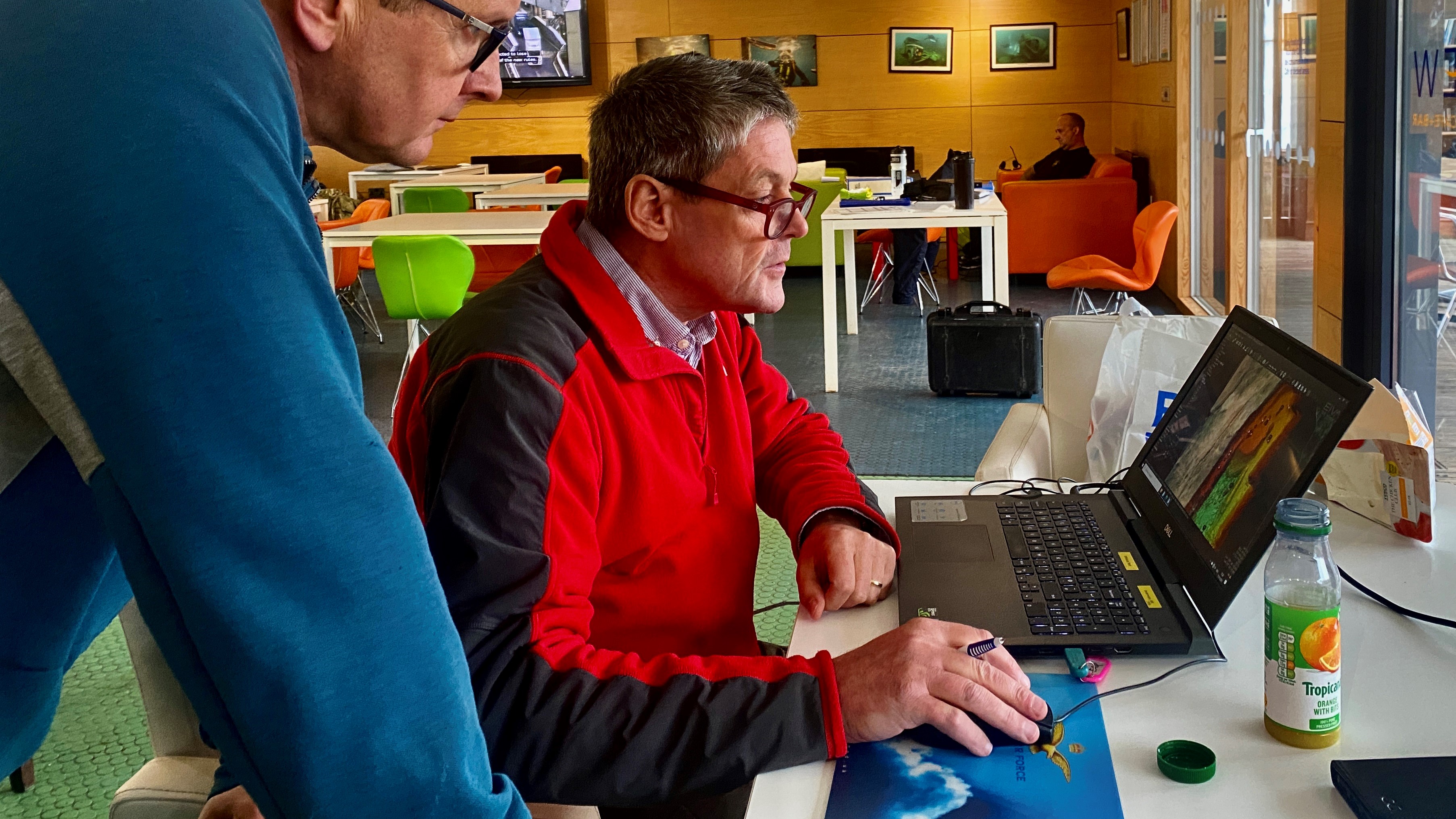
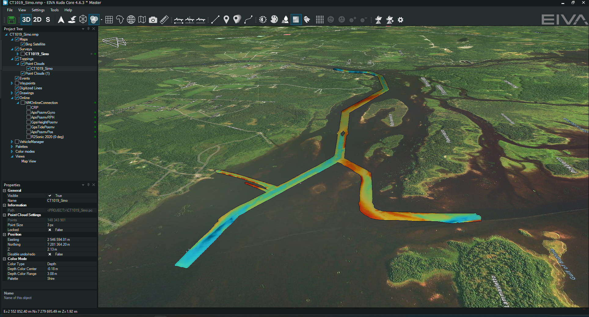
Rich Lear processing data in NaviSuite
I am happy to see that this new variant makes NaviSuite’s extensive software capabilities more easily accessible and intuitive to use for hydrographic surveys – both by tailoring the user interface and offering a variety of pricing options.
Before this variant, NaviSuite Kuda was already a survey software with great capabilities – but the interface looked ‘geeky’ and unnecessarily complex for many hydrographic surveyors’ needs. That same complexity is due to one of the great things about NaviSuite, namely you can do pretty much anything in NaviSuite: data acquisition, navigation, visualisation, post-processing and more. This is also one of the reasons why big contractors like DOF Subsea often require survey results to be delivered in EIVA’s data format.
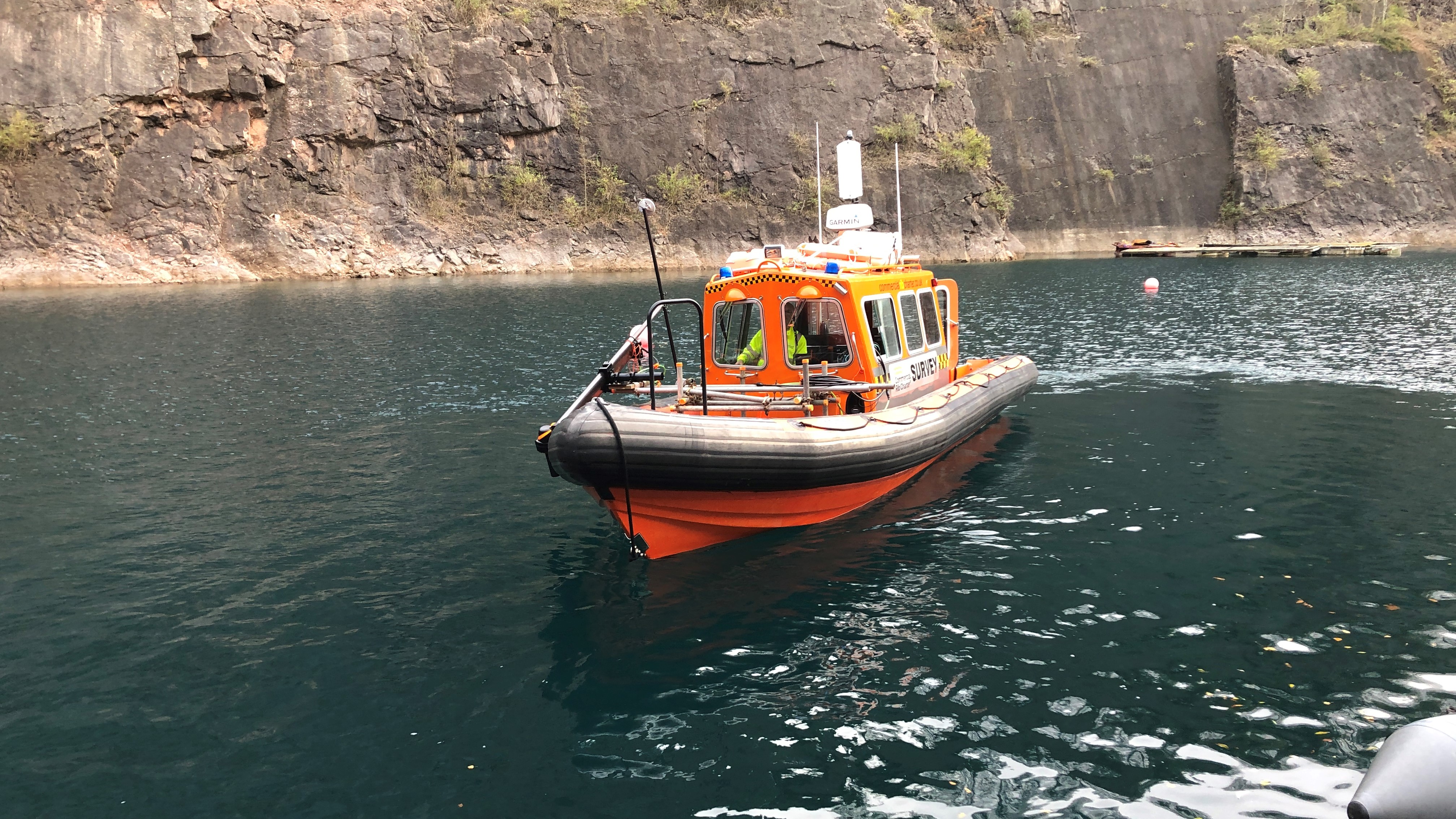
A survey vessel which Rich Lear recently used for a project – it is fitted with a NORBIT iWBMS multi-beam with integrated INS and a NORBIT iLiDAR laser scanner, while navigation and acquisition were using NaviPac and NaviScan with all data processed and delivered using NaviEdit and NaviModel
As I explored NaviSuite Kuda Core’s slimmed down, streamlined user interface, it was apparent that when performing a survey in this new interface, you can see all the information you need displayed in real-time, in a single window. One would think this means a lot of information in a small space, but the interface is redesigned so it only shows the information you need – while the ‘engine is under the hood’ so to speak. I think many surveyors will appreciate this simplified setup, since it means you have easy access to the information you need without any other data distracting you.
When I saw this, I thought ‘wow, this was just what I needed during my last project’. The possibility of real-time data displays will let me react quickly to any problems during a survey, such as gaps in the collected data – especially because of the extensive list of data display tools in NaviSuite which I can use to quality check (QC) data. Seeing these displays in real-time without having to switch application windows, as was previously the case, will help me perform more efficient surveys.
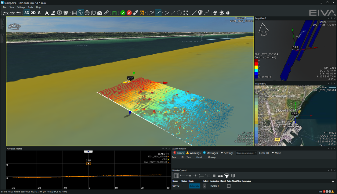
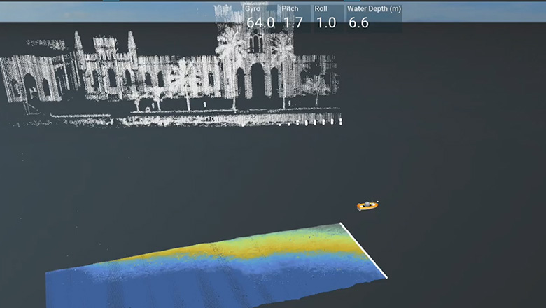
Rich Lear’s typical survey setup is to map multi-beam echo sounder depth in one view and display some kind of QC in another – that way he can see where he has and hasn’t been, and whether the data collected there was sufficient or not
It’s clear that despite the interface being slimmed down to a level of simplicity comparable to other popular hydrographic survey software solutions, NaviSuite Kuda Core keeps the advanced functionality of EIVA’s well-tested and advanced NaviSuite software tools. Based on my experiences, these are some of the benefits that come with using solutions in the NaviSuite software family…
There are countless tools in NaviSuite, which have been used and improved for years, decades even – this long history making them really reliable and well-integrated. For example, I know the patch test for multi-beam calibration has been used by DOF Subsea for the past 10 years.
NaviSuite Kuda Core comes in a variant that includes post-processing tools, which is fairly unique compared to many other hydrographic survey software solutions. Not all hydrographic surveyors need them, but I find tools for post-processing can really save your day – by saving your data. After all, these tools mean that if you have a less than optimal setup, it’s not fatal for your results. For example, if you mismeasured a sensor offset and didn’t notice it until after the survey, you can use post-processing tools from NaviSuite to fix the error in your data – so you don’t have to redo the survey.
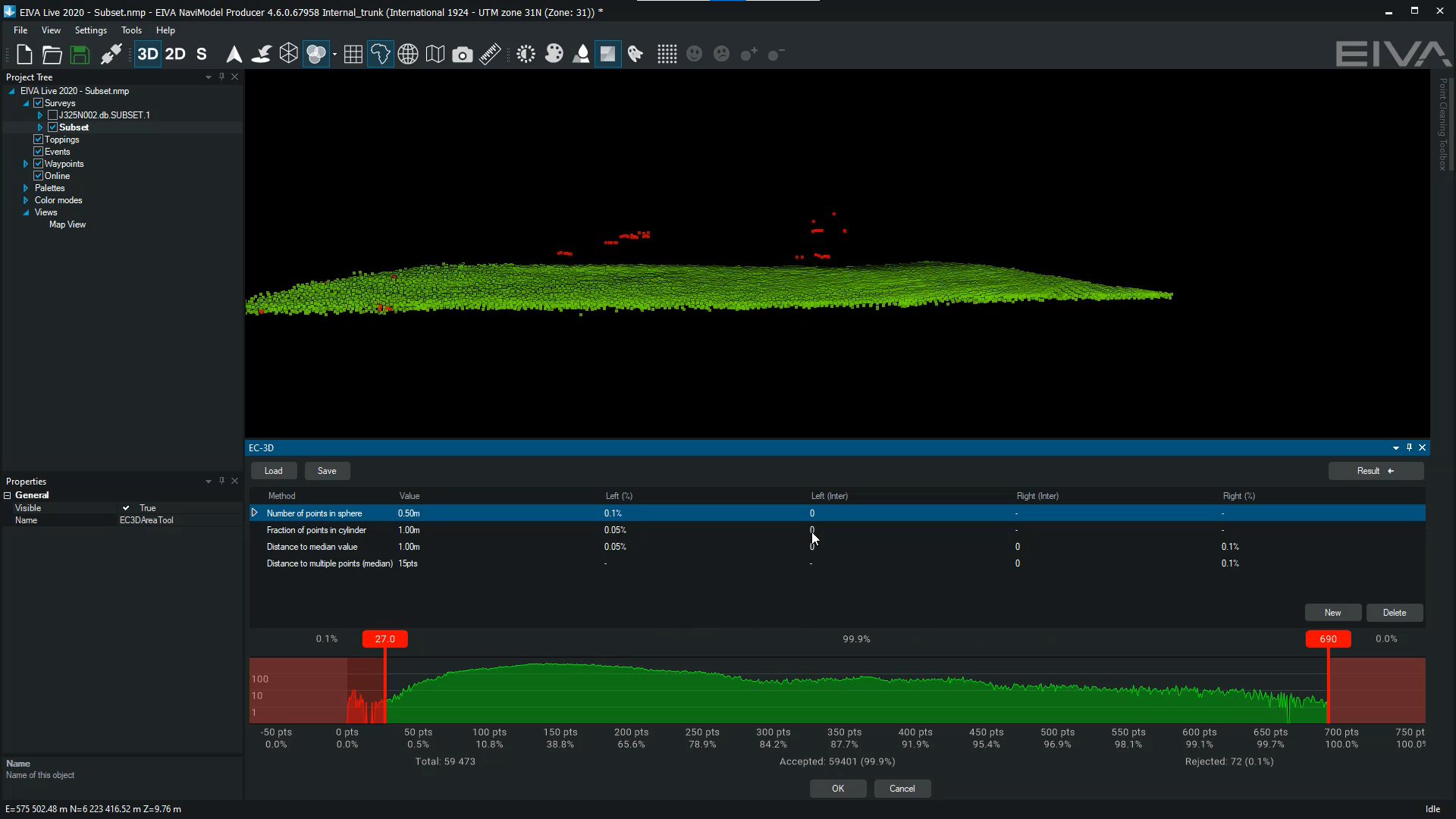
Check out the EC-3D automatic data cleaning tool, one of many data processing tools in NaviSuite
NaviSuite’s software development team is always developing useful new features, often based on customer inputs. When playing around with NaviSuite Kuda Core, I noticed some new handy tools I look forward to trying. For example, in the automatic survey route planning tool, you can now define exclusion zones (in addition to the boundary, turn radius, distance between and angle of runlines). This should save time, for example during harbour surveys, because now I don’t have to manually steer around obstacles, like a docked vessel or construction area – but can factor them into the runline planning.
The annual subscription of NaviSuite Kuda Core is very reasonably priced. Especially since it offers more software capabilities, such as automation and remote control, than other solutions in that price range.
It’s also possible to purchase daily subscriptions (with volume discounts per month). This flexibility in the pricing options makes it affordable for project-based freelancers like me to use NaviSuite too.
To sum it up, I think this new hydrographic survey software variant will be a big hit because it provides reliable and advanced software capabilities at an affordable price – and in a user interface that is tailored for hydrographic surveys. I’m looking forward to using it for future projects.
Thanks for diving into Rich Lear’s thoughts on NaviSuite Kuda Core! The EIVA crew is always happy to hear our users’ feedback. Please feel free to reach out and share with us your experiences with our solutions.