To use this site, please enable javascript
To use this site, please enable javascript
Introducing NaviSuite Kuda Core! This new software variant is tailored to support hydrographic surveys with a single USV or small survey vessel using multi-beam echosounder (including backscatter), LiDAR and/or camera. It is…
In addition to this entry-level variant, the list of bundle variants includes NaviSuite Kuda Pro, which supports more complex survey spreads at a reduced price. Since these variants are all part of one big NaviSuite family, you can easily upgrade between different variants if you scale up your operations! Meaning you can go from a single vessel setup to a large network installation – without changing software.
With NaviSuite Kuda, you can benefit from EIVA’s decades of experience developing and delivering hydrographic survey solutions. This software yields precise survey data, thanks to high-performance sensor data acquisition and processing, with which you can then create high-quality 3D visualisations of survey results.
Not only do you get high quality deliverable results, but you can improve the efficiency of your surveys with software tools for…
Sail on to see these features in action…
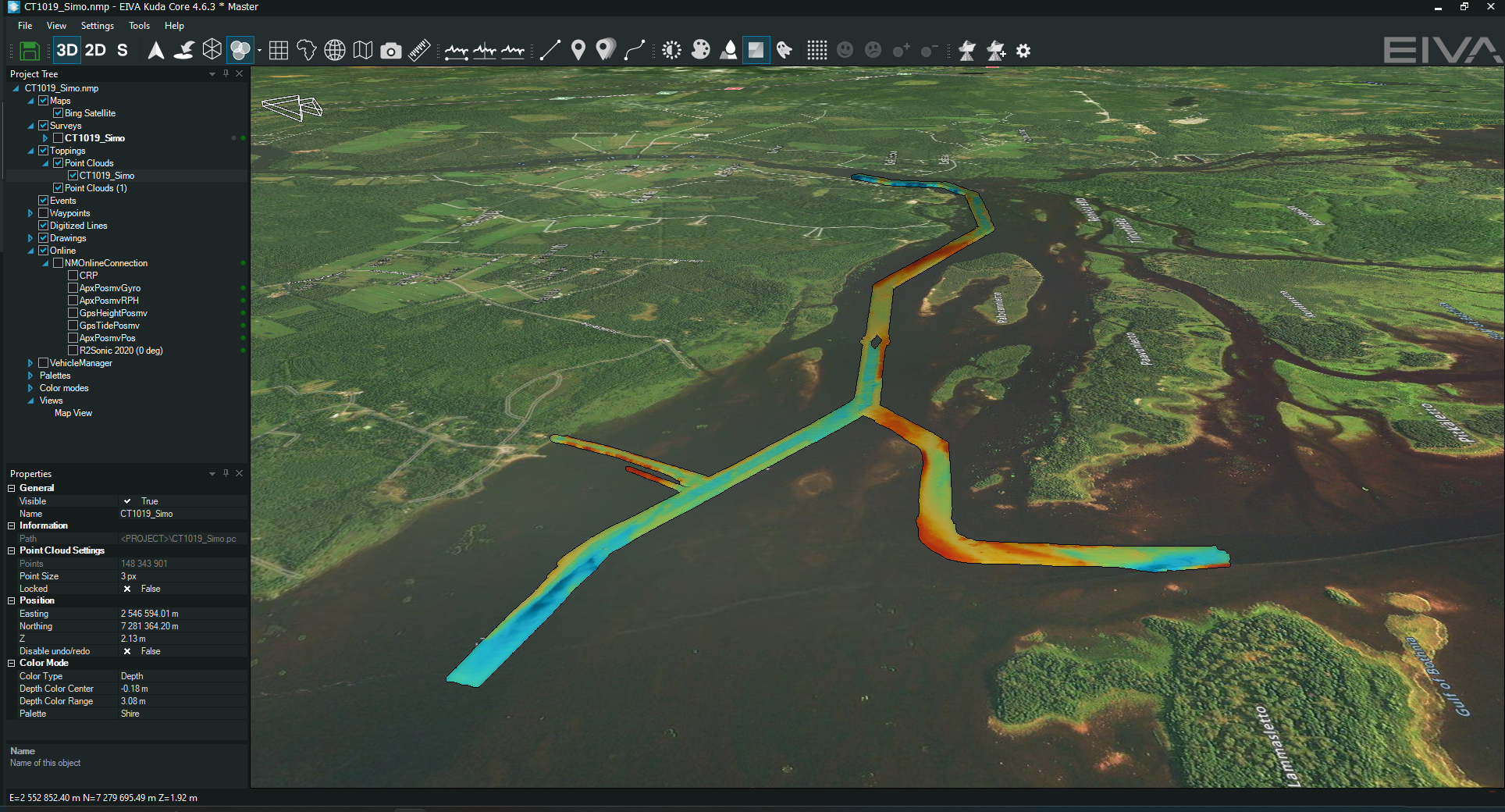
NaviSuite Kuda lets you present your high-quality results beautifully with advanced 3D modelling software! Dive into this customer case study to see how NaviSuite Kuda quickly created deliverable data from a harbour inspection…
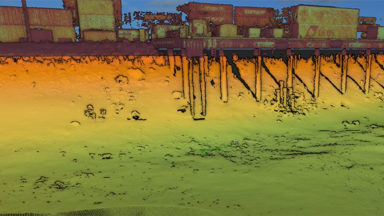
Hydrographic survey inspection of the Port of Moss harbour using NaviSuite Kuda software
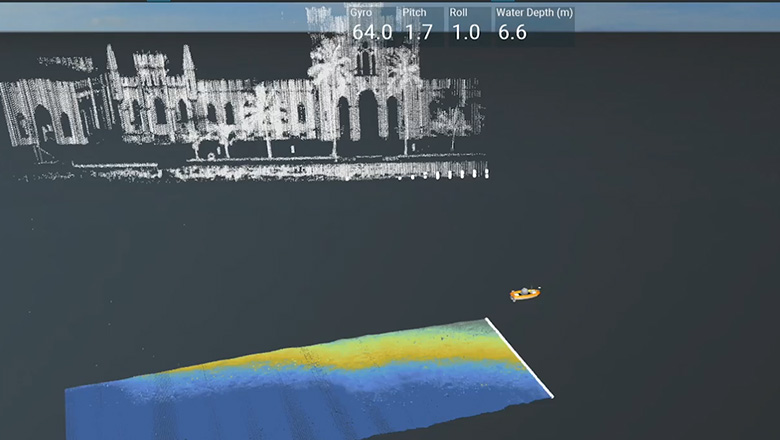
With NaviSuite Kuda, you can set up remote control of your operations from the office. Simply connect this software to your USV or manned vessel’s autopilot, and it can steer your vessel for you. You can then monitor the mission, change settings, change routes/runlines and process data while you sail – all from NaviSuite Kuda’s intuitive interface
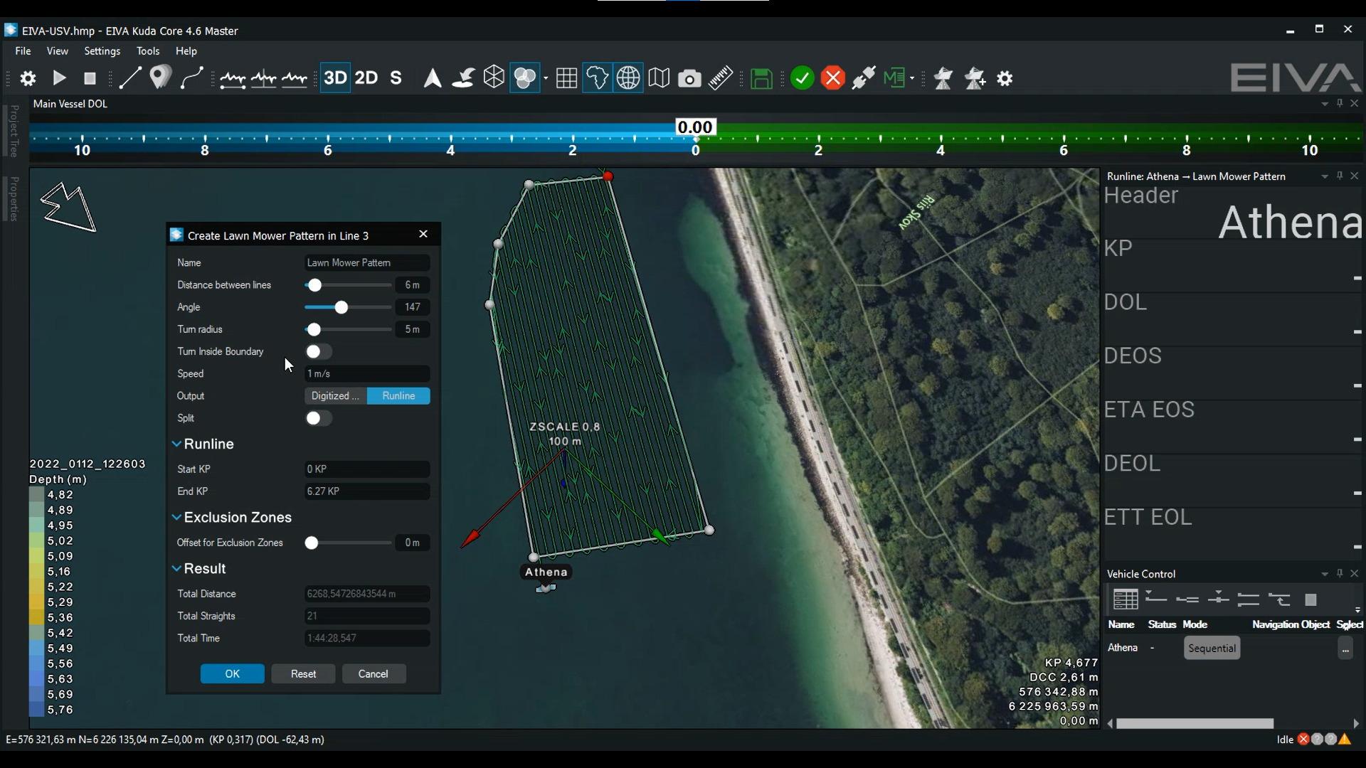
Generating a runline plan by defining a survey area and width of runlines – these runlines can then be inputted to an NMEA autopilot
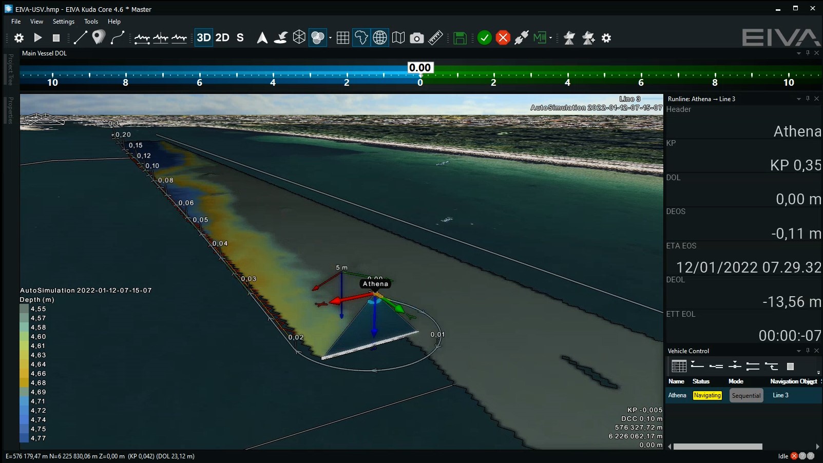
You can also improve your coverage during surveys in real time – with the Coverage Assist tool! This advanced tool takes into consideration how factors such as the weather influence your coverage. It plans runlines in real time during the survey based on the previous surveyed line, as well as the optimal route for turning.
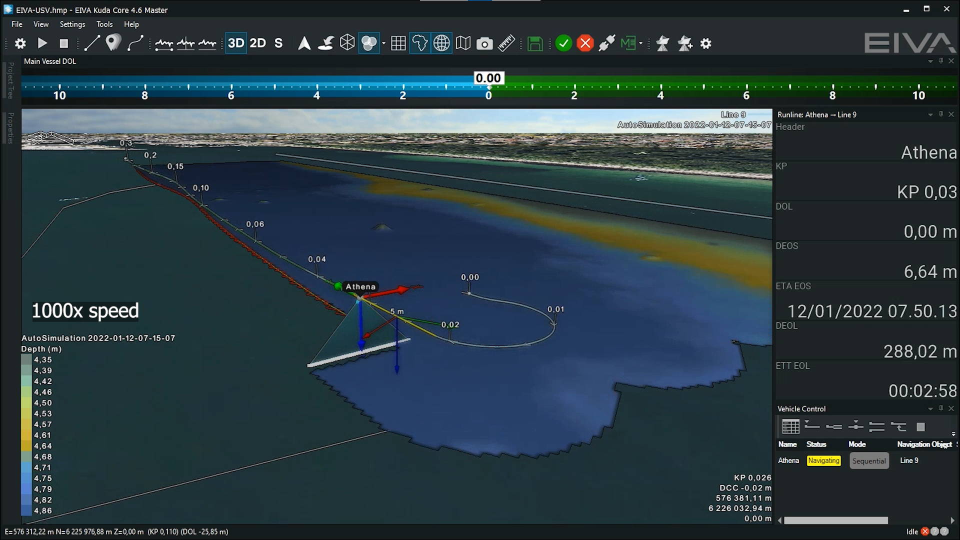
The Coverage Assist tool in action – Using the survey results of the previous runline to plan the next runline optimally
Removing noise from your data can be a tedious task, but EIVA’s automatic data cleaning tool, EC-3D, automates the process so you can clean data as efficiently as possible. Not only does this tool let you use a variety of cleaning methods, but you can combine them in customisable configurations. You can then save these configurations and load them on different data sets from a survey.
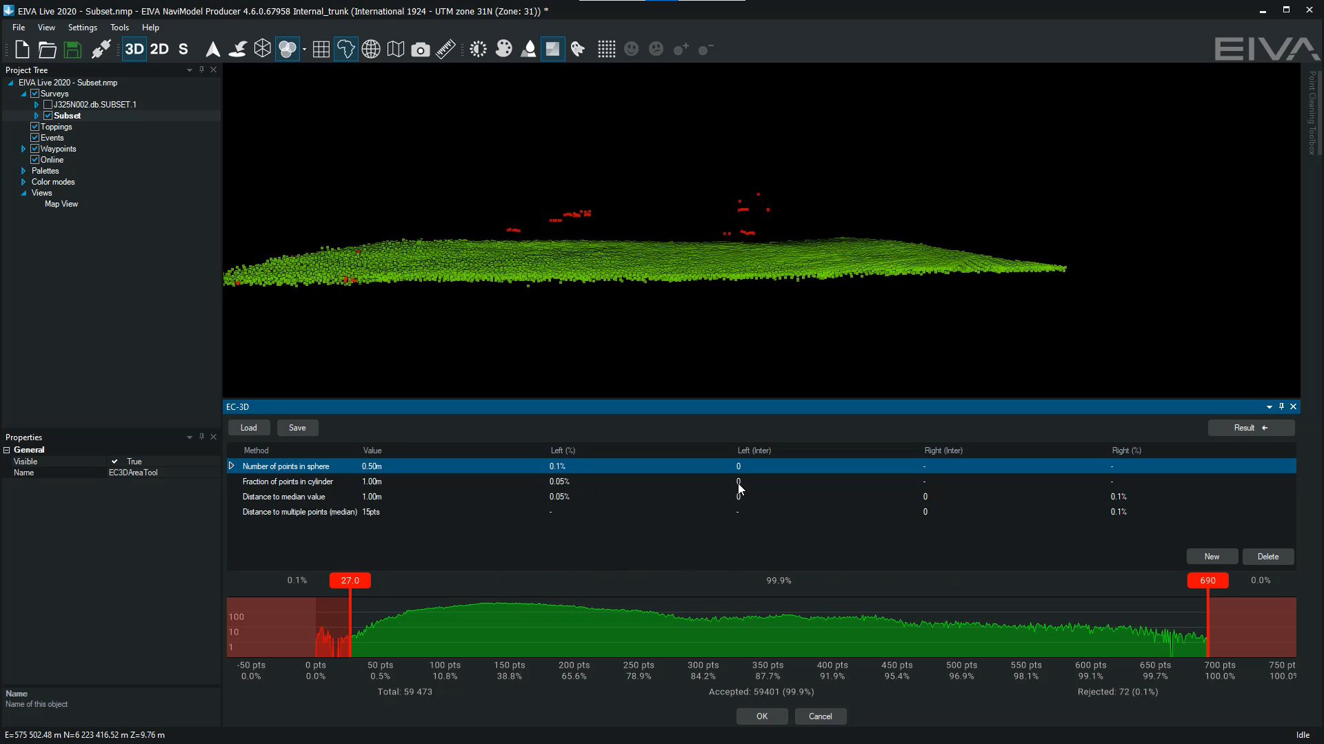
Check out this EC-3D data cleaning of a DTM using four different methods
You can also run EC-3D data cleaning configurations automatically in real-time onboard your vessel, thereby supporting onboard processing.
Want to process your survey data? There are variants for that!
You can get access to advanced data processing tools by choosing + Processing variants (NaviSuite Kuda Core + Processing or NaviSuite Kuda Pro + Processing). These tools include backscatter and sidescan mosaicking, GPS height processing, volume and difference calculation, and exporting to GISs.
With the + Processing variants, not only do you get a wide variety of processing tools, but also a workflow automation tool! You can save time and avoid doing menial tasks manually by using NaviSuite Workflow Manager to automate your data processing workflow. This tool can also be used for enabling autonomous operations through automatic onboard processing.
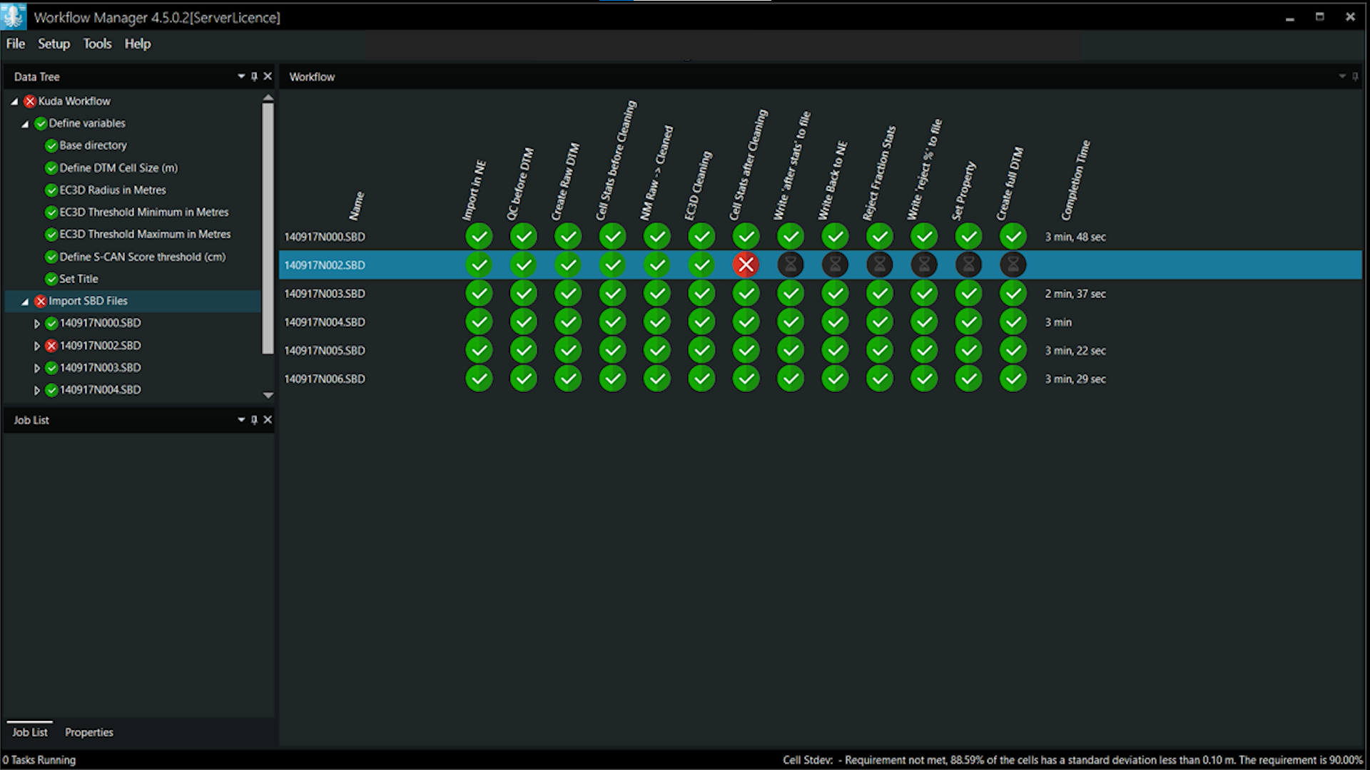
NaviSuite Workflow Manager in action – Showing the possibilities of this automatic data processing tool
The extensive list of advanced features in NaviSuite means that if you scale up your operations, your software can easily scale up with you. You can start small and grow, while using the same software!
If you start out using NaviSuite Kuda Core for single, small vessel surveys, it will be easy to upgrade to NaviSuite Kuda Pro when you have a more complex survey spread, such as multivessel operations with many work positions. With NaviSuite Kuda Pro, you get similar features to NaviSuite Kuda Core, however you can have an unlimited number of remote displays (as opposed to one local and one remote) and can track a subsea vehicle (ROTV, ROV etc) via USBL.
Find out which package is right for you by checking out the product comparison table at the bottom of the product pages. This table provides an overview of which features are included in which NaviSuite Kuda variants.
If you have any questions, feel free to reach out to the EIVA crew.