To use this site, please enable javascript
To use this site, please enable javascript
Remote surveys have seen a surge forward in many maritime industries – likely due to the many benefits they provide. Whether on unmanned or manned vessels, remote surveys help address the low availability of trained surveyors by allowing surveyors to work all over the world from wherever they are. In addition, operations with unmanned vehicles are low-cost, low-fuel and can reach more places – in part thanks to the fact that they can be lighter and smaller than traditional ones. This enables the industry to work toward understanding our oceans more fully for developing ocean resources and managing coastal zones – while at the same time lowering the carbon footprint of these surveys.
In this article, we will dive into the software capabilities which survey solutions must provide for efficient and safe remote operations and show tools you can use for a variety of survey types – allowing you, the survey professionals, to make use of said capabilities! The article is written based on the experiences of EIVA, a maritime software and hardware engineering company with over 40 years in the industry, as it has worked these past years to develop remote and automated survey solutions.
Firstly, for remote surveys to be viable, operators need reliable remote monitoring of survey operations and safe vehicle control. To provide these, the EIVA team has worked closely with customers and partners, developing and testing integrated solutions with the following key capabilities:
EIVA incorporates these remote survey capabilities into solutions for three main types of survey setups: unmanned surface vehicles (USV), remotely operated vehicles (ROV) and autonomous underwater vehicles (AUV).
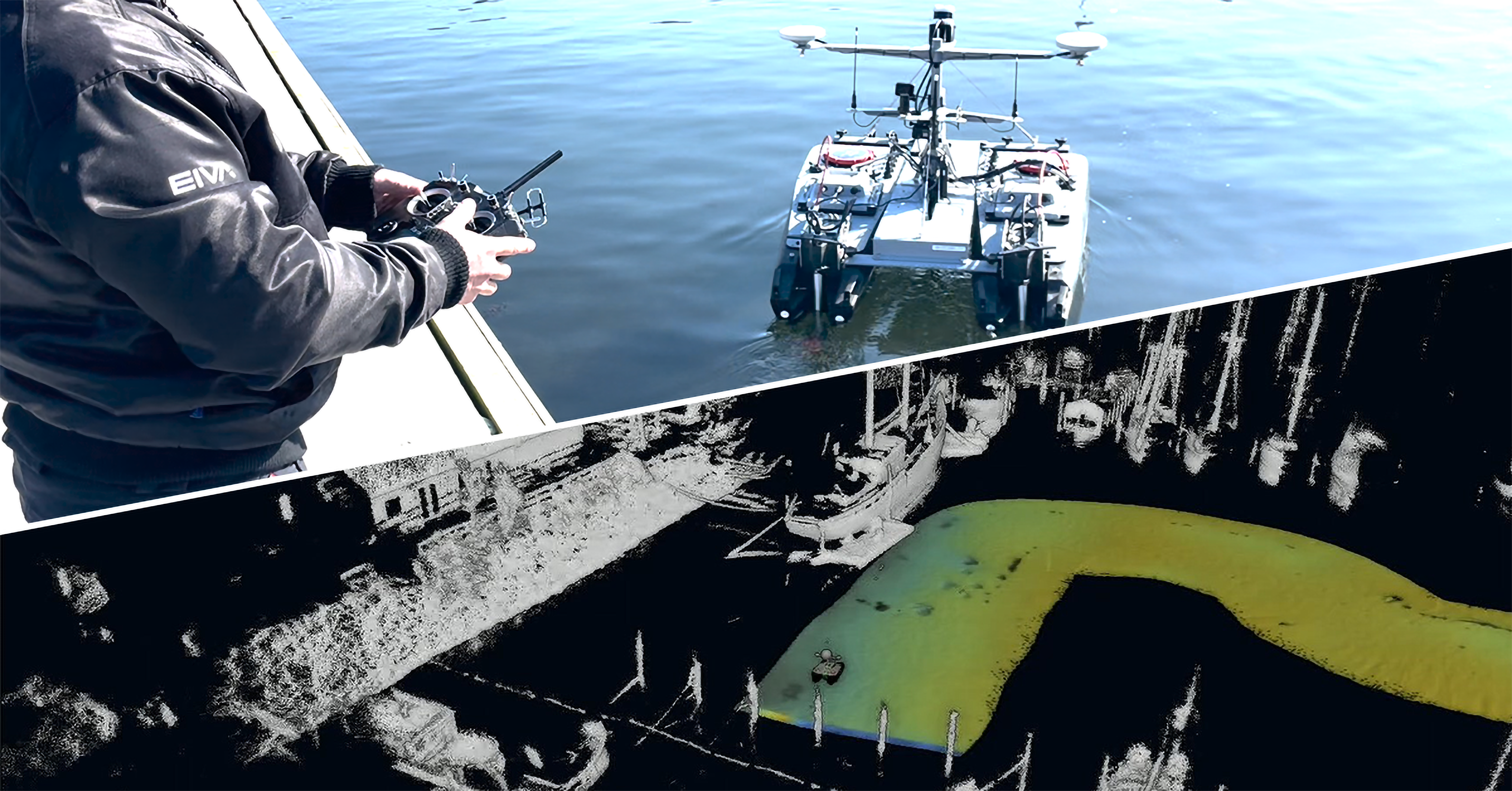
Each of these setups complements each other by being designed for surveys of different challenging environments/structures. For example, ROV and AUV inspections allow for surveys of subsea structures, tunnels and other areas that cannot be seen from the water’s surface. While USVs are ideal for shallow or narrow areas, as Flemming Christensen, Owner of SensorSurvey, a hydrographic survey company, described: ‘When we encountered areas where we couldn’t sail, such as narrow cable trenches or shallow water, we were able to use the small USV we rented from EIVA to continue our survey even in those areas’.
Firstly, for remote surveying below and above the water’s surface with vessels such as USVs, there is EIVA’s hydrographic survey software bundle NaviSuite Kuda. In addition to remote surveys, over-the-horizon surveys with a two-man crew have been performed with NaviSuite Kuda – during which the survey operator was in another city (or country even) than where the USV is deployed.
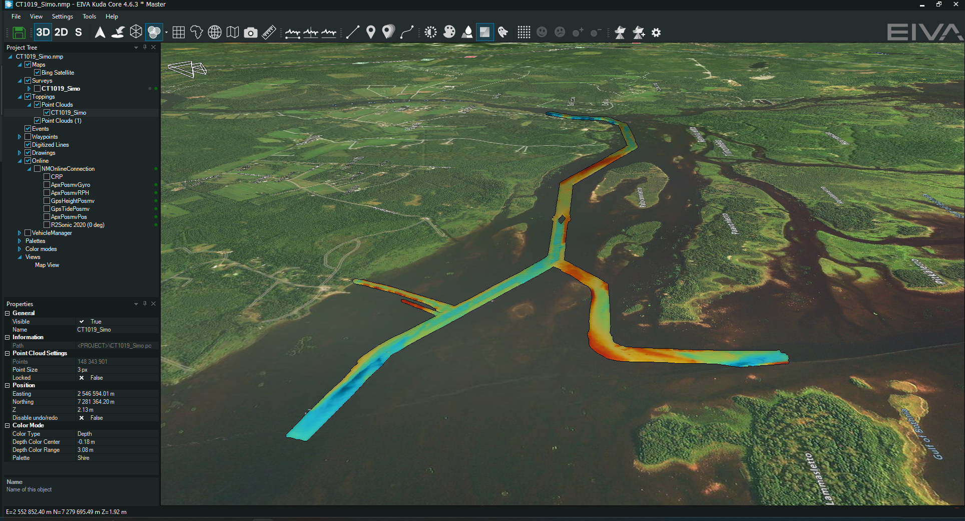
Data fusion display of LiDAR and MBE data (bottom) from a recent sea trial in Denmark with EIVA’s USV-16 (upper) – remote sea trials have also recently been conducted in in Brazil with the Tupan USV from TideWise
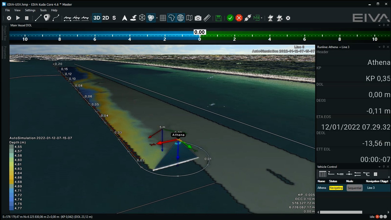
NaviSuite Kuda, in addition to the above listed capabilities, serves surveyors through automation of runline planning. Increasingly, surveyors must map large open areas, for example during construction pre-surveys for offshore wind farm sites – which used to mean long hours of monitoring repetitive runlines. To help change this, when survey company Clinton requested a solution for automating this process, EIVA developed the Coverage Assist tool. This tool creates runlines based on previous surveyed lines, ensuring optimal coverage. 'The NaviSuite Coverage Assist tool is ideal for optimally surveying large areas. Through real-time calculations, it can smoothly take into consideration changes in wind, currents and water depth' said Survey & Technical Manager at Clinton, Anders Wikmar. In some areas such as harbours or offshore wind farms, there are obstructions that need to be avoided, in which case, users can still use the Coverage Assist tool by first defining exclusion zones to avoid or, as a new feature, use real-time LiDAR and sonar data to dynamically avoid obstacles.
With NaviSuite Kuda software it is possible to input runlines to any vessels with an NMEA autopilot. In addition, EIVA’s recently launched NaviSuite Kuda – Autopilot ensures safer over-the-horizon surveys by providing the hardware and software setup needed for +/-15 cm precision line-keeping and other useful capabilities, which were not supported by the standardised NMEA APB format, such as battery/thruster monitoring and a hold position capability.
These tools for safe automation of hydrographic surveys complement the intuitive interface of NaviSuite Kuda, which has recently been tailored to provide a more streamlined overview. Freelance surveyor Rich Lear said about the new interface of NaviSuite Kuda Core: ‘I think many surveyors will appreciate its simplified setup, since it means you have easy access to the information you need without any other data distracting you.’
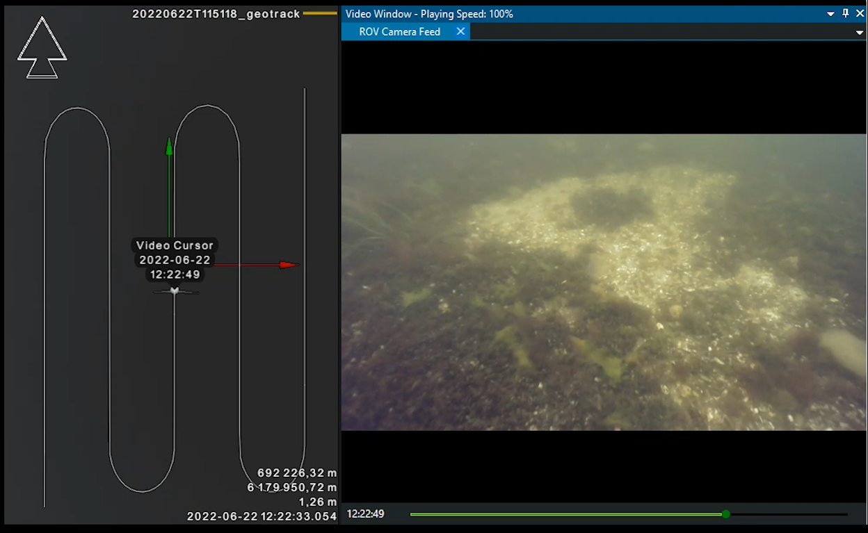
For ROV inspections of harbour walls, subsea structures, tunnels and more, there is EIVA’s ROV control and inspection software, NaviSuite Mobula. In addition to an extensive configurable remote user interface, this software provides precise ROV control with manual joystick steering in six degrees of freedom, along with assisted steering modes, such as hold heading or position, and automated inspection modes, such as scan wall or orbit object.
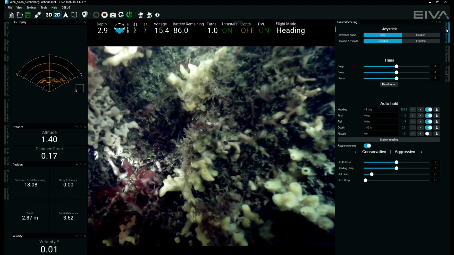
NaviSuite Mobula ROV control and inspection software during a harbour wall inspection – with a custom user display showing the camera feed, forward-looking sonar and positioning (left), as well as the automated and assisted steering options (right)
NaviSuite Mobula is available in several variants tailored to different setups – ranging from an advanced steering software to a total solution for everything from inspection planning to data processing and delivery in the form of video recordings, 3D models and more.
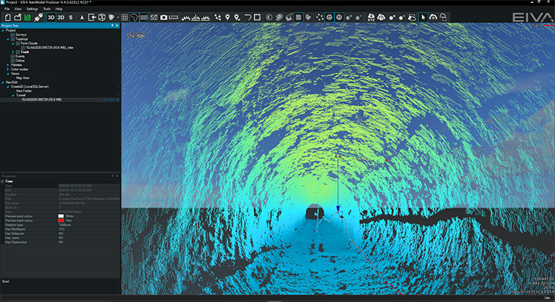
To further automate inspections and improve pilot situational awareness, EIVA is soon releasing VSLAM, a computer vision algorithm which in real time creates point clouds from as little as a single camera feed! This makes it possible to use an inexpensive setup to create 3D models during ROV dives – in real-time providing pilots with an even better understanding of the ROV’s surroundings, and after inspections serving as data deliverables akin to those created using sonar or underwater laser technology!
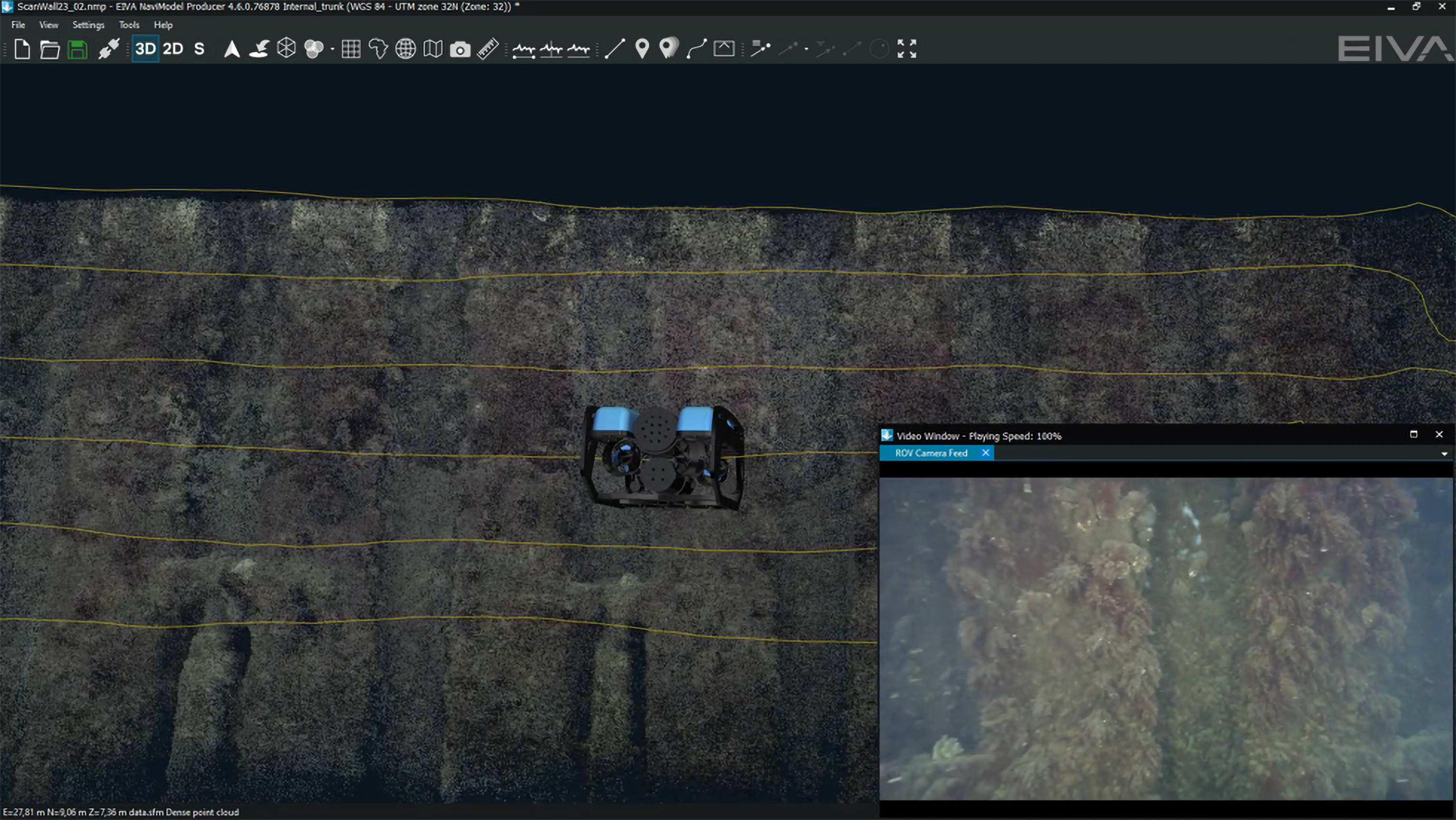
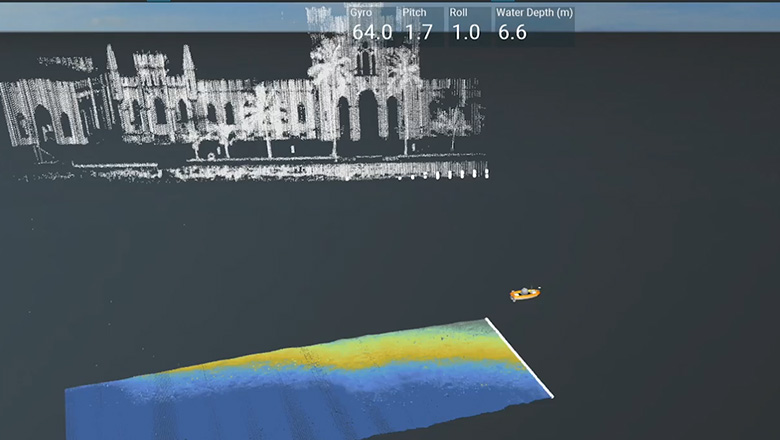
A harbour wall was inspected with a BlueROV2 equipped with a camera and using NaviSuite Mobula software – VSLAM was then used to create a point cloud 3D model which is shown here along with the camera view and a 3D model of the ROV
The high level of automation found in these software solutions reflects EIVA’s goal to provide the building blocks for autonomous, remote surveys. NaviSuite's deep learning features allow for automated eventing based on image recognition with machine learning. The tool has currently been trained to recognise over 20 types of events along a pipeline when used as an extension of EIVA’s software bundle for 3D pipeline and cable route inspections, NaviSuite Nardoa. It is also available as a complete image recognition toolbox for any application, for example it is currently being trained to recognise observations in coral habitats and mussel farms.
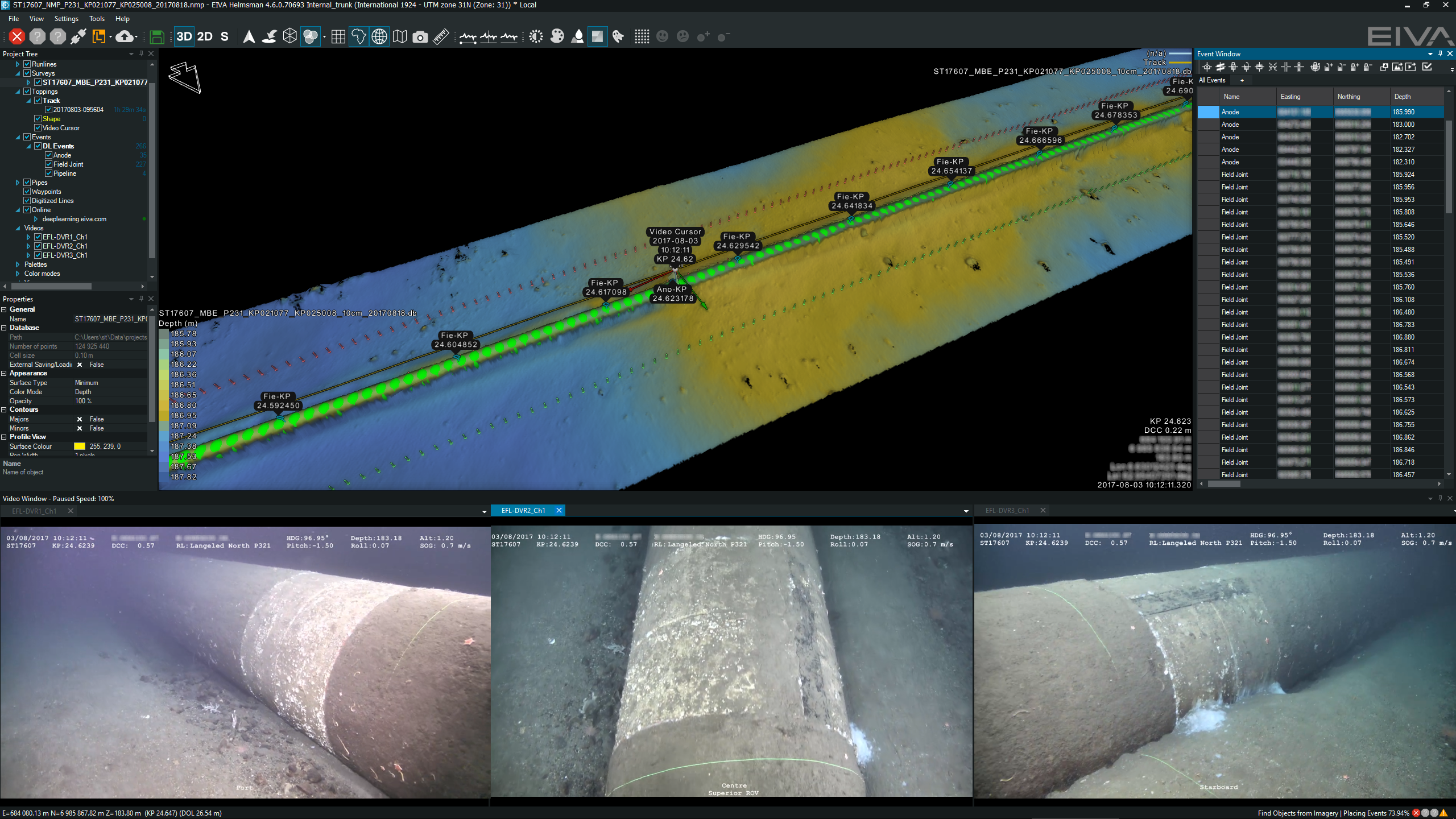
Automated eventing in NaviSuite – displayed with synchronised camera views and 3D model, as well as a log of events (right)
The automatically evented observations can be used both as deliverables and as input for navigation-aiding methods. Following the registered anodes along a pipeline is one of several navigation-aiding methods EIVA has developed. Another navigation-aiding method developed uses machine learning to follow the centre of a pipe. With a NaviSuite – Onboard computer, you can completely automate data processing workflows.
Pipeline navigation-aiding in NaviSuite Nardoa 3D pipeline inspection software
Solutions for remote, automated surveys and inspections make it possible to safely achieve low-carbon operations and take advantage of the skilled surveyors around the world. The above-mentioned solutions are developed by working closely with survey companies and hardware providers, so real-life needs and the latest technologies serve as EIVA’s compass for development. To achieve this, EIVA often needs help beta-testing our solutions, so feel free to reach out if you are interested in getting involved. You can for example provide survey data, which can be used to train NaviSuite's deep learning features for a variety of applications from pipelines to corals – or maybe you have a whole new application in mind?