To use this site, please enable javascript
To use this site, please enable javascript
Remote operations are integral to the future of hydrography – not only are they low-cost and low-carbon due to the smaller vessels required, but they help meet growing demands for trained surveyors around the world.
A skilled surveyor can remotely control surveys anywhere, even ones carried out at several places on the globe in a day, while staying close to the comforts of home – which is why EIVA has made sure that our solutions, such as hydrographic survey software bundle, NaviSuite Kuda, seamlessly support remote operations over-the-horizon every step of the way; from vessel control and runline planning to data quality monitoring.
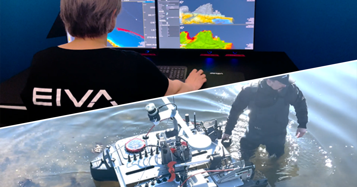
Check out a typical remote operation, which can be as simple as a two-man crew: one person with little training on site to deploy a USV – and one trained surveyor to operate it from wherever they are, whether on-site or over-the-horizon in a remote operations centre
Through developmental projects and working closely with our customers, EIVA has identified the software capabilities needed for enabling effective remote surveys to be…
We will dive into each of these, showing you the software tools in action…
One of the most important challenges to remote operations is low bandwidth. Operations are moving farther offshore and acquiring larger amounts of data – and so you can’t always guarantee that your bandwidth is good enough to stream it all to your remote surveyor in real-time. This is an issue, as it impacts how fast a surveyor can react to the data for example by retasking the vessel.
The solution the EIVA team has developed is a configurable tool to compress the data streamed to the remote. The data can be compressed across or along a swath or both – ensuring it is possible to compress it while maintaining a clear view of important data.
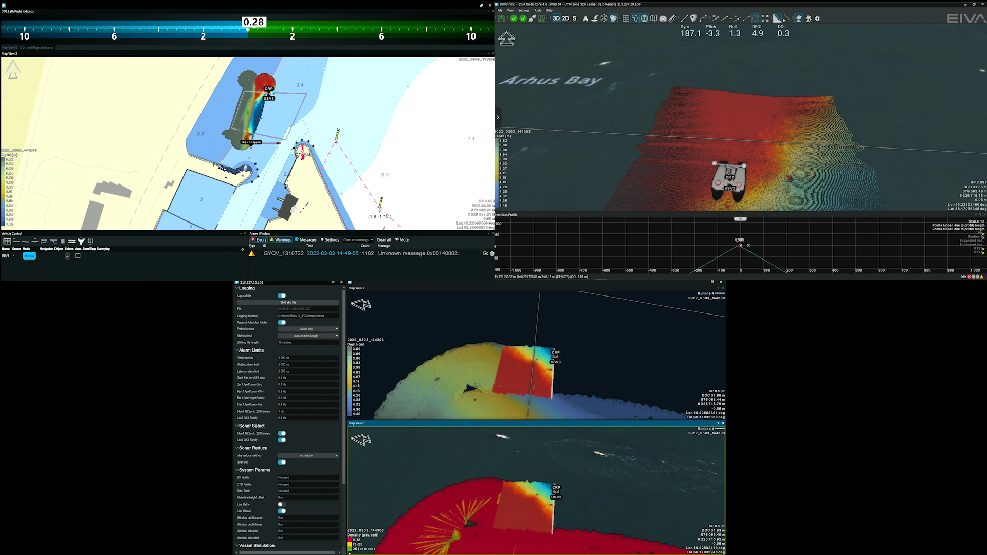
‘The possibility of real-time data displays will let me react quickly to any problems during a survey, such as gaps in the collected data – especially because of the extensive list of data display tools in NaviSuite which I can use to quality check (QC) data,’ Rich Lear, an experienced surveyor, told EIVA in his guest blog on the recently released entry-level survey software variant, NaviSuite Kuda Core.
In NaviSuite’s powerful 3D modelling software, there are several capabilities allowing you to QC your data intuitively, including…
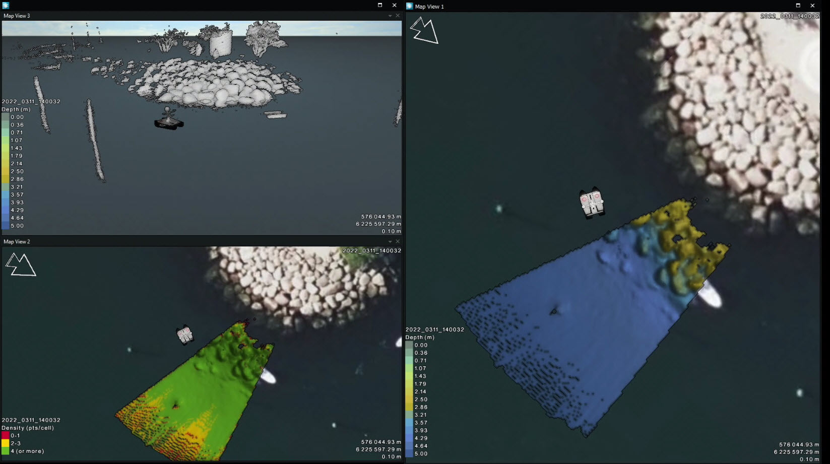
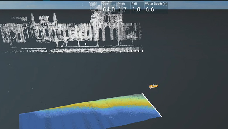
NaviSuite allows you to acquire several types of data simultaneously, and they can be displayed in real-time – for example here you see multi-beam echo sounder (depth on the right and density on the bottom left) and laser (upper left) data being collected and displayed on-the-go
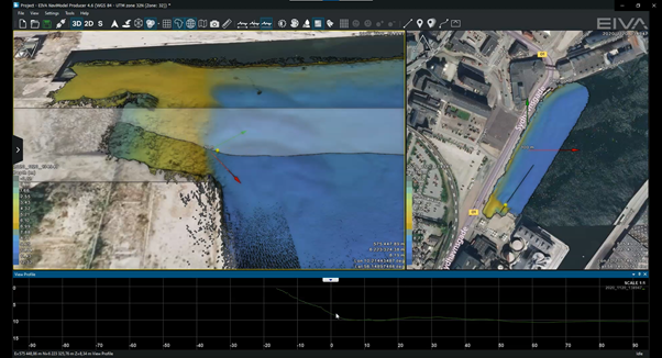
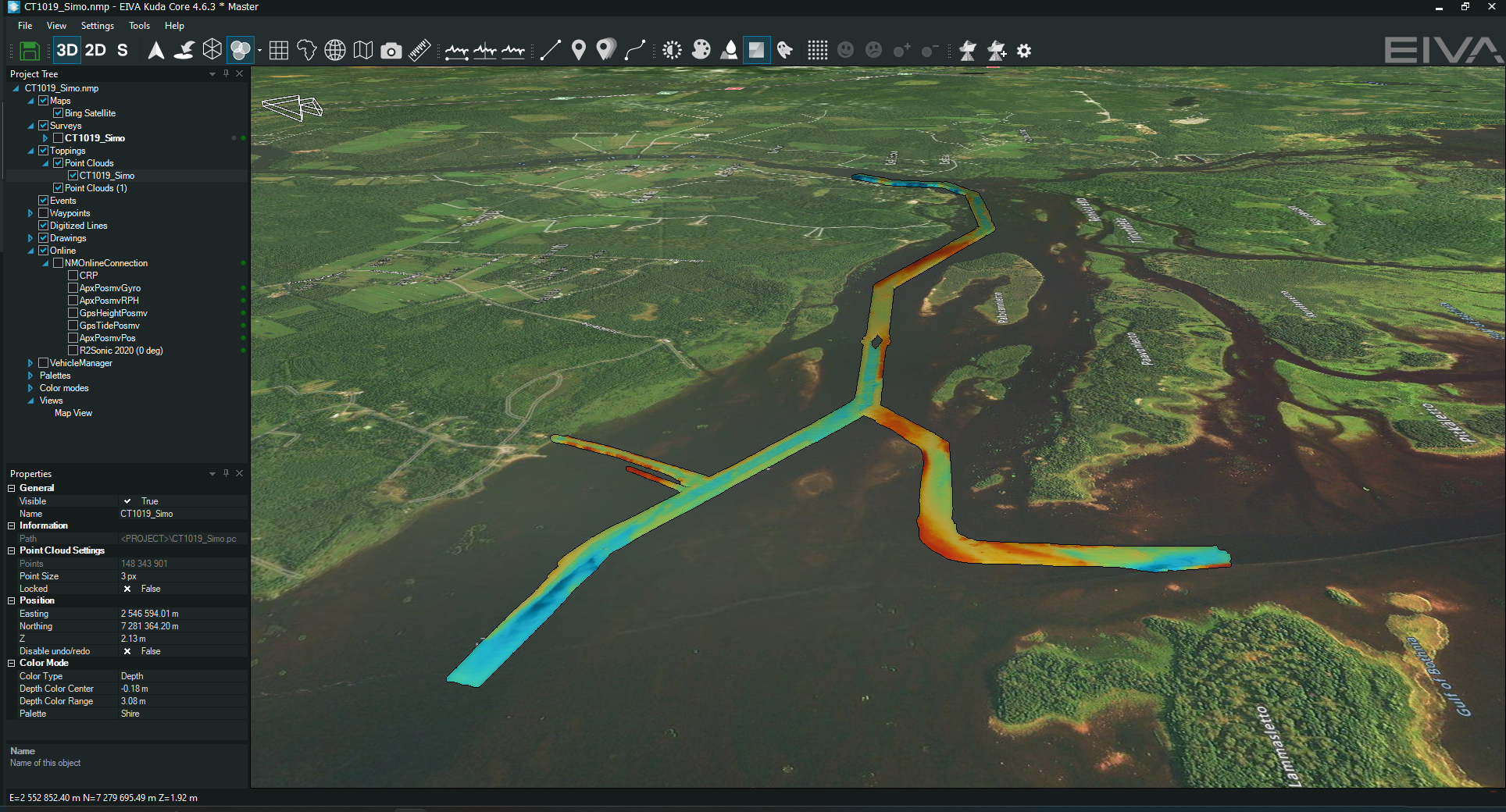
Shown here are more ways you can QC (quality control) a 3D model in NaviSuite – by looking at it from different angles and creating cross profiles
‘Offshore, we use the EIVA QC Toolbox for any QC checks that may come our way,’ a BP North Sea Surveyor said in this case study on how EIVA created a user-friendly QC toolbox for BP to use as an all-in-one single survey solution, replacing the need for several programs.
In addition to real-time quality control, NaviSuite users get to benefit from a fleet of survey automation tools available. Automation heightens the benefits of remote surveys by saving resources such as fuel through increased efficiency, as well as making better use of trained surveyors’ skills by taking over on tasks that can be automated.
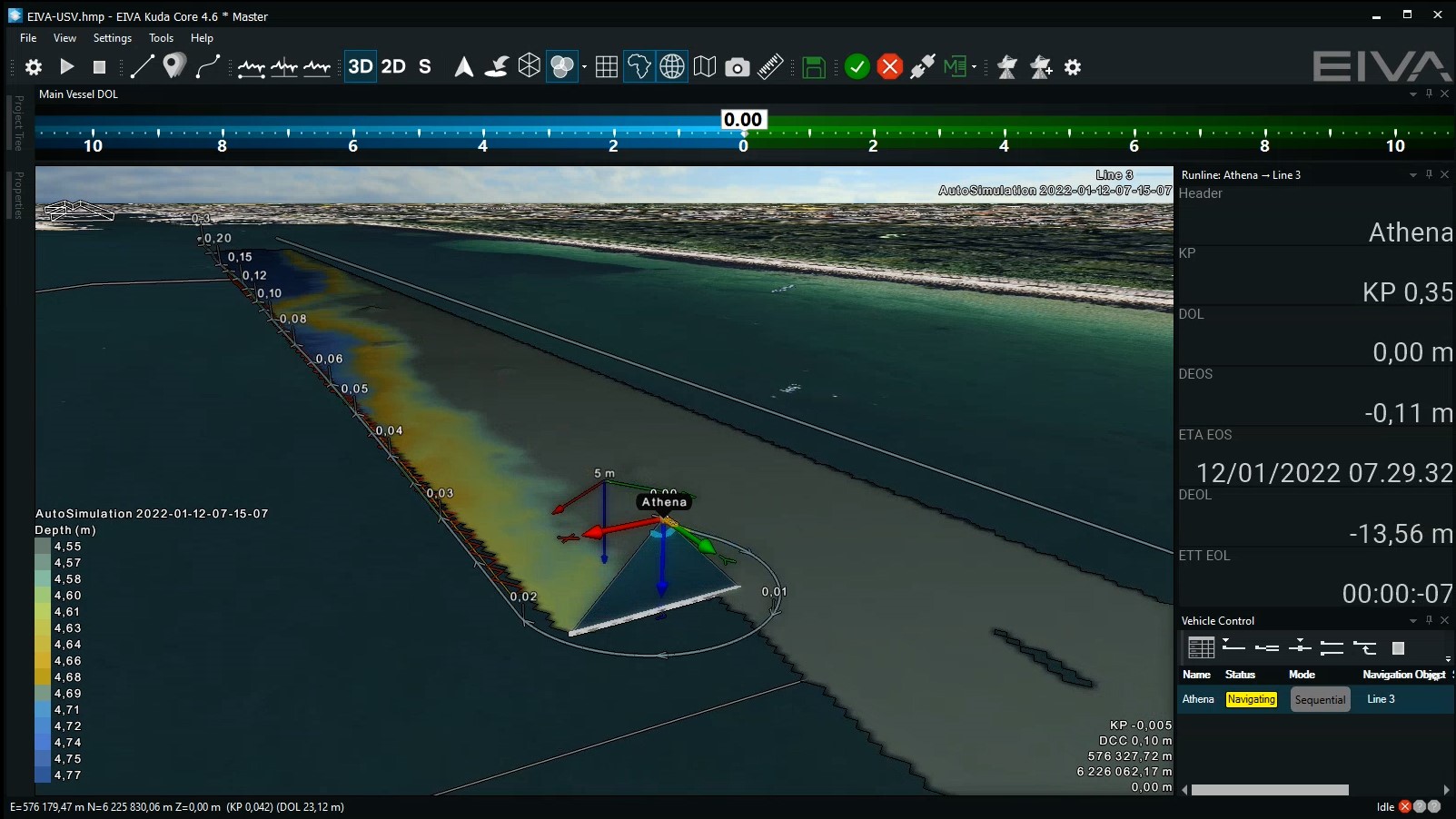
One such automation tool is the Coverage Assist tool for automatic, real-time adaptive runline planning. ‘The Coverage Assist tool frees up our employees from manual steering. It has a big impact on our operations – providing stable, optimal survey coverage and more engaging workdays for our employees as they can focus on tasks needing human knowledge and input.’ – Anders Wikmar, Njord, in this case study on the Coverage Assist tool which EIVA originally developed for Njord.
Adaptive runline planning with the Coverage Assist tool
Another benefit of automation is that you can have deliverable data on your screen before your USV is retrieved – which means that if there are any problems in the collected data, you’ll know about it while the USV is still on-site and be able to react fast. This is possible because, in NaviSuite, data processing can be done automatically in real-time!
The many small steps in data processing can be automated with the workflow automation tool, Workflow Manager, which is included in the NaviSuite Kuda + Processing variants.
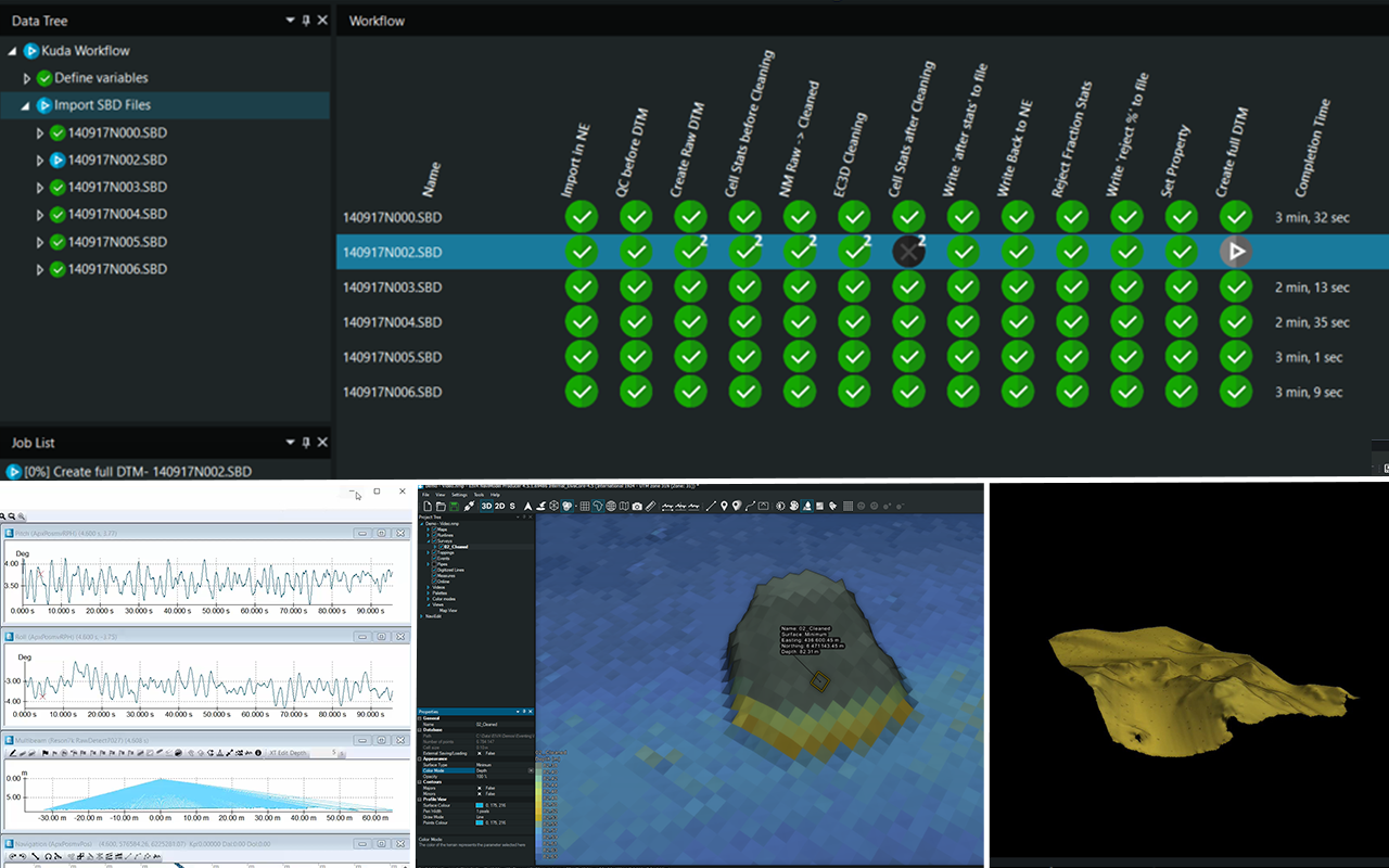
Check out the capabilities of the Workflow Manager tool
In addition to automating the workflow, NaviSuite Kuda provides tools to automate individual data processing steps, like data cleaning. All variants of the NaviSuite Kuda survey software bundle include EC-3D, EIVA’s automatic data cleaning tool. With this tool, you can create a customised filter which will clean you data in real-time during acquisition.
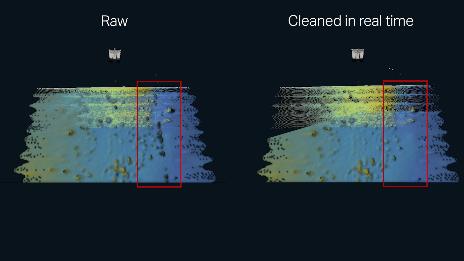
Real-time seabed data cleaning with EC-3D – displaying the raw data (left) and the cleaned data (right)
Hand-in-hand with complementary hardware solutions, NaviSuite Kuda’s breaks the waves for autonomous surveys… EIVA has developed several hardware solutions which are fully integrated with NaviSuite software to ensure autonomous operations run smoothly.
Want to stay up to date on the latest software and hardware developments for survey operations above and below the water’s surface? Feel free to follow EIVA on your preferred social media channels or sign up for our newsletter to dock in your inbox about once a month.