EIVA A/S

To use this site, please enable javascript

NaviModel 4.11 now integrates with Absolute Ocean to expand cloud capabilities

30 October 2025
At EIVA, we’re always looking for ways to streamline workflows and simplify data handling for our customers. That’s why we’re excited to introduce a new integration between our NaviSuite software and Absolute Ocean – a seabed information platform- developed by Terradepth. 
 
This integration is now available for NaviSuite Kuda and NaviSuite Nardoa users.
 
Absolute Ocean enables efficient data handling and sharing across survey workflows.

What is Absolute Ocean? 

Absolute Ocean (AO) is a secure, cloud-based platform designed to help users store,  visualise, and share seabed data. It’s used by operators around the world – including Oceaneering – to manage large datasets and collaborate with end clients and stakeholders.

EIVA Lidar data, Ronne, Denmark

MBES & Laser data from SensorSurvey NaviModel project uploaded into AO

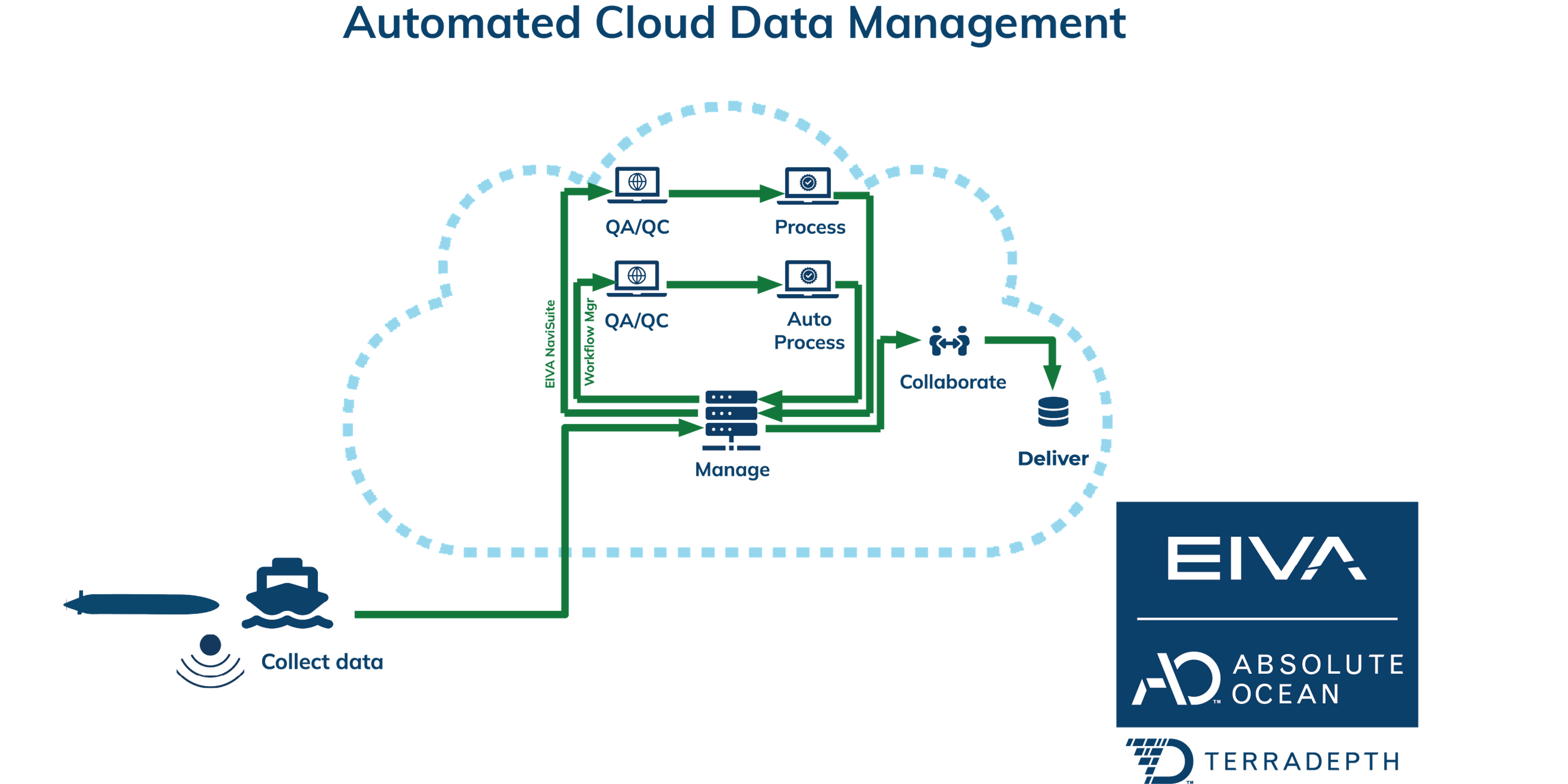
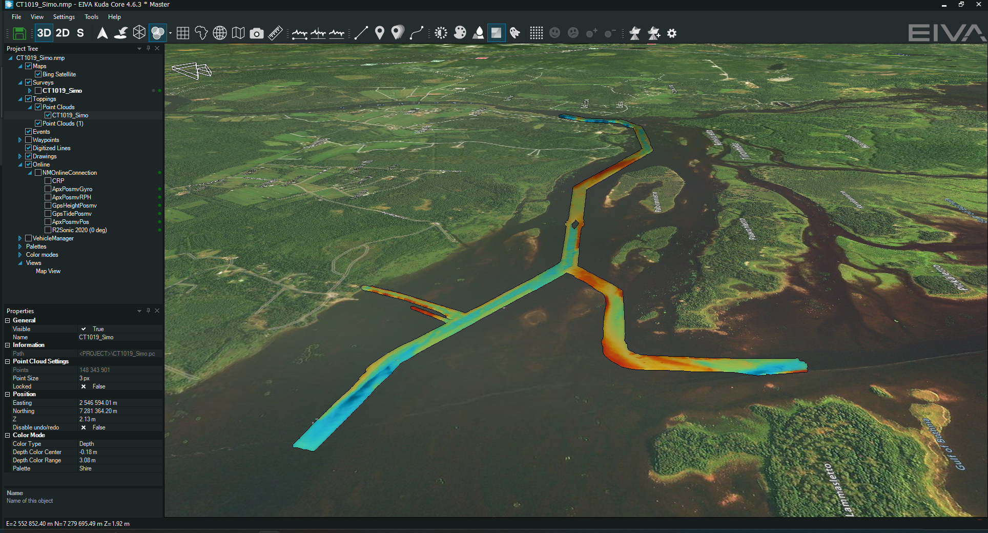
By integrating AO directly with NaviSuite, we’re enabling seamless data exchange between acquisition, processing, and delivery – reducing the need for manual file transfers or reliance on third-party viewers. 

Designed for survey professionals 

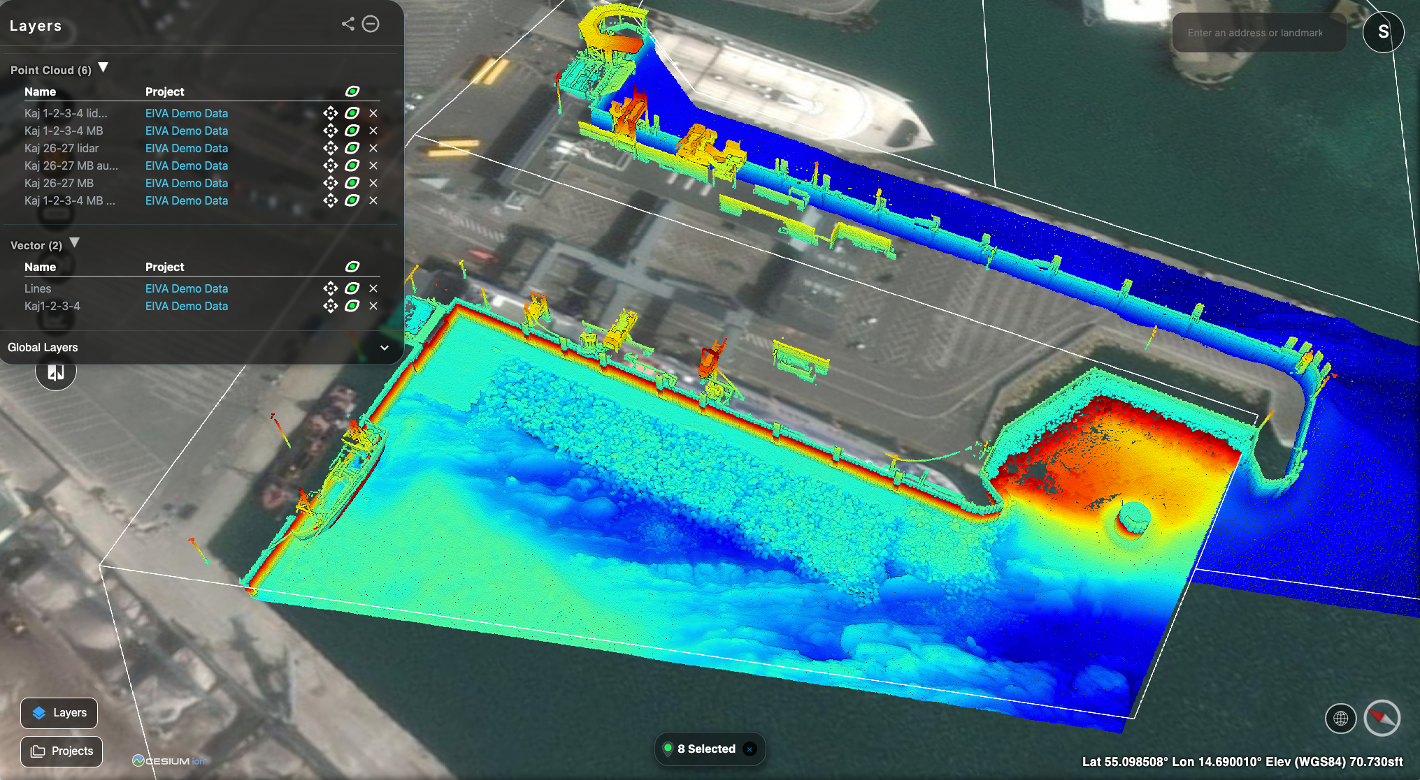
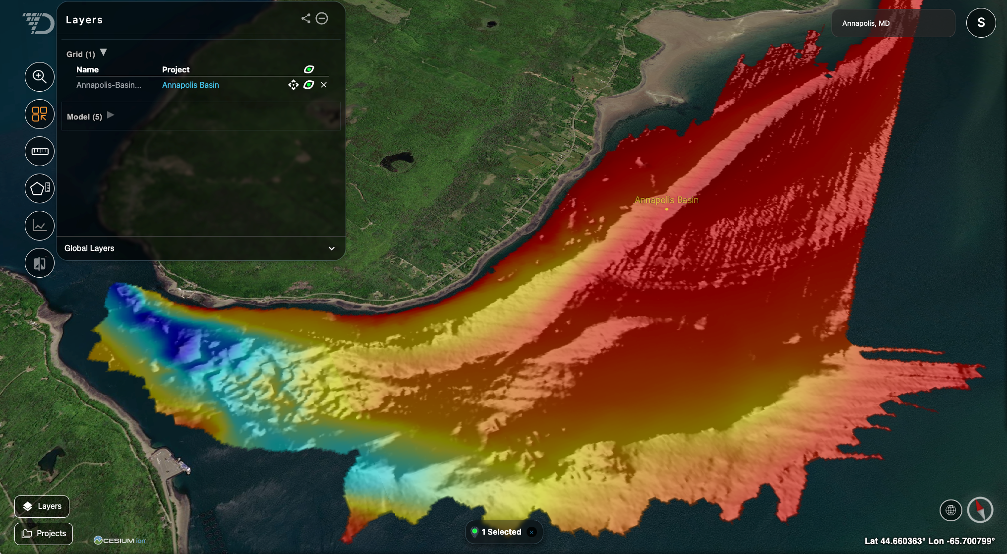
This integration is particularly valuable for survey managers, data processors, and  reporting teams who need to collaborate across locations and organisations. It’s also a  game-changer for clients who want easy access to deliverables without technical barriers.  

Free with NaviSuite – licencing handled separately 

AO licencing is handled directly between users and Terradepth. The integration tools are included in NaviSuite as standard (though final packaging may vary) so most users will have access to these features without additional setup. Users will only need to align on licencing directly with Terradepth to get started.
 
We’re proud to offer this integration as part of our ongoing commitment to automation, interoperability, and customer-driven innovation. 
Bathymetry from Annapolis Basin, MD, USA

Public data from AO and EIVA Lidar data, Ronne, Denmark.

Three key workflows, with automation built in 

The integration supports three major use cases: 
  • Offloading raw data to AO cloud storage 
  • Upload processed data from NaviModel into AO for visualisation and sharing 
  • Download data from AO cloud storage and process it in NaviModel
Users can activate data downloads from AO directly into the NaviModel database,  enabling remote processing workflows and the ability to share results and models with clients. 
 
These workflows are powered by high-level commands built into NaviSuite, including project creation, file upload/download, and cloud-based visualisations. 

A scalable solution for large clients 

While NaviSuite already includes NaviSuite Cloud Viewer, this integration complements existing tools and fills a gap for clients with large-scale data sharing requirements. AO offers real cloud hosting and local deployment options, making it suitable for enterprise level workflows. 

A proven solution for fast-paced offshore operations 

This integration isn’t just about convenience – it’s about enabling faster, more  collaborative decision-making. As demonstrated in Oceaneering’s case study, Absolute  Ocean allowed their teams to deliver high-resolution subsea data to clients the same day it was collected, using a cloud-native platform that supports real-time access across locations. 
 
By bringing AO into NaviSuite, we’re giving survey professionals and their clients the same powerful capabilities – helping teams work smarter, respond faster, and share results more easily. 
 
Read the full case study to see how Oceaneering used AO to transform their data workflows. 
 
Reach out to Terradepth for more about AO.

Related case studies

Show all case studies