To use this site, please enable javascript
To use this site, please enable javascript
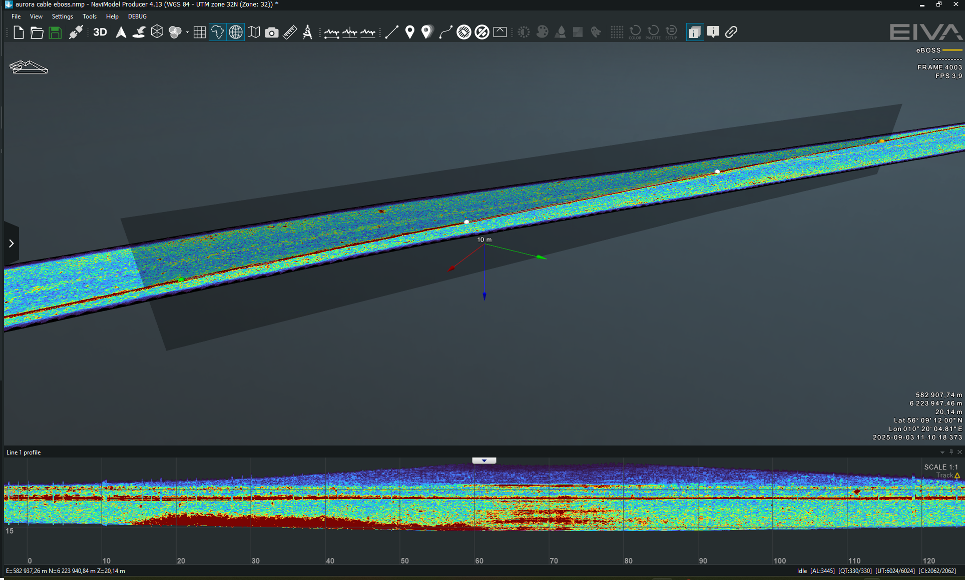
The diagonal profile view reveals the digitised cable path, maintaining a consistent depth through the dataset. The upper edge of the profile marks the limit of sonar coverage — not the seabed.
With eBOSS data now supported, users can load and navigate through sub-bottom data in both 2D and 3D views, mark targets such as cables or UXOs, and estimate burial depth – all within the familiar NaviModel environment.
The data is georeferenced and time-stamped, allowing it to be combined with other survey data types for a comprehensive overview.
Note: The data processing solution is based on standard JSF recording from EdgeTech.
.png)
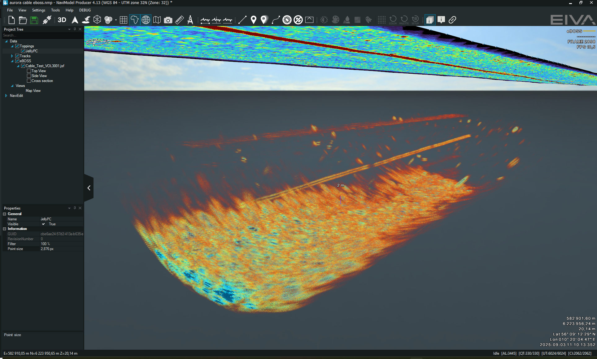
This image highlights high-intensity targets in a point cloud visualised in NaviModel 4.13