To use this site, please enable javascript
To use this site, please enable javascript
Technological advancements have improved the efficiency of data collection, as well as the resolution of modern sensors, resulting in an increase in the size of 3D data sets. When these large amounts of data are handled efficiently, for example through automation, a cleaned version of the data can be used in real-time, for example for re-tasking.
Overcoming the challenges of efficiently leveraging large datasets calls for optimising information architecture and tools for analysis and data sharing. EIVA has implemented several solutions that focus on these areas, made available in EIVA’s data visualisation and analysis solutions NaviModel 4.8 (and consequently also the bundles including this product) and NaviSuite Cloud Viewer.
In this article, we will introduce you to a few examples of the implemented products and tools which ensure…
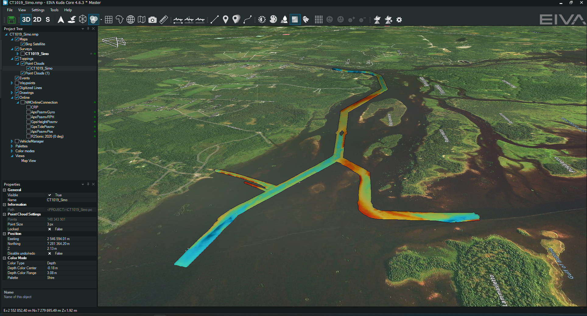
With the increasing sizes of datasets, customers performing data visualisation or analysis of very large 3D point clouds previously encountered the issue of relatively long loading times on these. Consequently, in NaviModel 4.8, which was released in September 2023, EIVA implemented a new point cloud engine which has made it possible to render larger point clouds at a speed of ~300,000 to 500,000 points per second for as long as you need. This makes it possible to navigate your 3D data even more easily, viewing it from any angle and zooming in and out freely.
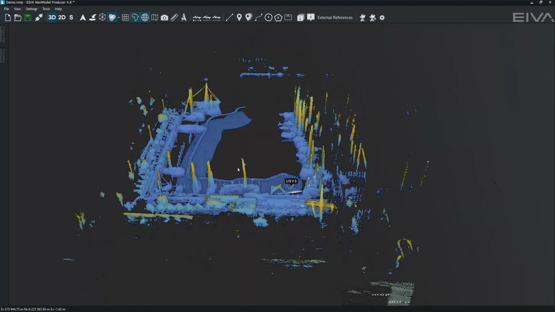
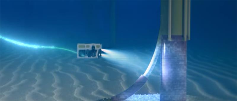
Watch as LiDAR and MBES data are acquired and displayed in real time – the 3D point cloud of LiDAR data loading quickly whenever the view is moved
In large datasets, it becomes a challenge to perform analysis efficiently and thoroughly, for example to spot all gaps, which is where automation comes into play. Some of the tools which are continually improved upon, due to their essential nature, are the Identify DTM rock events and Identify DTM gap events tools. These automatically go through your entire DTM and create events for all rocks or gaps in the DTM.
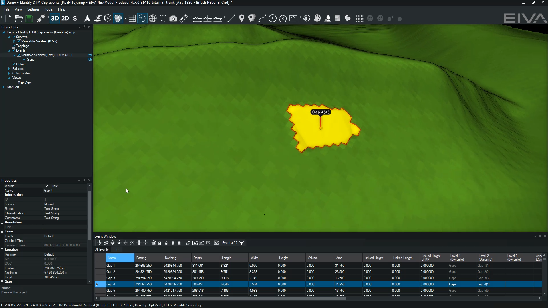
Watch how to automatically create DTM gap events in NaviModel
The Identify DTM gap events tool can be used for real-time QC (quality control), as well as quickly assessing the successful completion of a survey or planning resurvey operations, if needed. Both the Identify DTM rock events and Identify DTM gap events tools not only create events, but also generate the boundaries of the rocks/gaps. You can easily leverage this data for efficiently planning a mission to cover up all gaps or for identifying boulders to avoid during offshore construction.
.png)
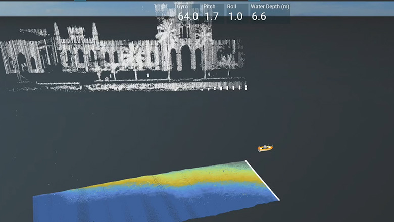
Identify rock events tool view (right) vs DTM coloured according to depth (left)
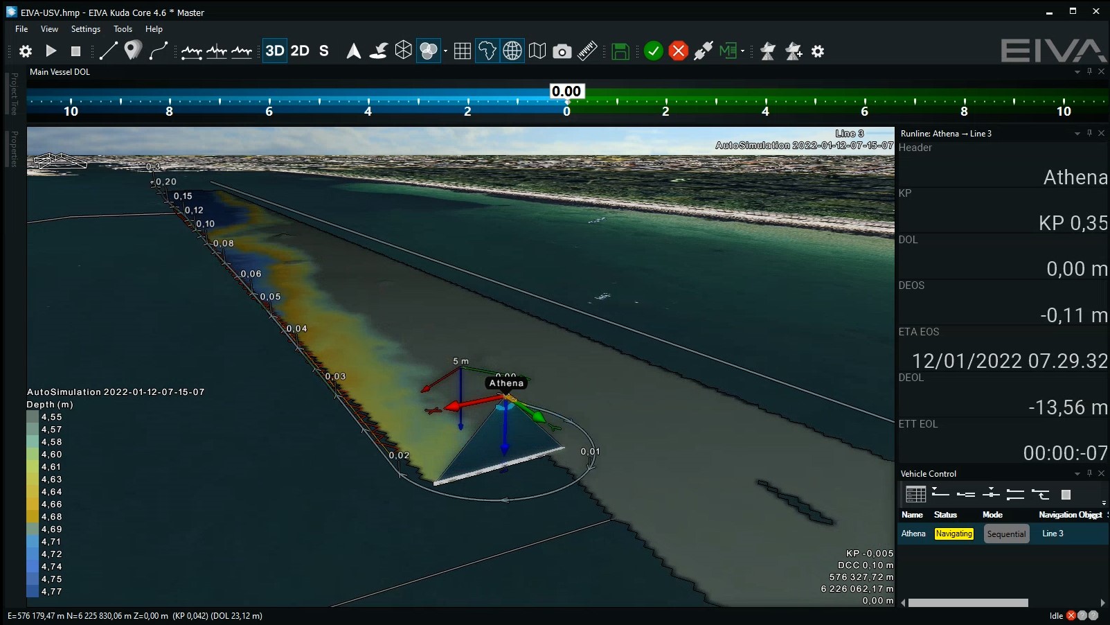
For planning resurvey missions, for example in NaviPac, EIVA’s NaviSuite navigation solution, you can also leverage automated runline planning tools such as Coverage Assist, as well as the Lawnmower Pattern or Optimal Runlines, with the option to create exclusions zones. To learn more about EIVA’s tools for automation, check out this article on optimising remote surveys with real-time automated survey software tools.
By using these and other NaviSuite software tools for real-time data processing, it is possible to achieve not only cost-savings, but enabling autonomous survey setups, and thereby reducing carbon emissions associated with offshore operations.
In 2023, EIVA launched a cloud-based thin-client, NaviSuite Cloud Viewer, which lets others more easily navigate datasets you share. Simply upload your project, send a link, and those given access can open it in a web-browser. This thin-client renders even large 3D point clouds and 3D models very fast – without any special requirements regarding computer/OS, software installation and local storage capacity. Viewers of your data deliverables can navigate the project you share using signature NaviModel Viewer visualisation tools.
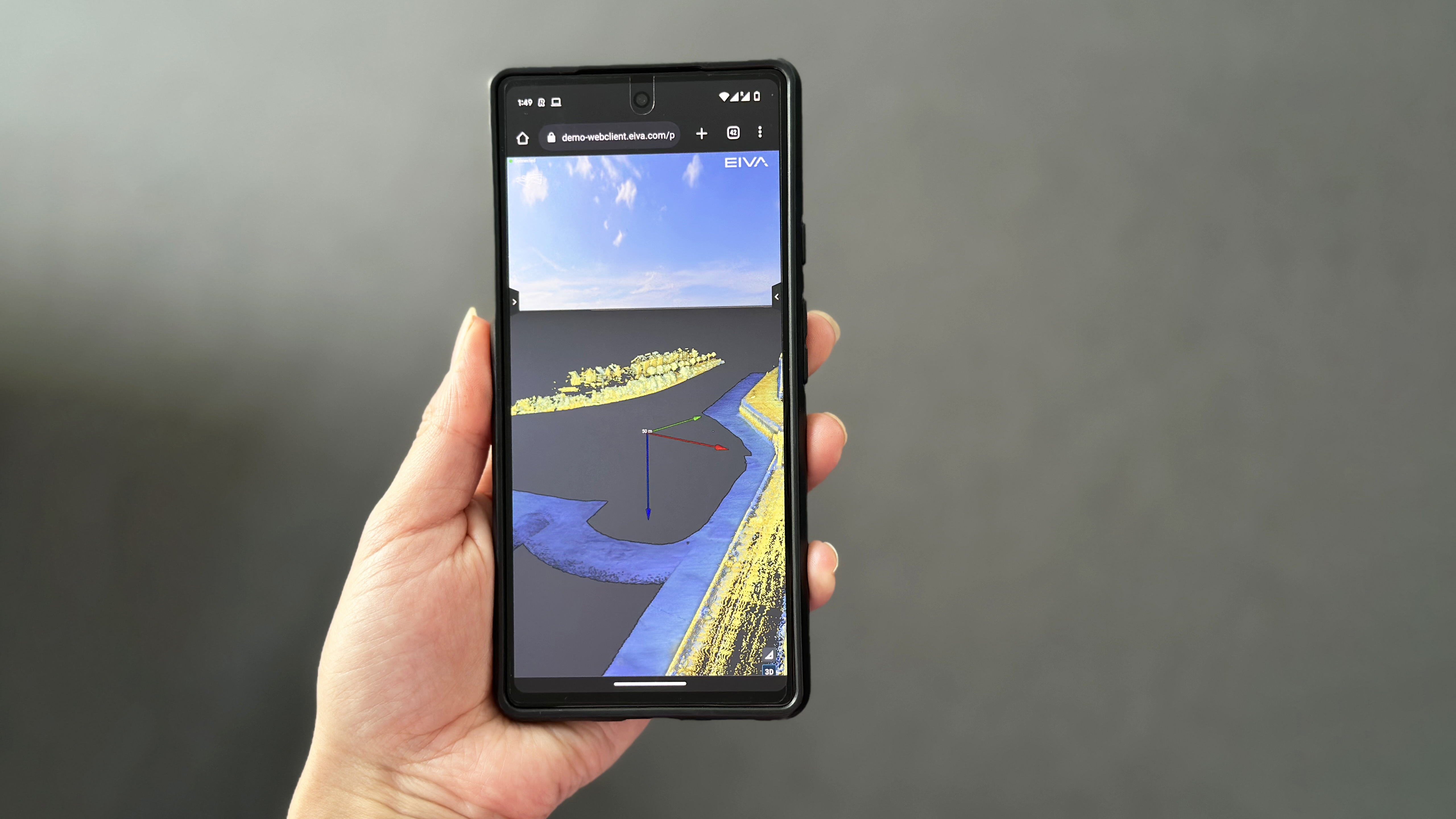
NaviSuite Cloud View renders large datasets fast for navigating datasets wherever you are, without special requirements
One example of a customer who uses NaviSuite Cloud Viewer for agile sharing of datasets is Styvehavn. On this page, they describe the benefits to this offering for end-clients, as well as sharing an example of one of their uploaded data sets – which you can navigate for yourself in NaviSuite Cloud Viewer via the link at the end of the page (note that the text is written in Norwegian, but a little google translate goes a long way).
What other solutions and capabilities are you missing to sail your operations into the future? Reach out to let us know.