


Key features and benefits

NaviModel in action with our customers
Featuring our customers’ own experiences with NaviModel in real-world settings, these case studies deliver valuable insights about how and where it can be adopted, deployed and utilised.
Check out how our customers use NaviModel for a wide variety of application, such as...
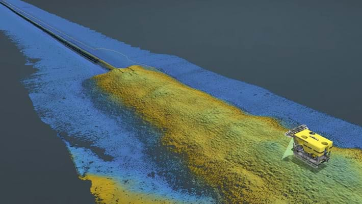
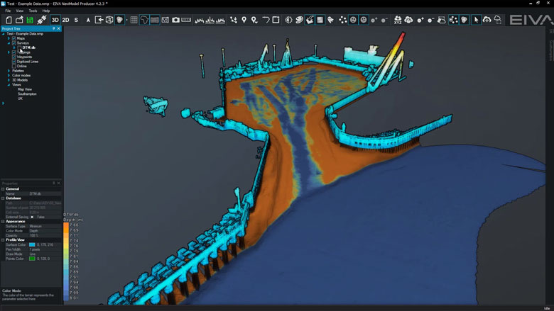
Harbour inspection
When performing harbour inspections, 'NaviModel is a modern, fantastic tool to work with’ according to Henrik Halvorsen, Styvehavn AS. ‘It can display many kinds of data in 3D and allows us to prepare and deliver state of the art survey data to our clients.'
Learn how Styvehavn used NaviModel for a harbour inspection
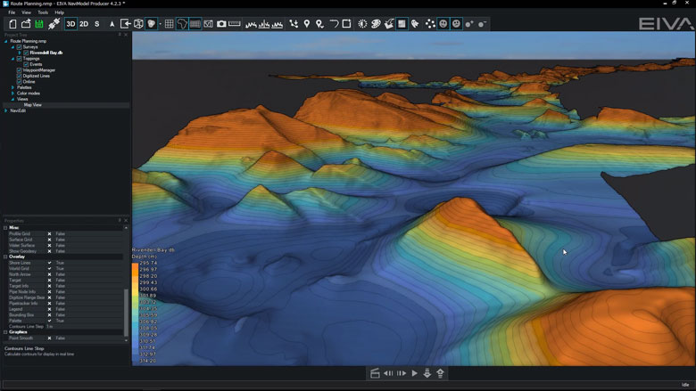
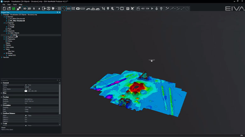
The Port of Moss visualised in NaviModel
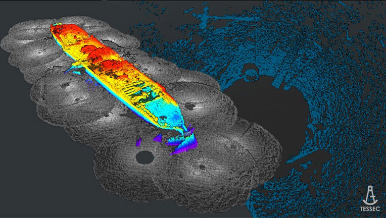
Shipwrecks
NaviModel is often used for modelling shipwrecks, due to its powerful 3D modelling and visualisation capabilities, as well as precise positioning.
Learn how NaviModel was used for studying WWII shipwrecks down to the millimetre
In a project using NaviSuite to pan and document a shipwreck removal, our software ‘provided tools that guaranteed a difficult process was made easy and intuitive, enabling fast analysis of data just a few hours after it was collected' said Technical Director Thomaz Tessler, TESSEC Engineering and Maritime Services.
Learn how NaviModel was used for planning and documenting a shipwreck removal
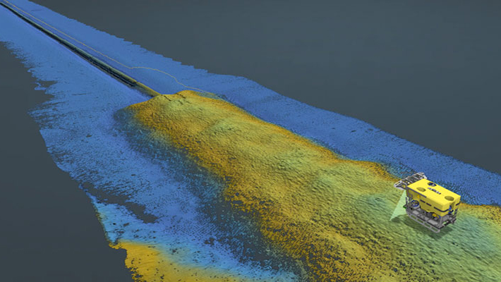
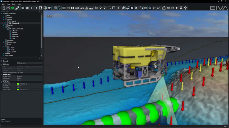
A 3D model of a wreck generated with NaviModel Producer software
Quality control (QC) toolbox
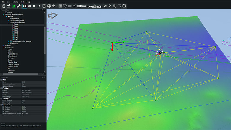
NaviModel can also be used for quality controlling data. The QC tools in NaviModel can quality control survey data (DTMs), geodetic networks (such as LBL arrays), tidal prediction, catenary models, seismic data (p-formats) and many more data types. Several of our QC tools are available in both the NaviModel Analyser and Producer variants, while others can be purchased with a QC toolbox add-on.
Undertake acoustic network adjustment and QC in NaviModel
Custom software tools
If there is a feature you are missing, you can always reach out to us for custom software development.
Learn how Njord uses EIVA as their single software provider for hydrographic surveys
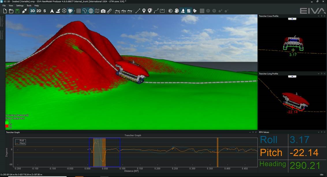
Learn how EIVA developed a NaviModel tool to simulate trenching for cable lay operations
Trencher tool developed as custom software fro Andrews Survey
-
Get more intelligence out of your data sets
With NaviModel Analyser, you can carry out volume and distance calculation, as well as generate digital terrain models and cross profiles.
Get more intelligence out of your data sets
With NaviModel Analyser, you can carry out volume and distance calculation, as well as generate digital terrain models and cross profiles
With NaviModel Analyser, you can carry out volume and distance calculation, as well as generate digital terrain models and cross profiles. In other words, you are not limited to the results provided by the inspection company, but can juggle around all your data sets to obtain the information needed to ensure optimal operation and maintenance of your offshore sites and structures.
This includes carrying out comparison over time by visualising the development between different datasets from the same site, acquired at different points in time – what we call 4D.
Not to forget your 3D visualisation options
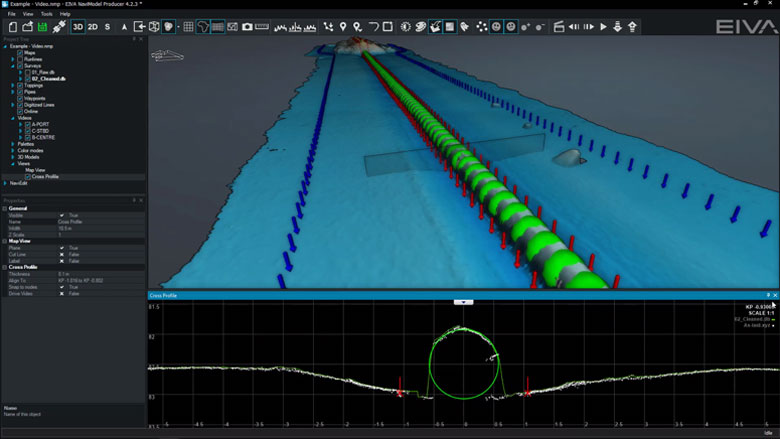
NaviModel is built on a strong 3D engine, which in itself ensures a detailed yet extensive visualisation of your data – throughout the post-processing and analysis workflow. Also, it is possible to include 3D and CAD objects for a complete overview of all relevant parameters on a site or along a pipeline or cable route.
This is supported by the possibility of combining different types of data sets (sonar, echo sounder, laser, etc) along with your 3D objects.
-
General visualisation tools
NaviModel and NaviPac share the same 3D engine, and therefore the same powerful 3D visualisation features. Data can be visualised in 2D, 3D, side view or by time.
General visualisation features
NaviModel and NaviPac share the same 3D engine, and therefore the same powerful 3D visualisation features. Data can be visualised in 2D, 3D, side view or by time.
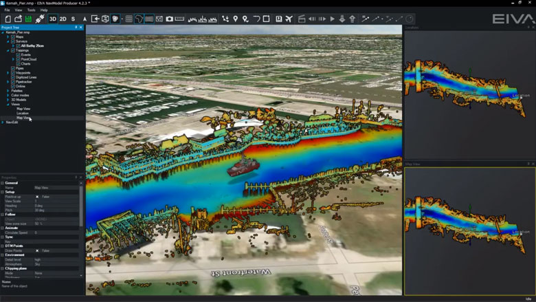
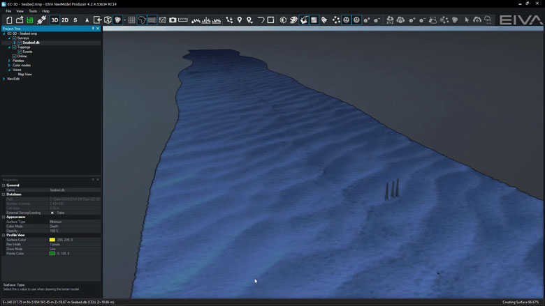
3D seabed terrain
Seabed terrain can be visualised in a 3D environment.
Multiple Map Views
Multiple Map Views are available. Each individual Map View window can be configured separately to display only the information required.
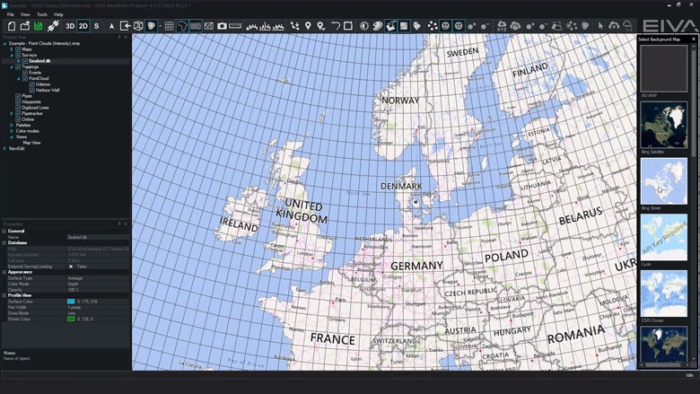
Background Maps
Background Web Map Service (WMS) maps can be displayed.
Import 3D models
3D models can be imported into NaviModel (drag and drop into the Map View window).
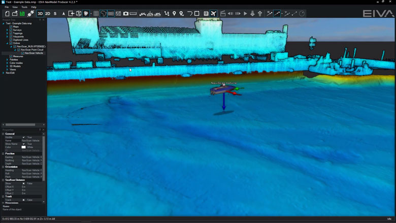
Link 3D models to live objects
3D models can be linked to any live objects (Vessel, ROV, Scanfish etc).
2D, 3D and side-view displays
2D, 3D or Side views allows the user to quickly change the view facilitating better data interpretation.
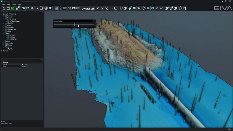
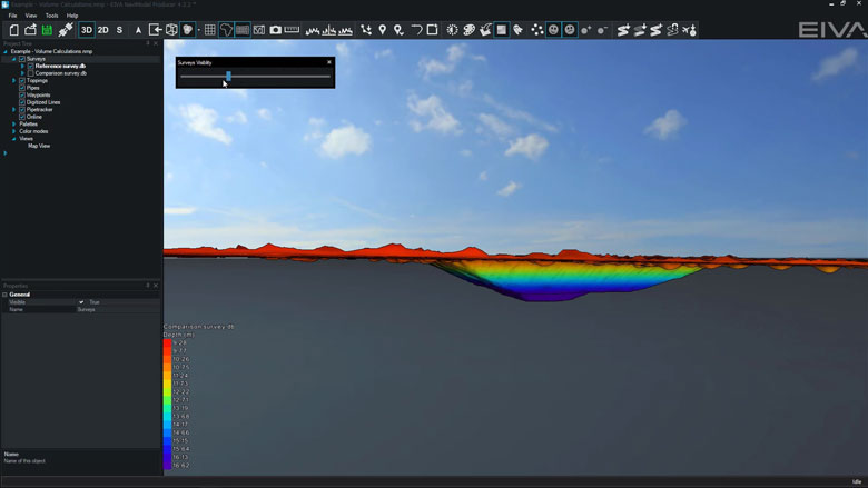
Visibility Slider
Visibility slider allows users to compare different DTM’s quickly. This enables comparison over time or between different data processing methods.
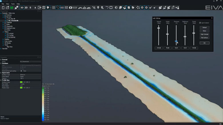
Control colours, lights, details
DTM light and palette settings can be changed at any time.
Profile views
The following profile views are available:• Cross Profile• Long Profile• Quick Profile• X & Y Axis Profile• View Profile
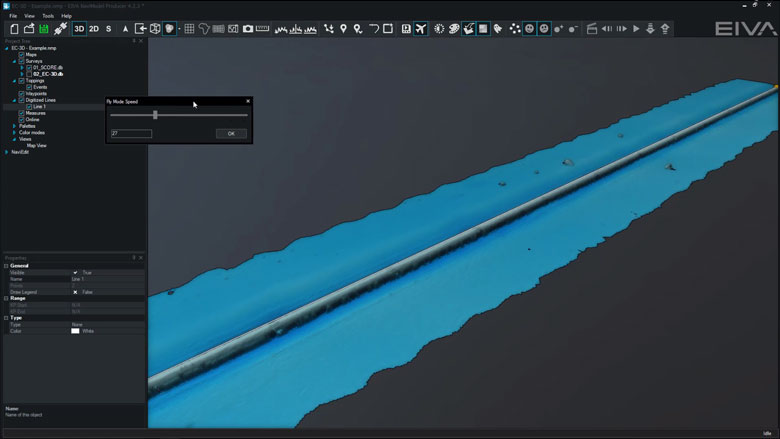
Create fly-through videos
Fly-through videos can be created for project or promotional presentations.
-
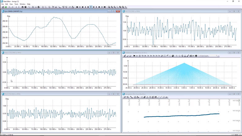
Sensor processing
NaviEdit can be used to recalculate data very quickly and where our sensor processing takes place. Here we change offsets, C-O’s, mounting angles, apply tide, apply SVP, de-spike sensors, improve object positioning, Kalman filtering, remove swell etc.
Sensor processing features
NaviEdit can recalculate data very quickly and where sensor processing takes place. Here we change offsets, C-O’s, mounting angles, apply tide, apply SVP, de-spike sensors, improve object positioning, Kalman filtering, remove swell etc.
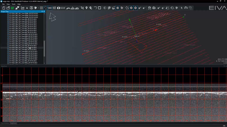
Sub-bottom profiler (SBP)
You are able to work with several SEG-Y files in NaviSuite at the same time. When loading the sub-bottom profiling data, the software extracts a rough track that is then taken through a two-step process of extracting a point every 100 metres, and then refined to 3 metres.
-
DTM tools
In NaviSuite Digital Terrain Models (DTMs) can be generated, manipulated, and edited with the help of various tools.
DTM features
In NaviSuite, Digital Terrain Models (DTMs) can be generated, manipulated, and edited with the help of various tools.
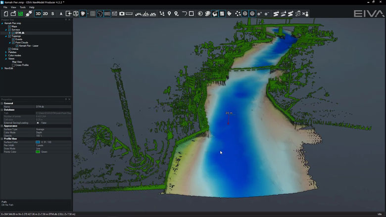
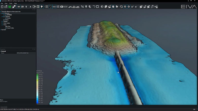
Create DTM surface from points (sonar & laser)
DTM surfaces and Point Clouds can be generated at any time from either sonar or laser data.
Create different DTM surfaces (mean, max, min, etc) and colour modes
Different surface types are generated upon data import and can be accessed at any time.
Light and Palette settings
DTM light and palette settings can be changed at any time.
Visibility Slider
Visibility slider allows users to compare different DTMs quickly.
This enables comparison over time or between different data processing methods.
Difference models
DTMs can be created from the differences between two other existing models.
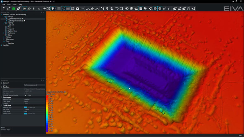
Volume calculation
A volume calculation is the difference between a reference surface and a comparison surface.Surfaces can be from a DTM or a TIN model.Volume calculations can take place between the following models:• DTM vs DTM• TIN vs TIN• DTM vs TIN
Density surface
Density colour mode can be enabled to QC how many points are in each DTM cell.
Custom surface
It is possible to create custom surfaces based upon hard-coded variables or user-configurable equations.
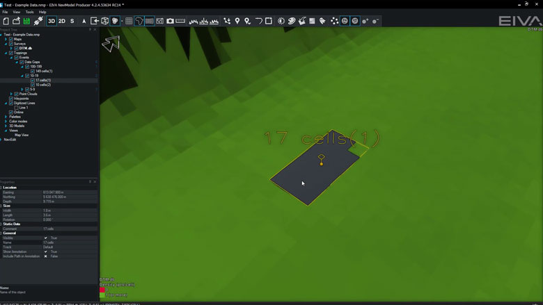
Automatic gap detection
This tool analyses DTMs to identify areas which have no coverage (i.e. contain gaps).
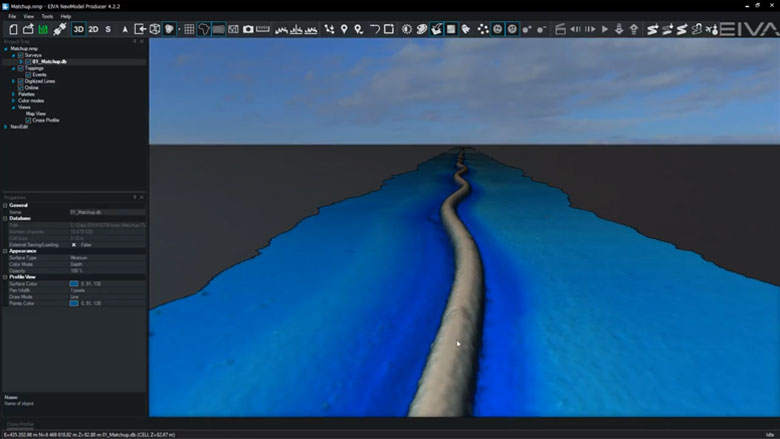
Matchup
Matchup tool can be used to correct for DTM artefacts caused by incorrect ROV XYZ position.
Points are moved based upon differences between two existing lines (source and destination).
Points are moved perpendicular to the destination line.
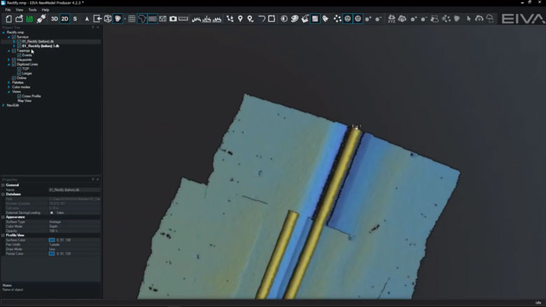
Rectify
Rectify tool can be used to correct for DTM artefacts caused by incorrect ROV XYZ position.
Points are moved based upon differences between two existing lines (source and destination).
Points are moved perpendicular and along length to the destination line.
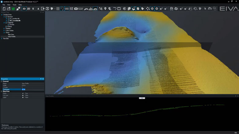
Level out
Level out tool can be used to correct for small depth differences between surveys.
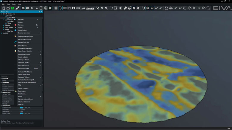
Smooth surface
Smooth surface tool smooths a DTM surface by an absolute distance or by the number of DTM cells.
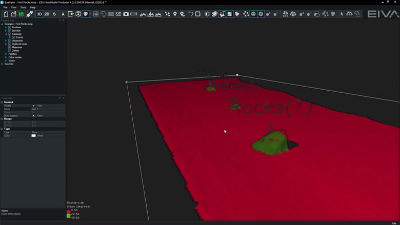
Find Rocks
This tool analyses DTMs to identify rock events.
-
Engineering/Construction Design
Within NaviModel, we can design trench or rock-placement profiles or import existing engineering drawings from various sources (AutoCAD).
Engineering/Construction Design features
Within NaviModel, we can design trench or rock-placement profiles or import existing engineering drawings from various sources (AutoCAD).
Find Rocks
This tool analyses DTMs to identify rock events.
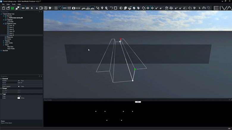
Trench design
In NaviModel theoretical trench profiles can be designed and visualised inside a 3D environment.
If available AutoCAD engineering drawings can also be used.
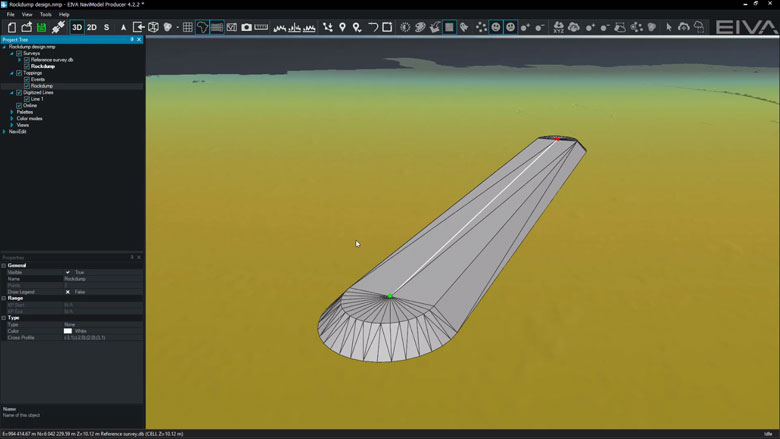
Rock-placement design
In NaviModel theoretical rock-placement profiles can be designed and visualised inside a 3D environment.
If available AutoCAD engineering drawings can also be used.
-
Optional extra services and special offers
EIVA offers a number of services for our NaviSuite software users.
Optional extra services and special offers
Get the most out of your software
EIVA offers a number of services for our NaviSuite software users. These include:
- Access to our self-service licence administration and purchase portal, My EIVA
- eLearning, virtual and classroom training
- Software maintenance and 24/7 support programme (Comes free of charge for subscription licences – Learn about the different licence types and the maintenance and support programme)
- Custom development
- Mobilisation/installation – on-site or remote assistance
- Dongle replacement programme for lost or broken dongles for permanent licences
Also, we have a number of special offers:
Variant comparison
Related products
-
NaviSuite Nardoa
Advanced 3D pipeline & cable route inspection software for data acquisition and processing.
€ 291.00/day€ 17,983.00/year€ 53,950.00/permanent -
NaviModel Producer
Full software solution for data processing, cleaning, modelling and reporting.
€ 81.00/day€ 5,008.00/year€ 15,025.00/permanent -
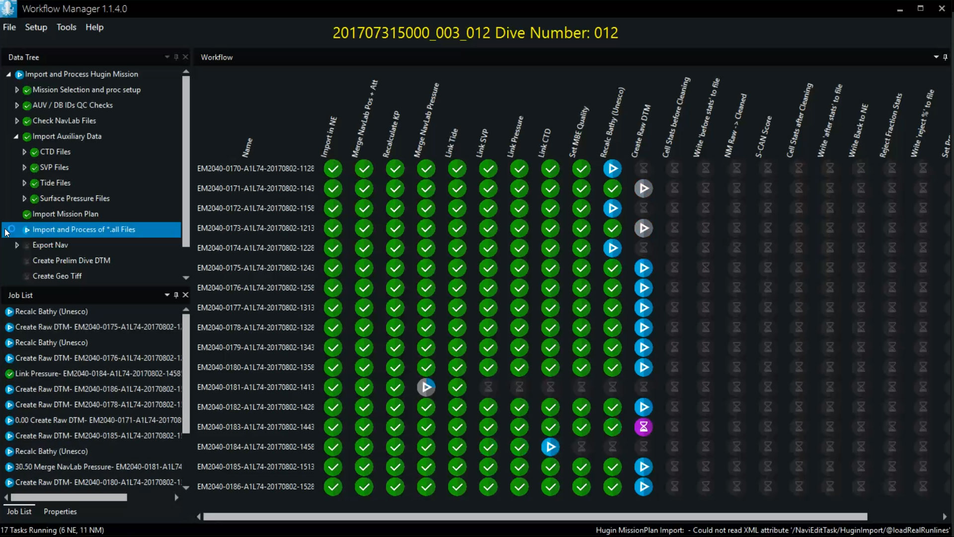
Workflow Manager – Server
Configurable workflow process automation tool allowing for automation of the small steps you normally go through when processing subsea data.
€ 13,650.00/year