


Key features and benefits

Cutting a long catenary story short: What you get
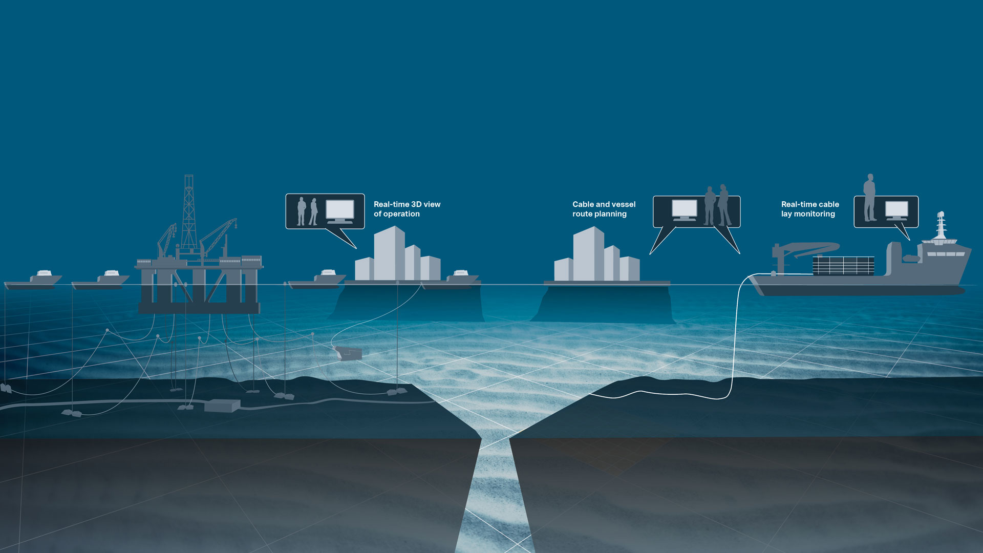
Advanced catenary simulation for anchor/riser handling and cable/flexpipe lay operations.
Cutting a long survey story short: What you get
Advanced catenary simulation for anchors/risers of FPSOs and other floating units
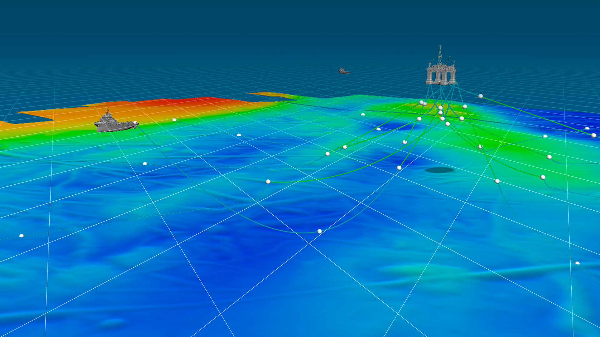
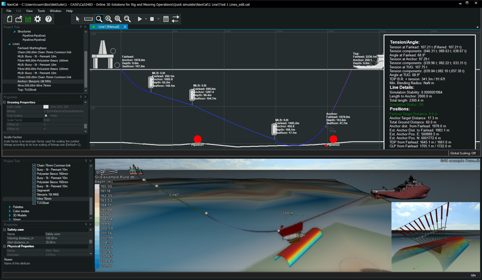
3D catenary simulation based on an advanced algorithm
... offering precise data and reducing operation costs by replacing the need for subsea sensors that provide data which the software can simulateDisplay that combines real-time, user-defined operation data in a single view that functions as a key operation tool
... which can be shared with your team, ensuring that you have all the information needed to run efficient operations that match your requirements and setupCalculation and visualisation of seabed, subsea object and structure clearance
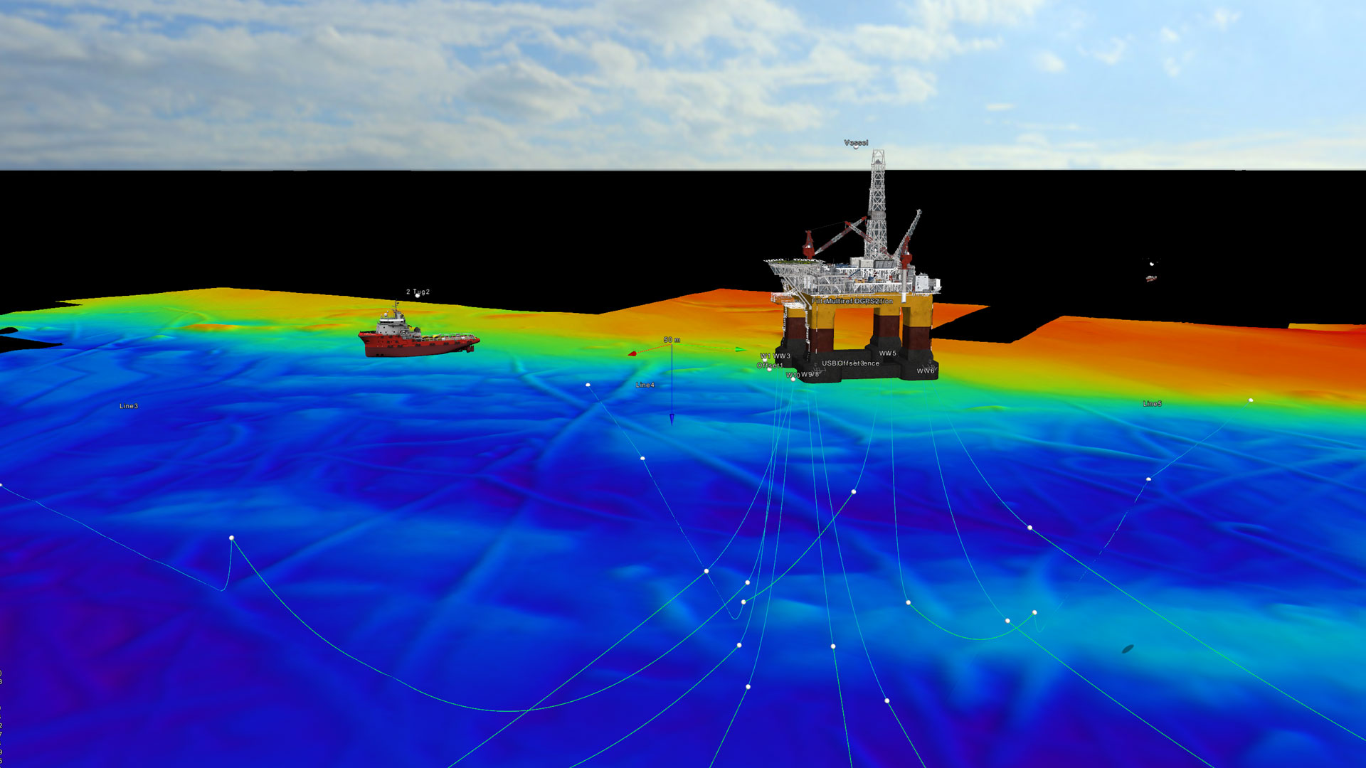
... enabling safer operations by avoiding collision with the seabed and subsea structuresReal-time 3D display of the seabed, structures, anchor elements, and surface and subsea objects
... offering a complete picture of the entire operation, thereby reducing the risk of errors being made and increasing the efficiency of the operationFor tug boat operations specifically, NaviSuite Beka offers you:
- Runline patterns for barge/tug boats
- Real-time positioning of barge and tugs
- Communication between barge and tugs
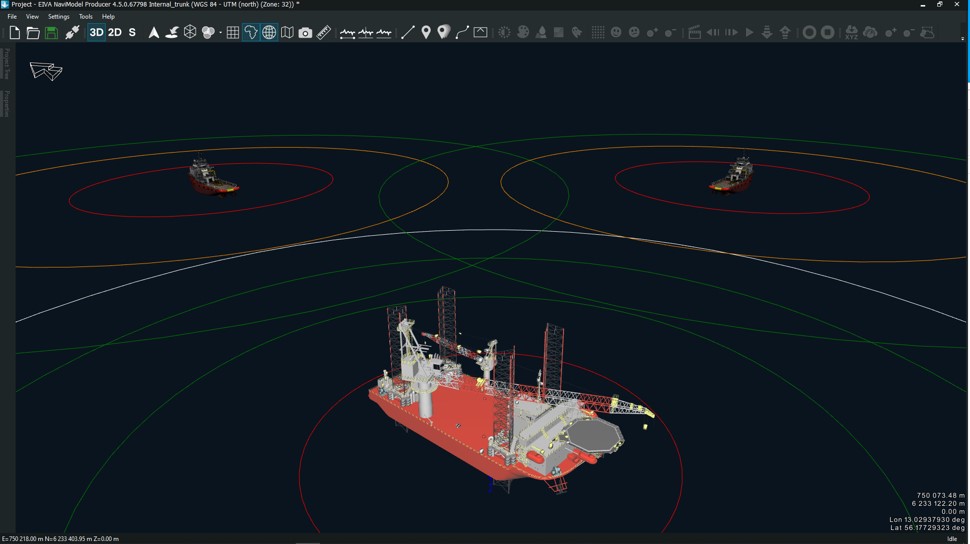
In terms of rig placement and rig safety, you get:
- Planning of anchor patterns
- Simulation of anchor and riser placement in water column (catenaries)
- Real-time estimation of anchor chain tensions without needing tension measurement sensors
Offer your clients a more comprehensive service
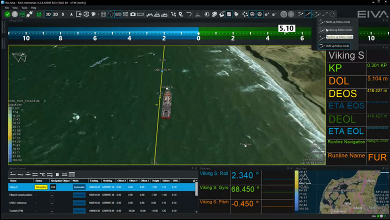
A real-time 3D view allows your clients to follow the operation. Also, they benefit from a reporting feature that offers automatic generation of detailed documentation on eg riser/anchor status, clearance distance and anchor chain touchdown point (TDP).
-
Flexible communications setup for rig move operations
Use your existing communications hardware more efficiently.
Flexible setup for rig move operations
With NaviSuite Beka as the software bedrock of your rig move operations, you can use your existing communications hardware more efficiently, saving you the cost of purchasing additional equipment.
The software allows for communications between the rig/barge and tugs via telemetry with up to three multiplexers or WLAN – or a combination of the two media types, depending on your needs. The bandwidth-efficient communications protocol ensures a faster data throughput and consequently reduced communications costs.
Additionally, licences for tugs are available at a low cost. This means that you get an operational software tool on board all vessels involved in the operation without breaking your budget.
AIS integration gives you a complete overview of all vessels in the operation area and ensures you a backup option if the telemetry/WLAN connection is lost, thereby eliminating the risk of downtime due to communications issues.
Choose between various rig move operation management setups
You can choose between various operation management setups. For example, the entire operation can be managed from the rig/barge, with tug operators following it on a display via an auto zoom/pan feature and delivery of commands and runline/waypoint assignments.
Alternatively, you can co-manage the operation with one or more tug operators, enabling them to, among others, respond to assignments and change anchor status (picked-up, dropped, etc).
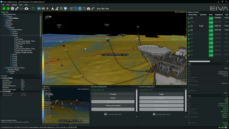
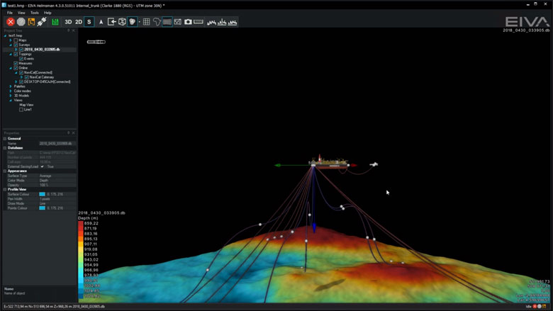
The NaviSuite Beka software offers high-performance, virtually instant anchor chain catenary simulation. You can make changes to all parameters and plan the next steps of the operation on the fly, and the changes will immediately be visible on the screen. Moreover, you can share the information with the tug operators as well as shore-based staff who are carrying out support and monitoring.
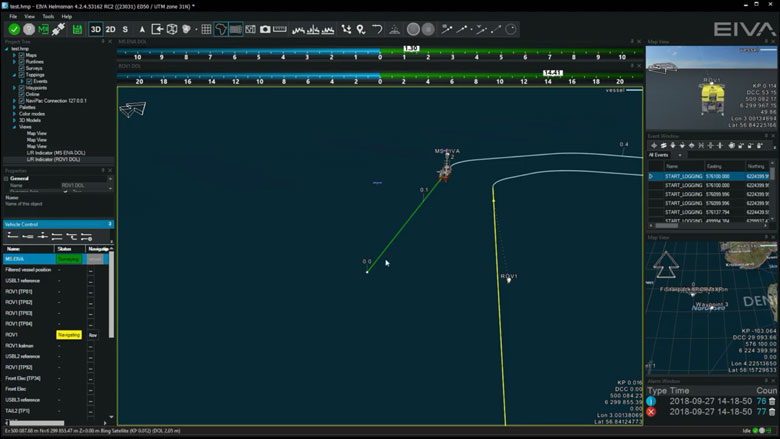
The entire operation is managed via a centralised rig/barge server and command centre, which reduces mobilisation and operation costs. You can design or import multiple runlines and waypoints, as well as manage anchor status and locations of up to 16 anchors manually or automatically.
-
Advanced catenary algorithm
The catenary feature of NaviSuite Beka has been developed and theoretically verified by the non-profit independent Danish research organisation the Alexandra Institute (member of the Danish GTS – Advanced Technology Group), and tested in real-life operations by the survey company iSURVEY.
Advanced catenary algorithm
The advanced catenary algorithm behind the catenary feature of NaviSuite Beka has been developed and theoretically verified by the independent, non-profit Danish research organisation the Alexandra Institute (member of the Danish GTS – Advanced Technology Group), and tested in real-life operations by the survey company iSURVEY (today Reach Subsea).
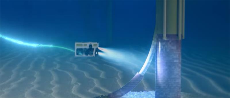
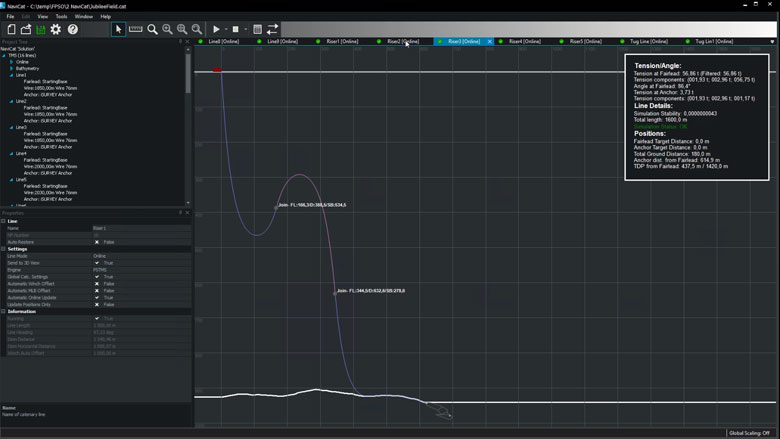
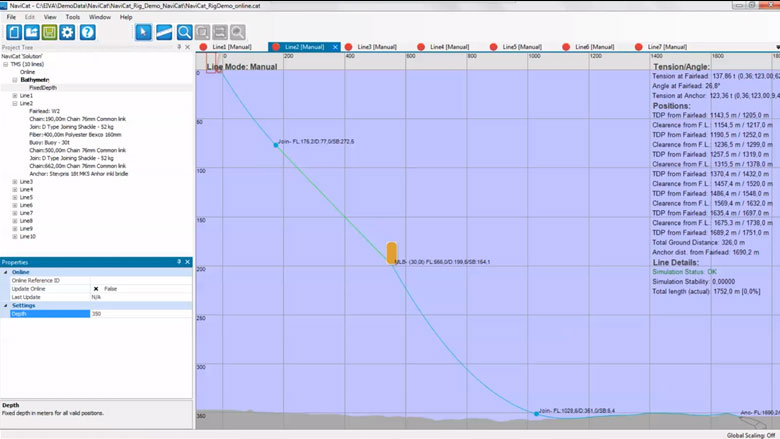
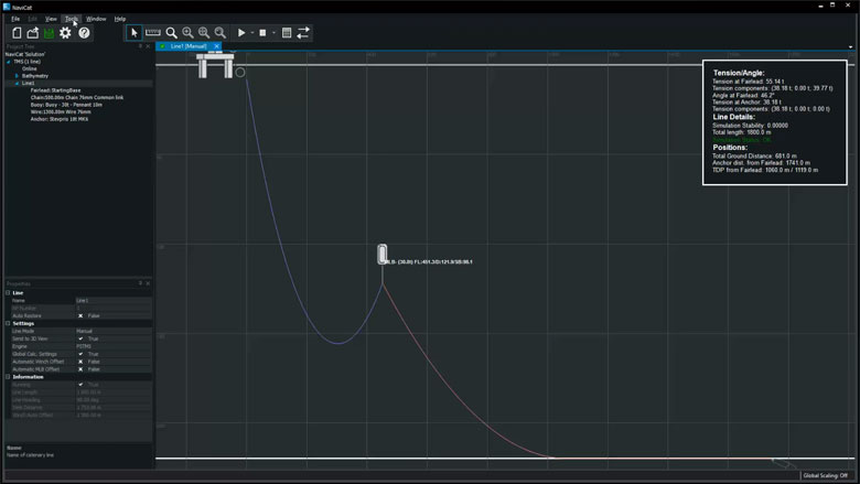
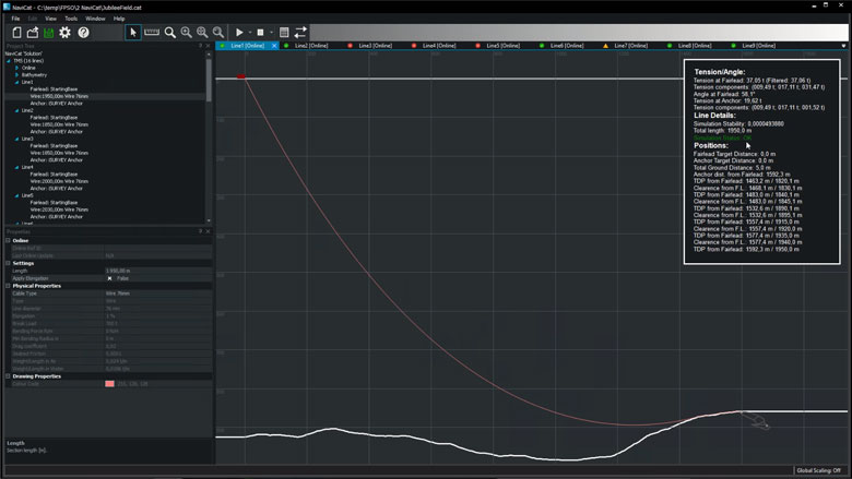
In addition to the advanced 3D display of all the objects involved in the operation, the software solution offers a comprehensive 2D display of high-quality catenary calculations that allows you to dive into the details of each anchor’s catenary. It is easy to use and offers instant results upon configuration changes.
A tension monitoring feature displays all the chain sections of all anchors, automatically colour-coded to illustrate the tension on each section. This feature also includes a three-level alarm function with user-defined limit values.
Easy integration with third-party systems and other EIVA software
Standard protocols such as the Inter-Vessel Survey Data Standard Telemetry Protocol IMCA S 006 are supported. This makes for quicker and easier integration and data exchange with systems used by third-party operators involved in the project, and you do not have to spend time on additional system configuration.
NaviSuite Beka is based on the NaviPac solution for offshore navigation and acquisition, which is widely used internationally. It offers seamless integration with the other solutions in the EIVA NaviSuite software family and consequently easy data import and export. Moreover, training costs are kept to a minimum, as the crew use the same software suite for various types of operations.
-
Take rig move specialists' word for it
Hear about some of our customers’ experience of working with NaviSuite Beka.
Take rig move specialists' word for it
Hear about some of our customers’ experience in working with the NaviSuite Beka software solution for anchor handling operations during rig move and barge management projects
iSURVEY Pte Ltd.
'iSURVEY have completed several hundred rig moves since 2004 using the EIVA NaviSuite platform. When complexity increases with regards to seabed structures and number of catenary segments involved, iSURVEY sees the benefit of having the ability to do advanced planning and integrated online catenary calculations in all stages of the operation.'
Senior Technical Advisor Rune Omdal
Tilone Subsea Limited
'Doing rig move and positioning using EIVA NaviSuite gives flexibility in usage. It is user-friendly, which makes it more robust and versatile as an acquisition platform.'
Managing Director and CEO Stanford Tassie
-
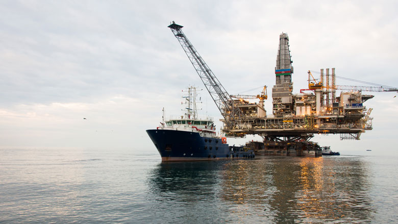
Anchors and risers
NaviSuite Beka combines anchor handling and catenary data acquisition, ROV inspection, and reporting in a single tool that covers both operation planning and execution for anchor handling operations.
Anchors and risers features
NaviSuite Beka combines anchor handling and catenary data acquisition, ROV inspection, and reporting in a single tool that covers both operation planning and execution for anchor handling operations.
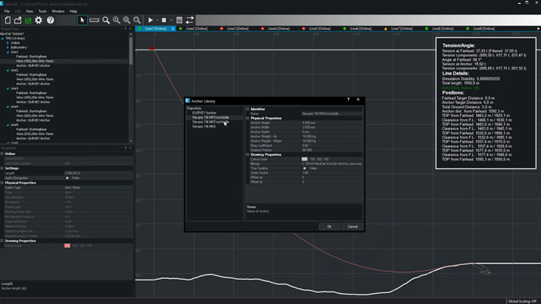
Materials property database
The catenary solution is delivered with an extensive library of chain components such as anchor, buoy, cable, chain and joints. You may furthermore define or import new components.
2D catenary monitoring
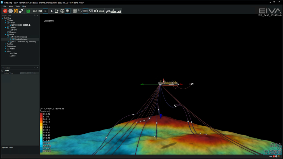
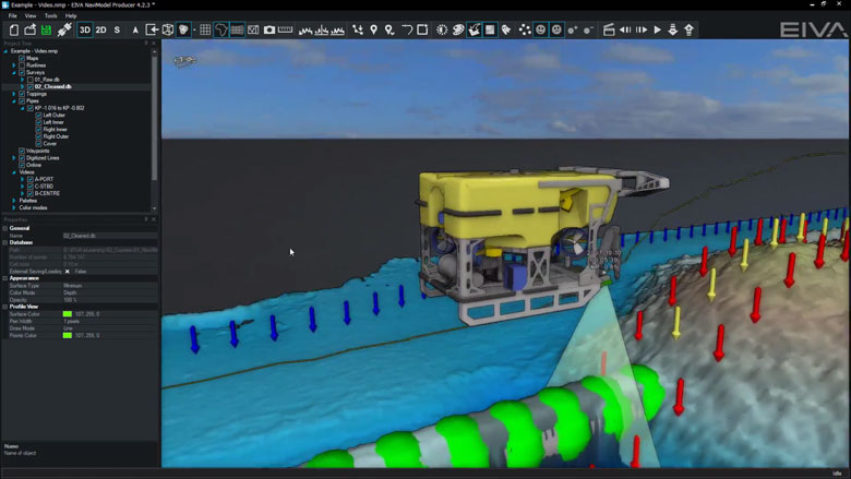
The catenary module is a stand-alone application used either in planning mode or live, together with NaviPac. It uses physical catenary simulation to estimate all parts of multiple catenary curves supporting cable, wire, chain, lifters, joints etc.
Change DTM
The catenary data model uses the seabed as reference and can use both terrain model and along-route profile of fixed depth as reference.
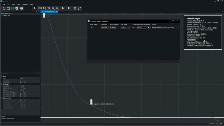
Suggest anchor position based on direction, configuration and desired tension
The system helps in calculating suggested anchor position based on either angle or tension by running iterative processes to obtain the best match.
Calculate 3D catenary using currents
The catenary model supports compensation for 3D current and will make final curvature and touch down based on the defined current.
Real time recalculation of caternaries
Catenary calculations act instantly as all components in the chain will have an impact on the resulting curve – as illustrated here by adjusting buoyancy.
Display catenaries in connected 3D displays
NaviPac version 4 connects to NaviCat. All chains and raisers are estimated instantly based on navigation and sensor inputs, and the catenary data model is sent to the HMD for graphical display. The entire 3D scene can be exported as Mesh for external use and documentation.
-
General visualisation
NaviModel and NaviPac share the same 3D engine, and therefore the same powerful 3D visualisation features. Data can be visualised in 2D, 3D, side view or by time.
General visualisation features
NaviModel and NaviPac share the same 3D engine, and therefore the same powerful 3D visualisation features. Data can be visualised in 2D, 3D, side view or by time.
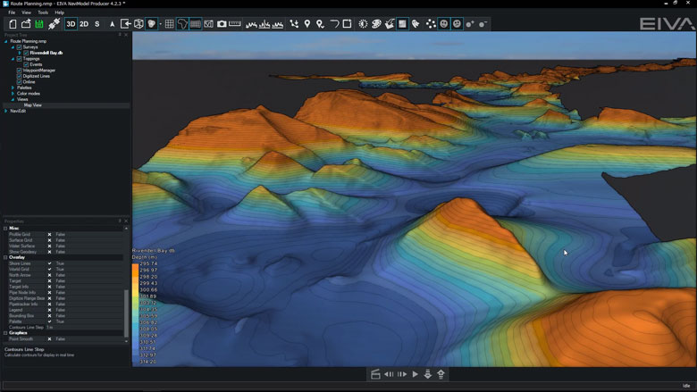
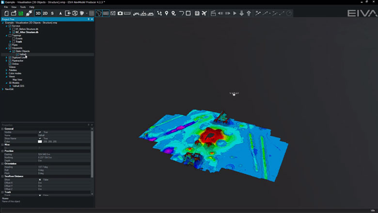
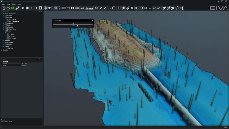
3D seabed terrain
Seabed terrain can be visualised in a 3D environment.
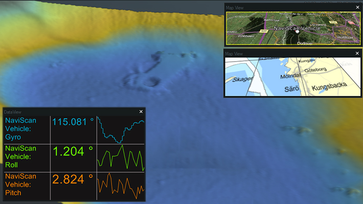
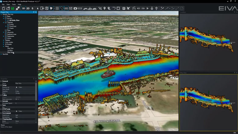
Multiple Map Views
Multiple Map Views are available. Each individual Map View window can be configured separately to display only the information required.
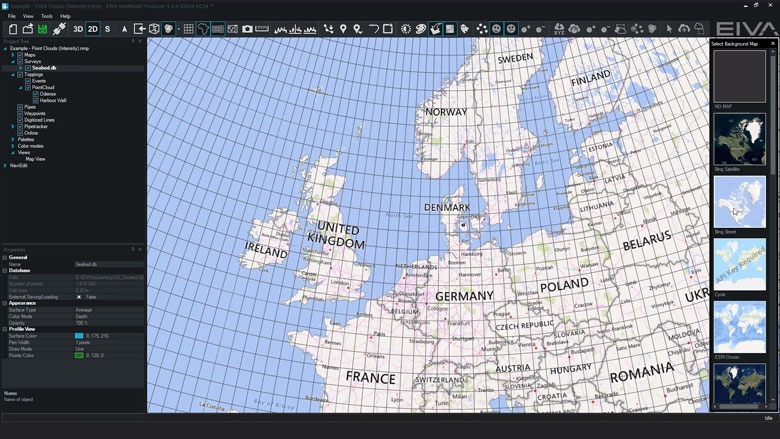
Background Maps
Background Web Map Service (WMS) maps can be displayed.
Import 3D models
3D models can be imported into NaviModel (drag and drop into the Map View window).
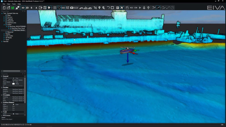
Link 3D models to live objects
3D models can be linked to any live objects (Vessel, ROV, Scanfish etc).
2D, 3D and side-view displays
2D, 3D or Side views allows the user to quickly change the view facilitating better data interpretation.
Visibility Slider
Visibility slider allows users to compare different DTM’s quickly. This enables comparison over time or between different data processing methods.
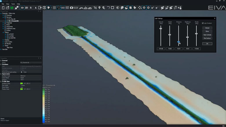
Control colours, lights, details
DTM light and palette settings can be changed at any time.
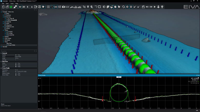
Profile views
The following profile views are available:• Cross Profile• Long Profile• Quick Profile• X & Y Axis Profile• View Profile
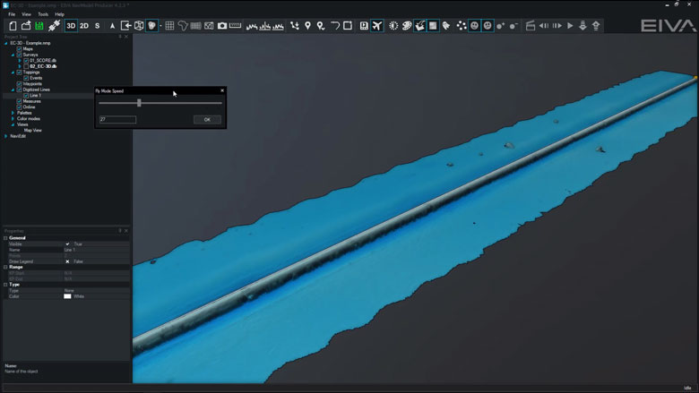
Create fly-through videos
Fly-through videos can be created for project or promotional presentations.
-
Navigation and routes
NaviPac is an integrated navigation and data acquisition software solution that includes surface and subsea navigation, route and waypoint planning, live tracking and piloting.
Navigation and routes features
Navigation and data acquisition are integrated in this software solution. Efficiently and easily navigate surface and subsea vessels using intuitive tools to plan routes and waypoints, track or pilot a vessel and more.
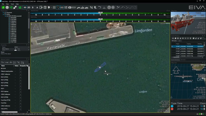
Display live position of a vehicle
NaviSuite supports display of vehicle data based on the NaviPac data feed. You can display the main vessel along with one subsea vehicle, such as an ROV or ROTV, on an unlimited number of local and remote displays. The data can be shown graphically in multiple map views.
AIS tracks
NaviSuite supports integration with AIS receivers. The data can be shown in a dedicated AIS window and overlaid in the NaviPac window. You can perform, read and utilise vessel dimension information.
Display north-up, heading-up, route-up
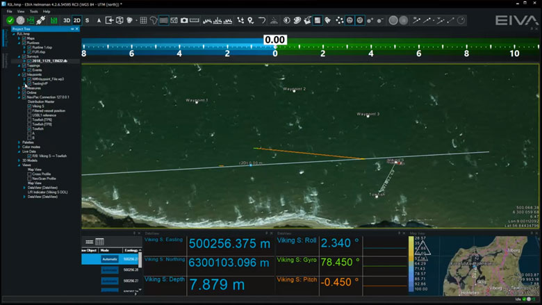
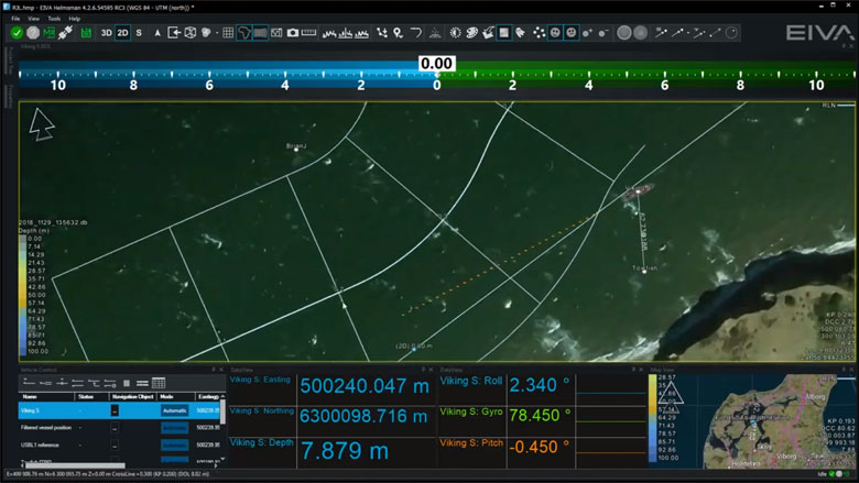
Each Map View can be designed and controlled individually when it comes to content, overlays and layout. Map Views can be 2D, 3D or side-views, and orientation can be user defined, north-up, vehicle up or line up.
Manual waypoint drawing
NaviSuite supports a series of runline and waypoint formats including our own RLX/WPT format, ad generic ASCII readers. You can also draw lines and points directly in the Map View.
Various runline patterns (parallel, cross, star)
You can inherit multiple lines based on the base line defined, such as parallel or cross lines to get an optimal route plan.
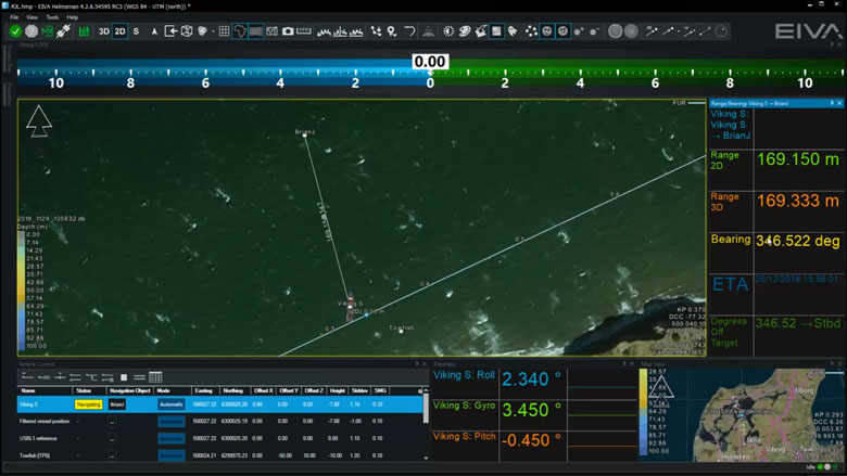
Vehicle control panel for multiple vehicle runlines and display DOL
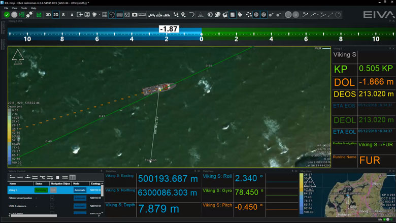
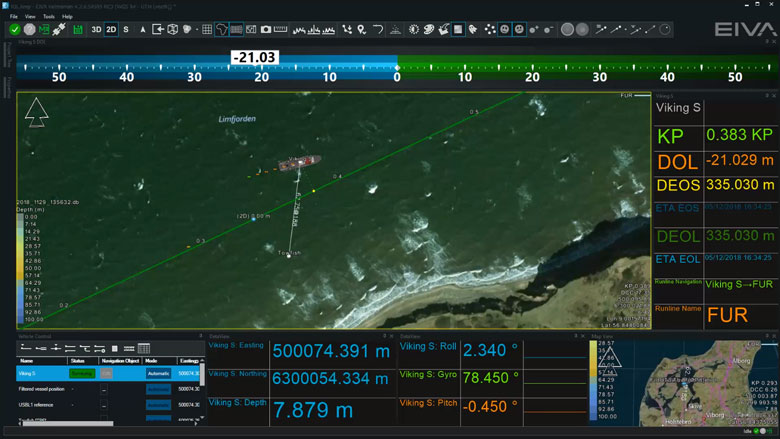
Assignment of lines and waypoints are handled through the dedicated Vehicle Control view, as you may control multiple vehicles simultaneously. Each controlled vehicle will be available as distance offline indicator (DOL/DCC) and various runline information (along line, target ETA etc).
Distance to waypoint
Waypoints are handled in a similar manner to runlines, as assignment of the waypoint is done in the Vehicle Control View. Hereafter, an artificial runline is created from the vehicle to the point and NaviPac monitors the range/bearing to the destination. and can a,.o. feed that into autopilots and DP systems.
Multi-object live range/bearing
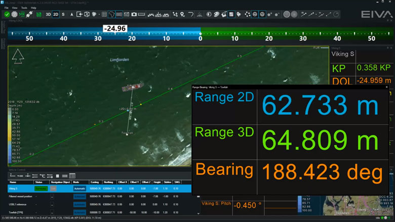
In NaviSuite, you may pair live vessels and monitor the range/bearings between them for online display as live data and range information on Map Views.
Auto-pilot (NMEA) control
When using runlines and waypoints you may connect NaviPac to autopilot systems using e.g., standard NMEA formats and pass cross-track error and destination waypoints on to the equipment.
DataUnits
NaviSuite supports use of other data units in addition to metric. The unit is selected in the project settings and all definition fields are then assumed to be in the selected data unit.
NaviSuite will follow the selected data unit, but you may, by using a simple keystroke, toggle between metric and data unit if required.
Data recording will still be metric to guarantee data integrity, but data outputs can be selected freely.
-
Engineering/Construction Design
Within NaviModel, we can design trench or rock-placement profiles or import existing engineering drawings from various sources (AutoCAD).
Engineering/Construction Design features
Within NaviModel, we can design trench or rock-placement profiles or import existing engineering drawings from various sources (AutoCAD).
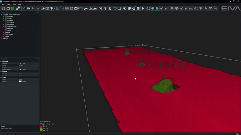
Find Rocks
This tool analyses DTMs to identify rock events.
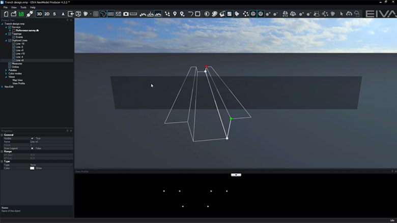
Trench design
In NaviModel theoretical trench profiles can be designed and visualised inside a 3D environment.
If available AutoCAD engineering drawings can also be used.
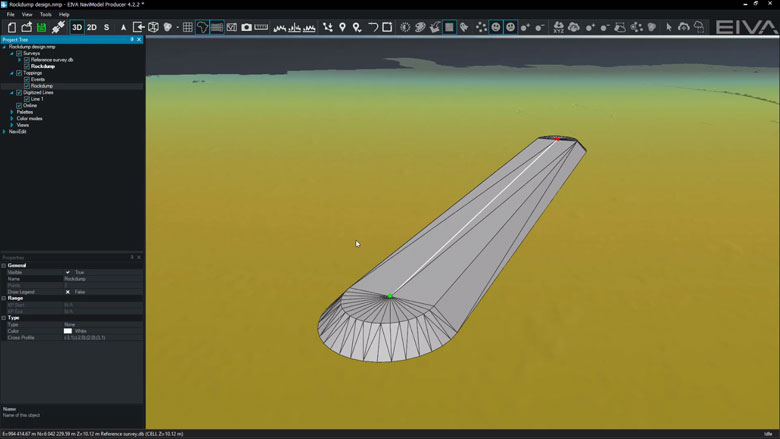
Rock-placement design
In NaviModel theoretical rock-placement profiles can be designed and visualised inside a 3D environment.
If available AutoCAD engineering drawings can also be used.
-
Sensor interfacing and recording
Many different sensors can be interfaced and integrated in both NaviScan and NaviPac.
Sensor interfacing and recording features
Many different sensors can be interfaced and integrated in both NaviScan and NaviPac.
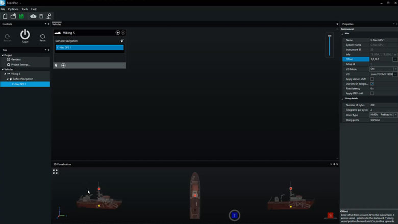
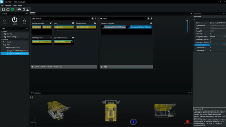
Surface positioning and motion (GPS, Gyro, IMU)
Setting up an entire vessel based project in NaviPac is easy performed using intuitive graphical definition tools. The video covers basic project definition, geodetics and vessel navigation setup.
Subsurface positioning (USBL, DVL, INS, Gyro, IMU)
Setting up remote and subsea vehicles is done in a similar manner to the main vessel – easy and intuitive. Adding instruments, positioning sources (transponders, INS, LBL etx) and defining weighting and Kalman filter settings is possible.
-
Sensor processing
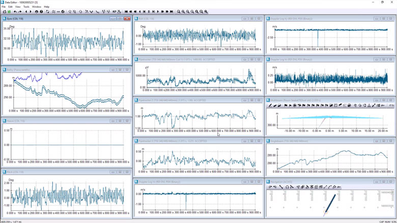
NaviEdit can be used to recalculate data very quickly and where our sensor processing takes place. Here we change offsets, C-O’s, mounting angles, apply tide, apply SVP, de-spike sensors, improve object positioning, Kalman filtering, remove swell etc.
Sensor editing (import and manual editing)
Sensor editing takes place in NaviEdit Data Editor. If required, we can run the following actions:• De-spike• Interpolate• Delete• Translate• Scale• Rotate• SmoothSensor processing features
NaviEdit can recalculate data very quickly and where sensor processing takes place. Here we change offsets, C-O’s, mounting angles, apply tide, apply SVP, de-spike sensors, improve object positioning, Kalman filtering, remove swell etc.
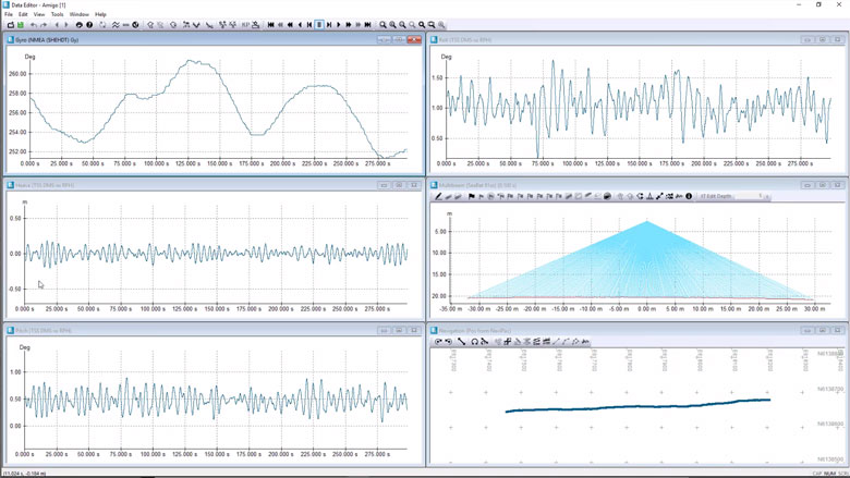
Subsurface positioning (USBL, DVL, INS, Gyro, IMU)
You can check an ROV setup. View and QC sensor data via a series of graphical displays.
-
Optional extra services and special offers
EIVA offers a number of services for our NaviSuite software users.
Optional extra services and special offers
Get the most out of your software
EIVA offers a number of services for our NaviSuite software users. These include:
- Access to our self-service licence administration and purchase portal, My EIVA
- eLearning, virtual and classroom training
- Software maintenance and 24/7 support programme (Comes free of charge for subscription licences – Learn about the different licence types and the maintenance and support programme)
- Custom development
- Mobilisation/installation – on-site or remote assistance
- Dongle replacement programme for lost or broken dongles for permanent licences
Also, we have a number of special offers:

Related products
-
NaviPac Tug
Navigation and positioning software dedicated to tugs during rig moves and similar jobs.
€ 14.00/day€ 642.00/year€ 1,925.00/permanent -
NaviPac Pro
The most elaborate NaviPac variant for navigation information and positioning calculations.
€ 115.00/day€ 7,100.00/year€ 21,300.00/permanent -
Rig move and tug management option for NaviPac Pro
The Rig move and tug management option for NaviPac Pro is a planning and real-time solution for rig moves, anchor handling and tug boat control.
€ 38.00/day€ 2,367.00/year€ 7,100.00/permanent