To use this site, please enable javascript
To use this site, please enable javascript
The technological development of the maritime industry is moving faster than ever. Staying ahead and thus ensuring maximum gain of the possibilities it brings, from the beginning, is vital to every organisation involved in operations at sea.
EIVA sees five decisive trends resulting from new and improved technologies. In this and four additional blog items, our CEO, Jeppe Nielsen, dives into each of these trends in detail.
Author: EIVA CEO Jeppe Nielsen
EIVA was born out of the offshore construction sector in 1978. Through the years, we have expanded our activities and products to cover numerous other sectors of the maritime industry. The nearly 40 years in the business have taught us that the technologies behind the equipment and software in play are intertwined, and that there is an evident synergy of applying these across the numerous sectors evolving around subsea and above water survey and engineering. This includes new trends and the possibilities they bring.
One such trend is the large amount of data we see our customers acquiring, processing and turning into visual end-products for their clients – an amount that keeps expanding as new technologies are introduced. Moreover, we see more and more survey professionals expanding their survey spreads with multiple unmanned systems to bring home far more data during survey operations than seen before.
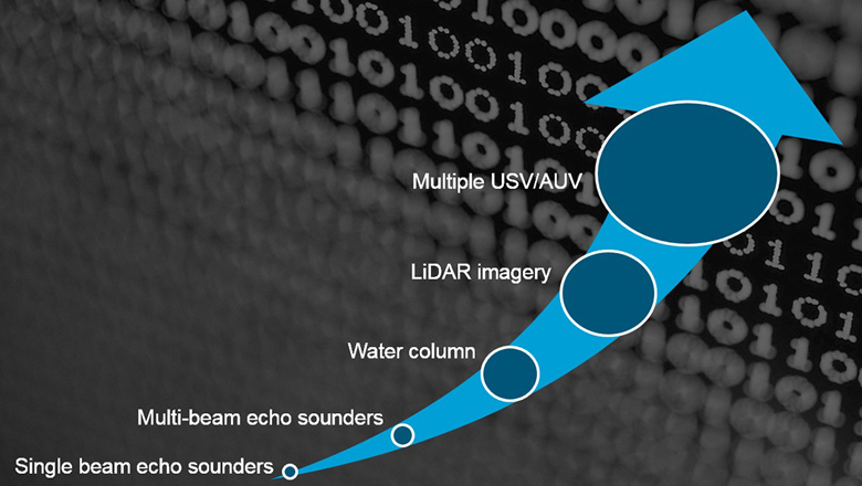
The amount of data acquired during survey operations has grown exponentially due to new technologies
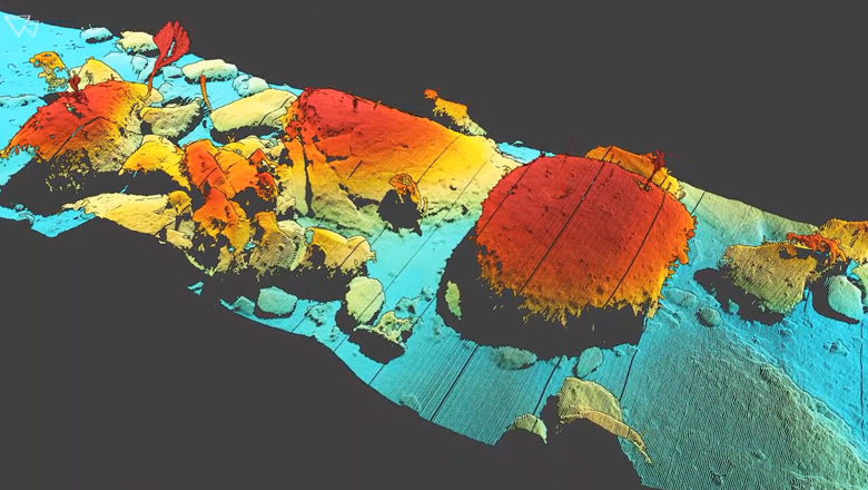
In the past 20 years, the survey industry has seen an explosion in the amount of data being collected and made available. Some organisations are still working with simple, single-beam echo sounder (SBE) surveys. The majority of the players in the offshore and subsea industry, however, have adopted multi-beam echo sounders (MBEs), consequently increasing the number of data points by 100-500 times. Furthermore, the sonar manufacturers have given us the possibility of backscatter and water column recording, thus multiplying the amount of available data points by another 100 times.
But sonar data is neither the only nor the largest source for the expanded amount of data: The use of LiDAR (that is, both terrestrial and subsea lasers), combined with video/imagery, has rapidly increased the size of data to an enormous degree. A terrestrial LiDAR easily produces up to 1 million points/sec – equalling roughly 100 times that of a sonar.
This of course means that the software products used for survey operations at sea where these large amounts of data are in play need to be able to live up to a whole new set of requirements – as does EIVA NaviSuite. Our software developers have made this happen, and have also made sure that we build on the possibilities this brings, adding features that harvest the benefits of working with large data sets. An example of such is our automated rock detection and measurement feature.
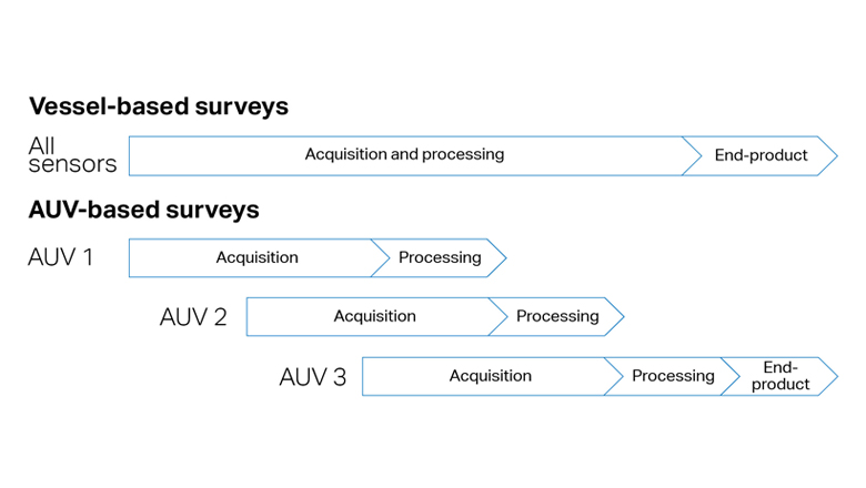
We are now at a point where data size is about to explode once more due the use of unmanned systems, such as AUVs or USVs – and not just one at a time, but multiple systems sent out from a single vessel. This will multiply the amount of data the team on board the vessel has available to work with.
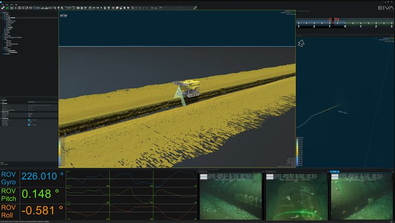
The EIVA NaviSuite software is known for high performance, especially our ability to handle very large data sets, virtually unlimited size of DTMs and point clouds with hundreds of millions of points. High performance is not just a gimmick or buzzword – it enables the operators to work efficiently with their data at all times, regardless the nature of the task.
As part of EIVA’s Q1 2017 roadmap, we are increasing the performance of our software once more, being ready for this next explosion in data size. For example, it will allow you to work with essentially unlimited sizes of point clouds (only limited by the specs of the computer used) in a near-real-time manner, thus opening up entirely new possibilities.
If you are interesting in discussing how to best work with large data sets, we will have the tools available and coming soon in the EIVA NaviSuite software products at the Ocean Business exhibition in Southampton 4-6 April 2017.