To use this site, please enable javascript
To use this site, please enable javascript
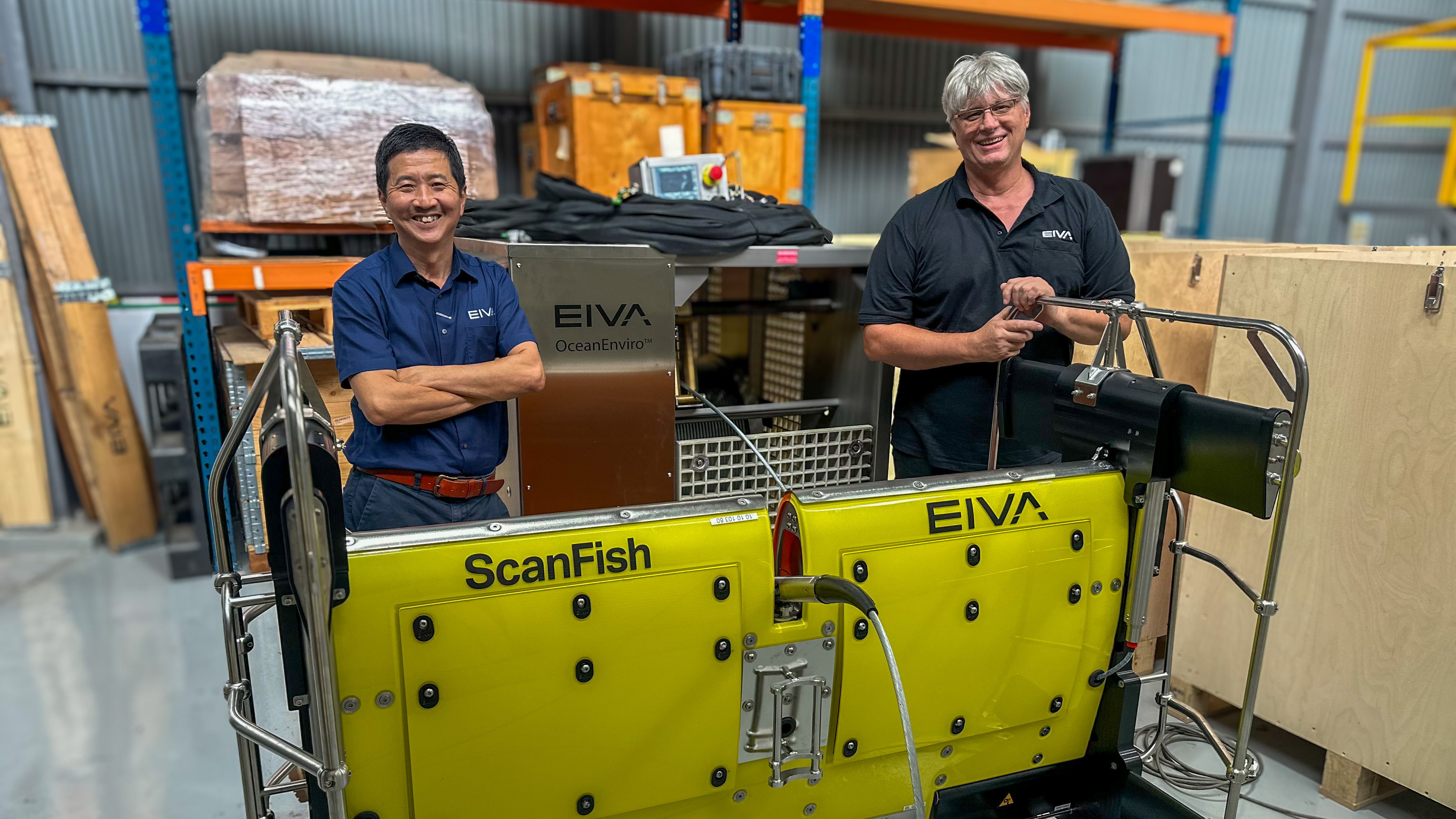
Author: EIVA CEO Jeppe Nielsen
There is the hard way – manually. And there is the easy way – letting EIVA NaviModel do all the work for you, finding as many as 325 rocks in 1 minute (maybe even more, depending on the computer used).
The enormity of the surveys and data processing work performed in our industry often amazes us. One example is eventing – registration of items of interest in a survey. Events can be many things – pipe joints, damages to structures, anodes, corals, holes, special seabed features – and of course rocks!
We have customers that identify as many as 150,000 events during a single survey. Every event is outlined, measured and categorised – and all by NaviModel, our post-processing software product.
Rock eventing is relevant for projects during which you (for example) have to assess how many rocks need to be removed or destroyed prior to the commencement of a construction job. For other projects, rocks could pose a risk to existing infrastructure or the upcoming job, and therefore need to be mapped.
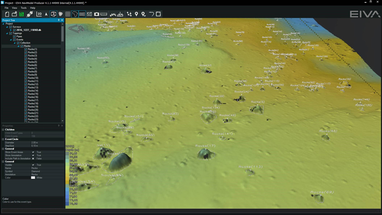
NaviModel screenshot of rock events detected by software (data courtesy of MMT)
One of our customers, the bathymetric, geophysical and geotechnical survey specialist MMT, recently did a survey aimed at detecting and measuring all rocks over a certain size. This survey was a perfect example of how the easy way of rock counting can make a big difference.
Imagine having to go through the survey data (video, sidescan and/or bathymetry) to first detect large rocks and then to measure the height, length, width and volume of each of them. Imagine that you have maybe 50,000 of them in your survey, as it was the case for MMT. In that case, you know what you will be doing for the next weeks, perhaps even months.
One of EIVA’s strategic focus areas is automation. One result of this focus is a number of automated eventing features such as Find freespan, Find gaps… and Find rocks… in NaviModel.
We are currently testing an improved version of the Find rocks… feature so it will not only automatically detect rocks over a certain size, but also create an outline, and measure height, length, width and volume. This allows you to save weeks of data processer time on jobs where the end-client requests rock eventing.
'MMT has been testing the new Find Rocks feature on some recent project data. The results are very positive and this is definitely a good step in the automation direction, which we believe is where we need to aim to meet the current market trends. We will keep evaluating and provide EIVA with user input to further improve the tool and make it market ready,' said MMT Data Processing Manager Lars Kårlin.
How the algorithm works is, of course, our little secret. We can however reveal that we use the slope differences in the DTM to detect the rocks and outline them. We then find the longest cross-section as the length and the width. The volume is calculated as the difference between the TIN model of the outlining polygon and the DTM. So, it is as precise as it gets.
You only have to specify the minimum and maximum size to characterise rocks of interest. The algorithm does the rest. You can of course modify properties and measurements afterwards, create more events, and delete false positives as you see fit.
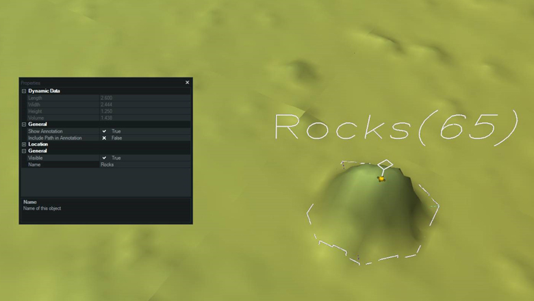
NaviModel will create an outline and measure height, length, width and volume of each rock (data courtesy of MMT)
We have tested with a data set covering an area of 500,000 m2. The algorithm detected and measured 1,060 rocks in 10 minutes. The algorithm performance scales linearly with the area searched, so we recommend ignoring large areas without rocks of interest. In our test data set, 750 of the rocks were in an area of approximately 90,000 m2 and took around 2 minutes to search.
The functionality is now being tested with selected customers, including MMT, and will make it into an official release during the first months of 2017. If you are interested in helping us test how effective the new functionality is, please send an email to eiva@eiva.com.
(And, yes, the feature is included in NaviModel Producer at no extra cost.)