How the ScanFish ROTV solution can increase data coverage and efficiency of data acquisition during waste water monitoring surveys
Challenge
All populated coastlines share a variety of pollution-related challenges. Those municipalities in the USA who engage in the discharge of waste water through ocean outfalls are subject to state and federal regulations requiring them to monitor the quality of the water near those structures and the marine environment beyond them.
The City of San Diego in southern California is one such municipality. With two vessels and a wide array of oceanographic sensors, the City’s Ocean Monitoring Program conducted by the Public Utilities Department continually inspects and reports on environmental conditions surrounding two large ocean outfalls: (1) the Point Loma Ocean Outfall (PLOO), which discharges treated wastewater to the ocean about 4.5 miles west of the mouth of San Diego Bay; (2) the South Bay Ocean Outfall (SBOO), which discharges wastewater about 3.5 miles offshore and just north of the US/Mexico border. The water quality component of these monitoring surveys includes performing vertical casts with a Sea-Bird CTD at a series of fixed grid stations conducted at various frequencies and over multiple day periods.
Solution
The City of San Diego looked to the ScanFish Rocio model in EIVA’s ScanFish ROTV (remotely operated towed vehicle) product line as a means of increasing data coverage and quality while at the same time decreasing vessel time.
The ScanFish Rocio is a highly flexible multi-purpose platform. It is capable of integrating a wide variety of sensors and being configured to collect continuous readings at any point in the entire water column at normal vessel speed. It can automatically track at a fixed depth in the water column, move in a undulating pattern from surface to seabed or move in a terrain-following mode while towed by a vessel, collecting in-motion profiles of the sensor data.
These attributes have made the ScanFish Rocio popular with many oceanographic institutes and organisations, including the U.S. Naval Research Laboratoy and NATO Science and Technology Organization – Centre for Maritime Research and Experimentation (formally NURC), as a platform for fast and high-density data acquisition. It is also what attracted the City of San Diego to purchase a system.
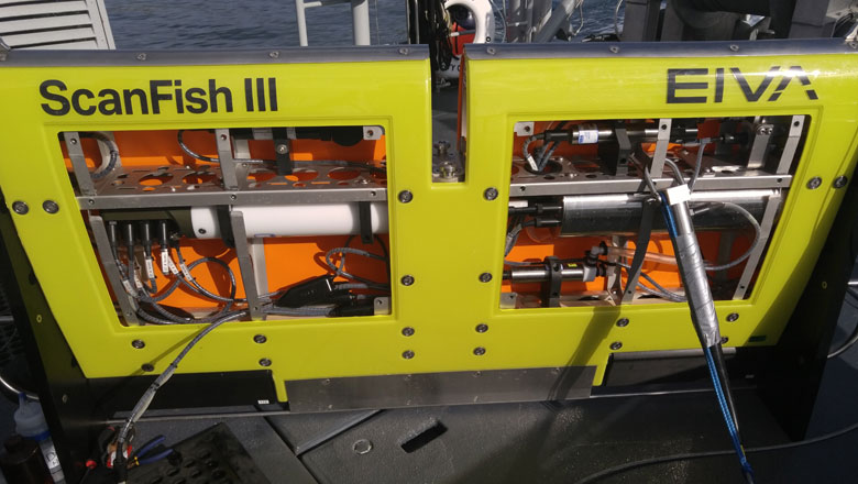
The ScanFish ROTV solution with the top lids removed to show how the different sensors are fitted inside the platform
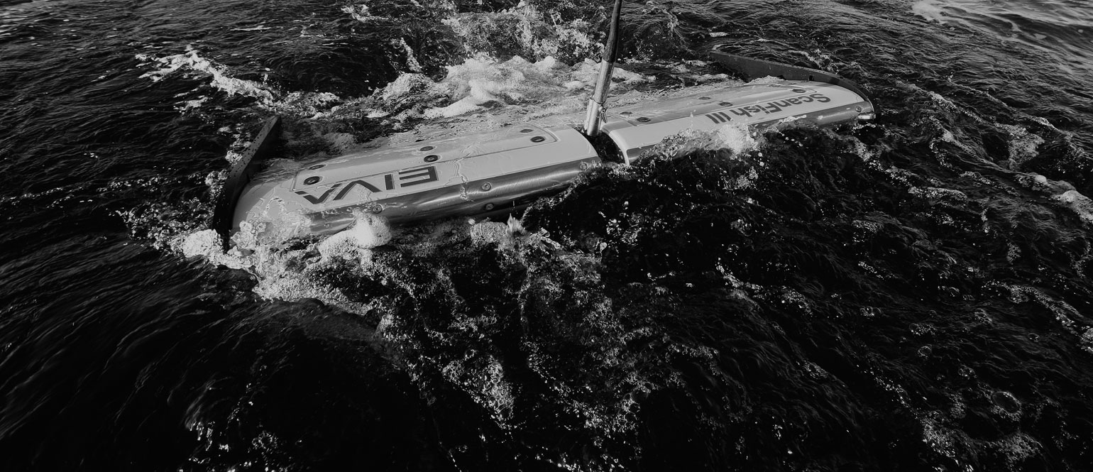
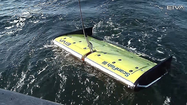
The ScanFish ROTV peeking through the water surface in the background, towed behind the City of San Diego’s monitoring vessel Oceanus
Result
The ROTV system was first used in the spring of 2016. The sea trials were successful and the data was processed using EIVA’s NaviModel software to quickly visualise the results.
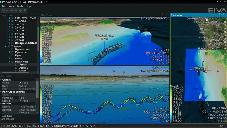
Data acquired with the ScanFish and presented in the EIVA NaviModel software, shown as an XYZI point cloud with the I value representing oxygen, temperature, etc. The wave/undulating pattern of the ScanFish is clearly seen together with the sensor data
The first trial performed by the City of San Diego indicates that a significantly larger area could be covered in the same amount of time. More trials must be performed in order to determine precisely the extent of the additional coverage that can be completed on a typical sampling day. City staff were impressed with the initial results and were optimistic that utilising the ScanFish system could lead to improvements in sampling efficiency and data collection, and potentially a better understanding of local waste water plume dynamics.
Even more features for waste water surveys to come
The configuration supplied to the City of San Diego has laid the groundwork for the development of a turn-key system dedicated to waste water management operations.
Based on the City of San Diego’s feedback, a number of features have been added to the EIVA NaviSuite software development plan for release in 2016, including:
- Improvements to the multi-parameter drivers inside NaviPac, especially live generation of XYZI for each of the sensors so they are shown in real-time inside the NaviPac 3D display as well as in graphs/data value displays as you sail.
- Real-time generation of digital terrain models (DTM)/surfaces from any sensor, not just traditional sonar/laser values. This is useful for other customer groups as well, such as magnetometer users.
- New visualisation features in NaviModel making it easy to filter the samplings on sensors values to easily visualise the plume and to have different terrain models built from the many different sensors for ease of visualisation.
See the ScanFish ROTV solution in action
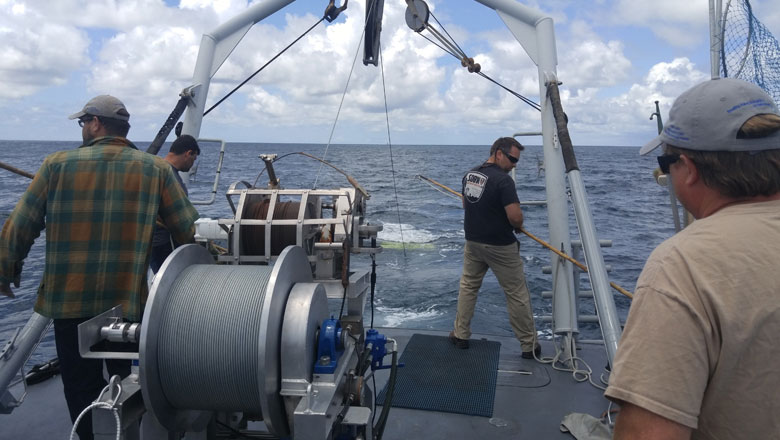
EIVA ScanFish ROTV deployment and recovery
Components of the ROTV waste water solution
ScanFish Rocio fitted with a number of environmental sensors:
- SBE 25plus Sealogger CTD
- SBE 43 Dissolved Oxygen
- SBE 3 Temperature
- SBE 4 Conductivity
- SBE 5 Pump
- Cyclops-7 fluorometer CDOM
- Cyclops-7 fluorometer Tryptophan
- Cyclops-7 fluorometer Optical Brightener
- UviLux BOD-tryptophan fluorometer
EIVA NaviSuite