


Key features and benefits

Cutting a long navigation story short: What you get
Ensure vastly cost reductions on buoy deployment – virtual buoys stay in the right place, can easily be moved, don’t require service and are free to deploy and recover.
Cutting a long navigation story short: What you get
Ensure vastly cost reductions on buoy deployment – virtual buoys stay in the right place, can easily be moved, don’t require service and are free to deploy and recover
The NaviSuite Perio software allows for:
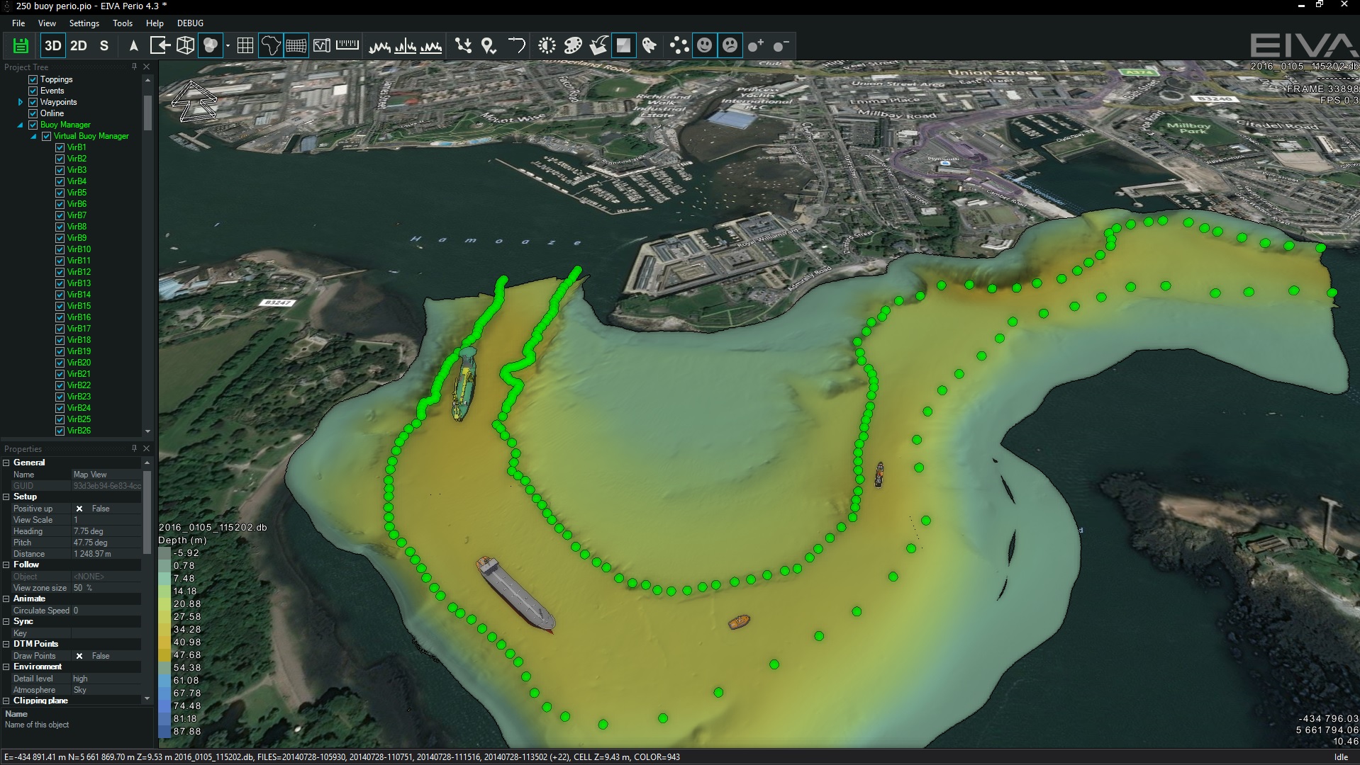
- 3D visualisation of seabed, navigation charts, buoys, etc
- Placement of buoys via the software on exact location based on latest seabed survey
- Support of all AIS AtoN buoy types
- Built-in quality control – NaviSuite Perio will listen for the buoy data and verify that it is received as it is sent
- Easy control of transmission being on/off
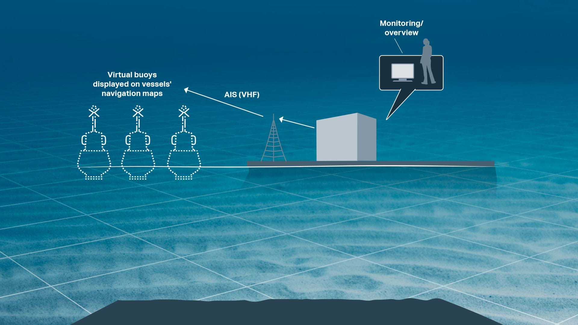
We use the AIS AtoN (Aid to Navigation) standard that allows for transmission of virtual object positions – in our case 250 or more buoys positioned in the software.
The hardware items of a complete system solution as a minimum encompass AIS transponder, AIS antenna, antenna cable, mounting bracket, etc, thereby allowing for transmission of the buoys' positions from shore.
-
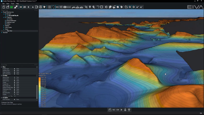
General visualisation tools
NaviSuite’s powerful visualisation features allow you to visualise maps and buoys in an intuitive interface.
General visualisation features
NaviSuite’s powerful visualisation features allow you to visualise maps and buoys in an intuitive interface.
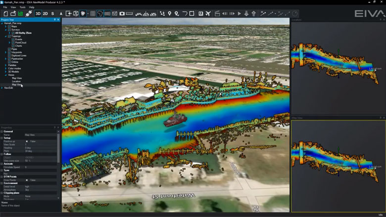
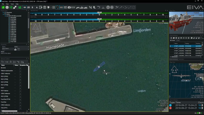
Multiple Map Views
You can display different views simultaneously, so you can keep track of different information visually. Map Views can for example be a map showing your location, 3D visualisations viewed from different angles and visualisations of data from different sensors. Each individual Map View window can be configured separately, so you can make a Map View displaying virtually any information you require.
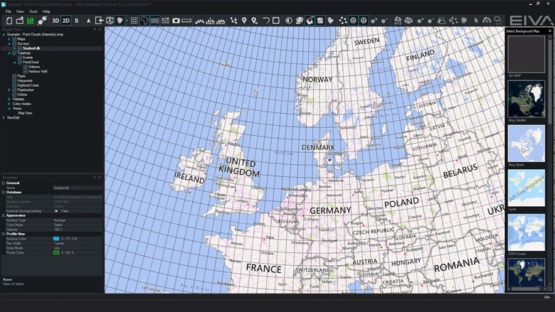
Background Maps
You can import existing third-party maps for example for line planning, navigation and procession quality control. Maps which can be displayed in NaviSuite include background maps from Web Map Service (WMS), geocoded images (for example geotiff), CAD drawings (for example DXF or DWG) and MicroStation drawings.
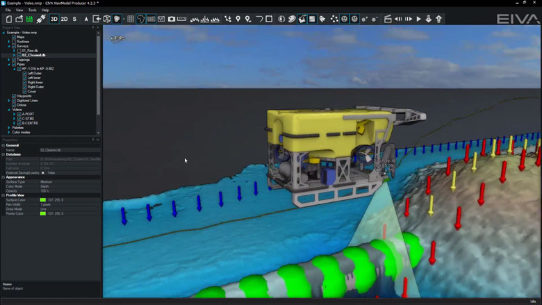
2D, 3D and side-view displays
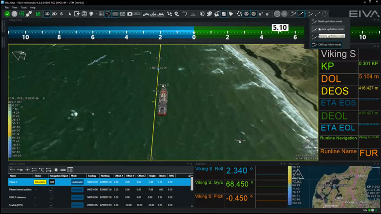
NaviSuite facilitates better data interpretation by making it easy for the user to quickly change the view displayed. Display options are 2D, 3D and side-view, as shown in the tool bar. Orientation can be user-defined, north up, vehicle up or line up.
-
Navigation and routes
NaviPac is an integrated navigation and data acquisition software solution that includes surface and subsea navigation, route and waypoint planning, live tracking and piloting.
Navigation and routes features
Navigation and data acquisition are integrated in this software solution. Efficiently and easily navigate surface and subsea vessels using intuitive tools to plan routes and waypoints, track or pilot a vessel and more.
Display live position of a vehicle
NaviSuite supports display of vehicle data based on the NaviPac data feed. You can display the main vessel along with one subsea vehicle, such as an ROV or ROTV, on an unlimited number of local and remote displays. The data can be shown graphically in multiple map views.
AIS tracks
NaviSuite supports integration with AIS receivers. The data can be shown in a dedicated AIS window and overlaid in the NaviPac window. You can perform, read and utilise vessel dimension information.
Display north-up, heading-up, route-up
Each Map View can be designed and controlled individually when it comes to content, overlays and layout. Map Views can be 2D, 3D or side-views, and orientation can be user defined, north-up, vehicle up or line up.
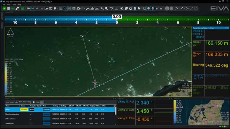
Distance to waypoint
Waypoints are handled in a similar manner to runlines, as assignment of the waypoint is done in the Vehicle Control View. Hereafter, an artificial runline is created from the vehicle to the point and NaviPac monitors the range/bearing to the destination. and can a,.o. feed that into autopilots and DP systems.
-
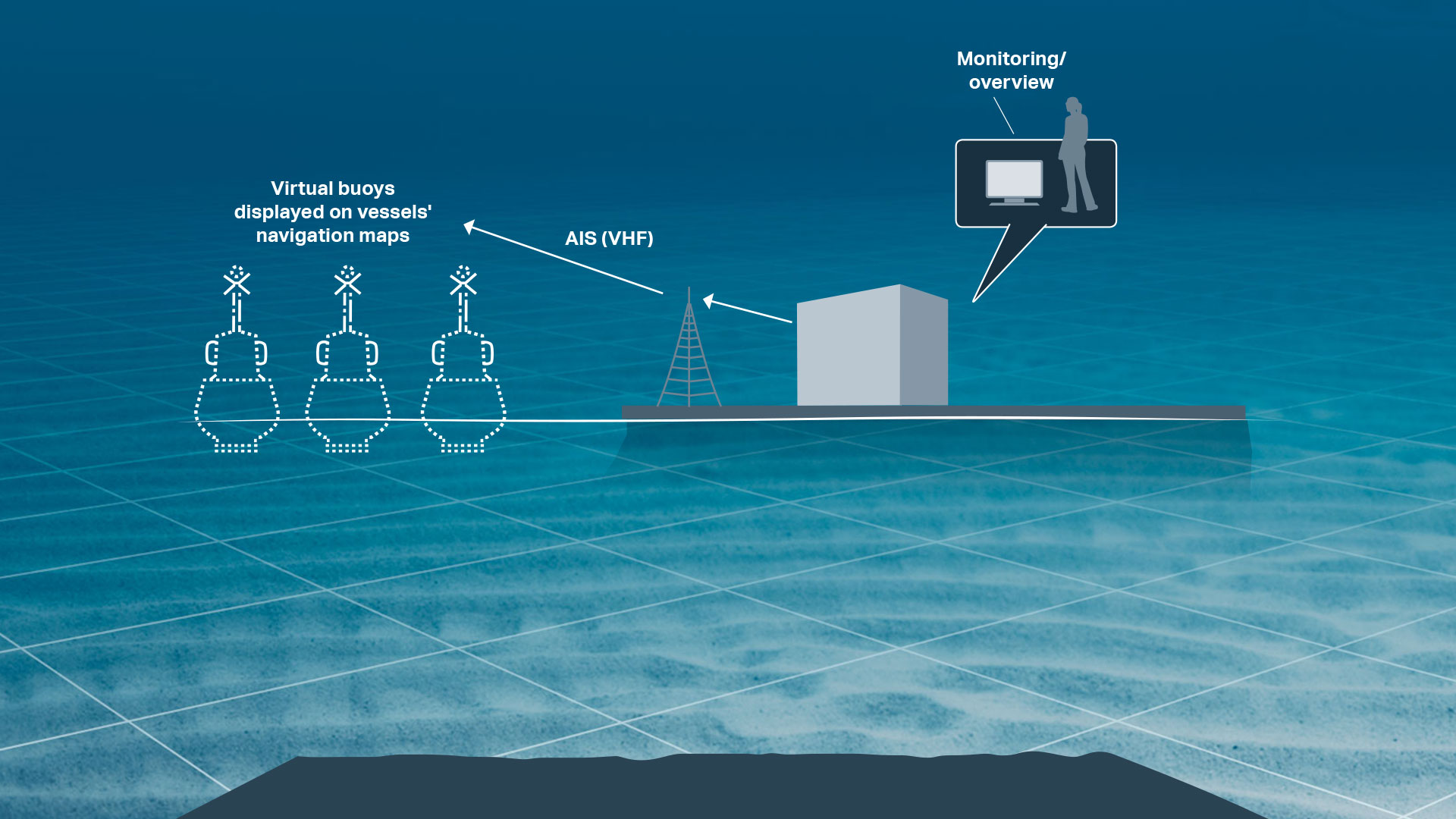
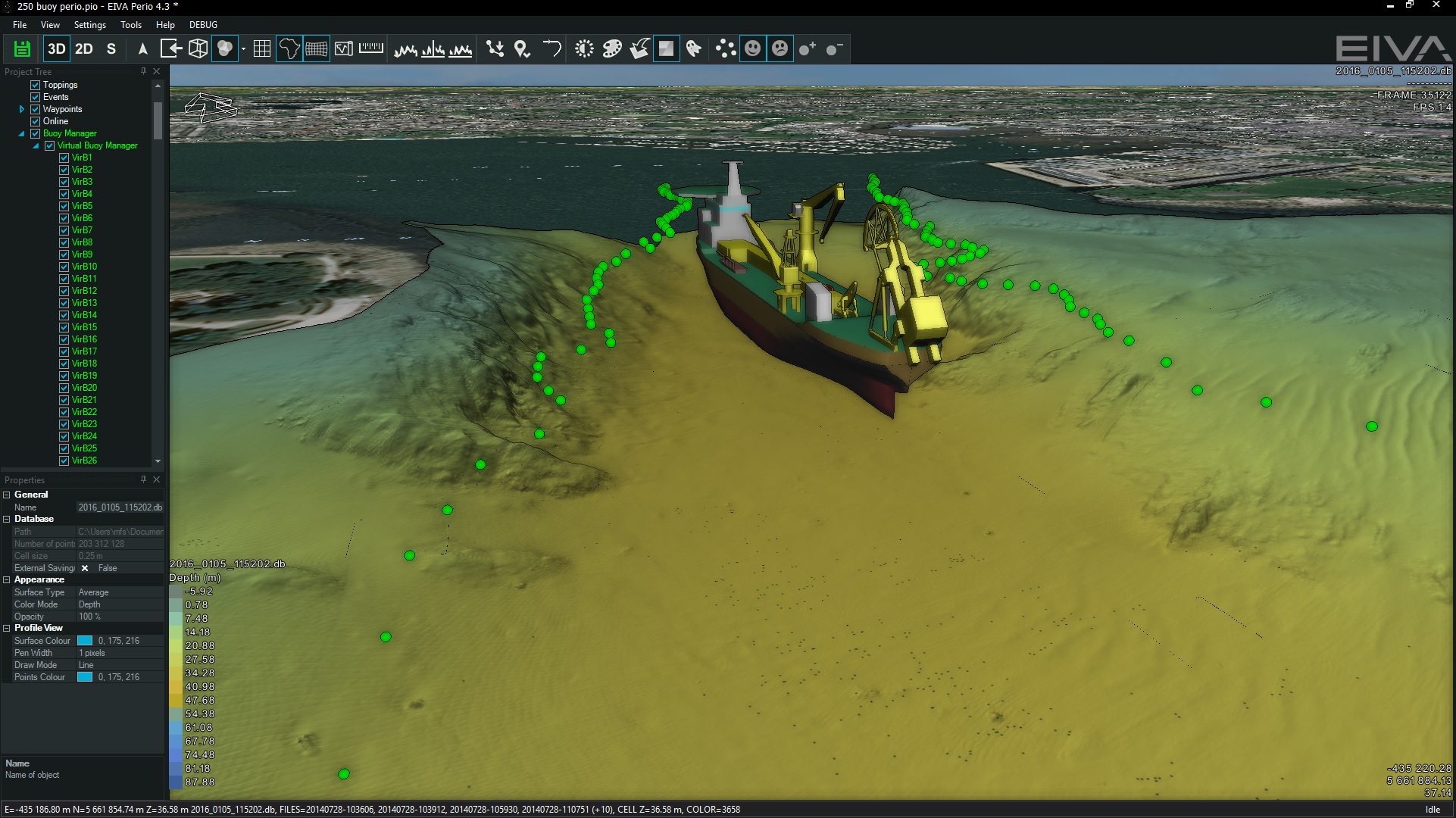
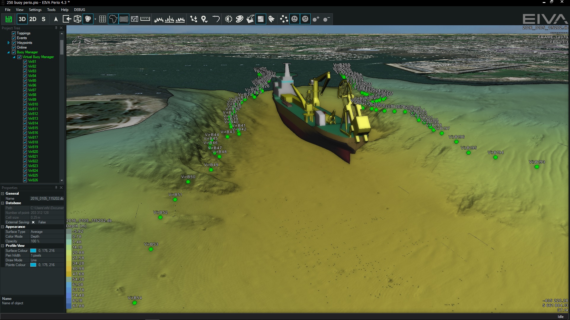
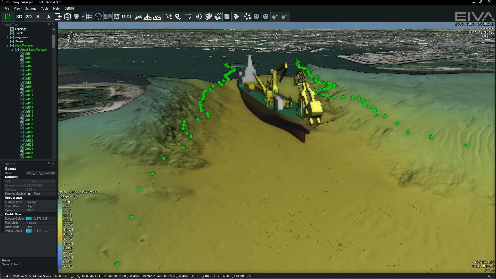
NaviSuite Perio – virtual buoys
NaviSuite Perio provides the possibility of replacing marker buoys with virtual buoys that are managed via a software user interface.
NaviSuite Perio – virtual buoys features
NaviSuite Perio provides the possibility of replacing marker buoys with virtual buoys that are managed via a software user interface.
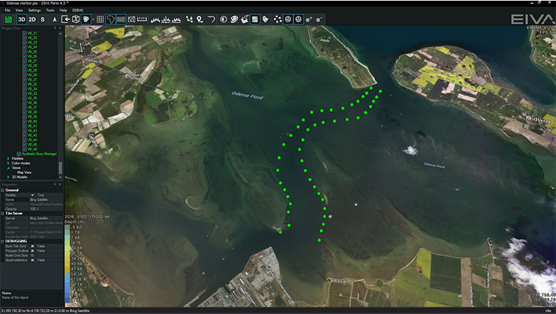
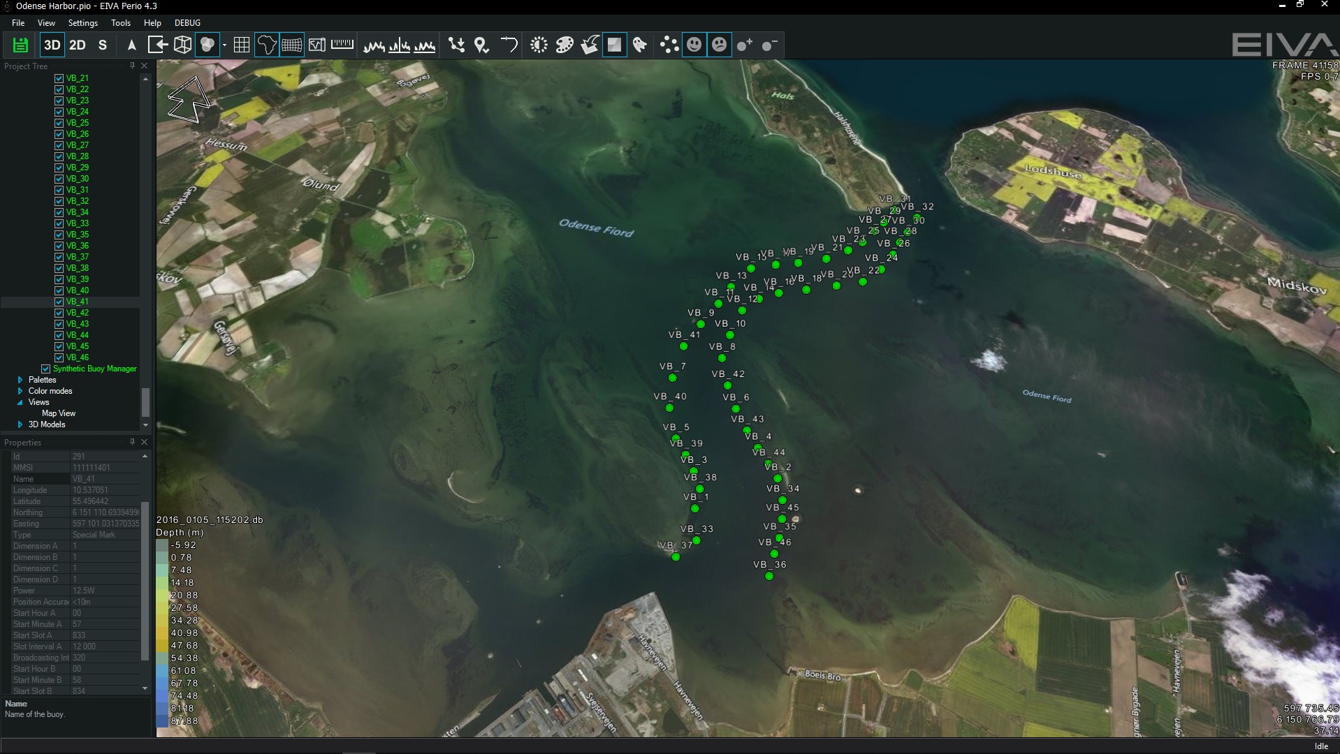
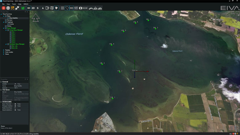
Define buoy location
Planning of the buoy location is done in the NaviPac Helmsman’s Display (or NaviModel), where you place the buoys graphically on top of charts, drawings or terrain models – or import/enter location as grid or geographical coordinates.
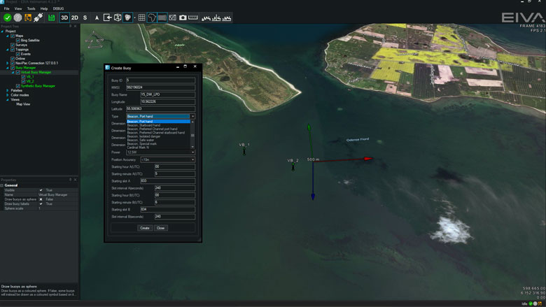
Define buoy type (AtoN types)
NaviSuite Perio supports the standard 31 types of buoys. Based on the selected type the operator defines additional parameters as well, including dimension, direction around them, communication control etc.
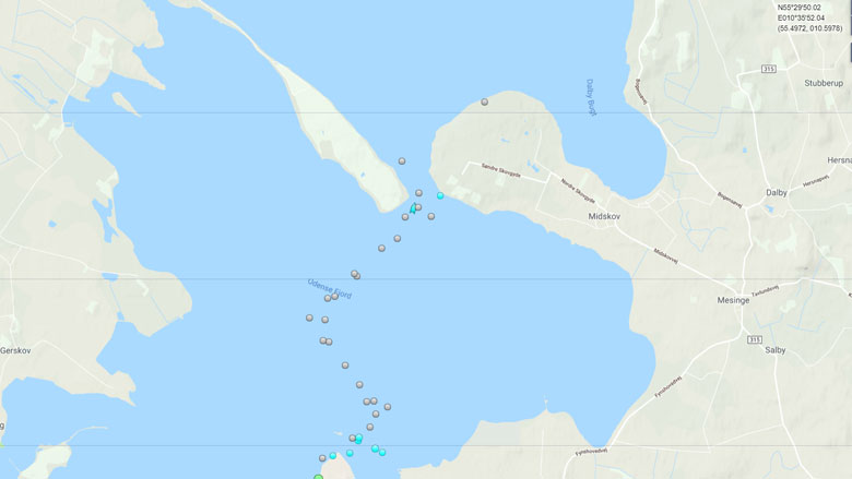
Broadcast buoys as AIS AtoN
NaviSuite Perio will send out AIS signals via radio using the standard communication protocol. This means that any vessel or land station with an AIS receiver will be able to receive and use the information no matter which solution they have. Image courtesy of Marine Traffic.
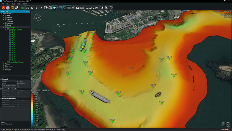
Show buoys in 3D in HD
If using NaviPac onboard the receiving vessel, you may display the buoys in the standard NaviPac 4 Helmsman’s Display together with NaviPac vehicles, live AIS tracking vessels and the charts and terrain data in 2D/3D.
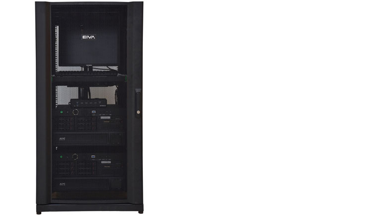
NaviSuite Perio rack
NaviSuite Perio can be supplied as a single or redundant system with all included from computer, software, radio and connection to antennas.
-
Optional extra services and special offers
EIVA offers a number of services for our NaviSuite software users.
Optional extra services and special offers
Get the most out of your software
EIVA offers a number of services for our NaviSuite software users. These include:
- Access to our self-service licence administration and purchase portal, My EIVA
- eLearning, virtual and classroom training
- Software maintenance and 24/7 support programme (Comes free of charge for subscription licences – Learn about the different licence types and the maintenance and support programme)
- Custom development
- Mobilisation/installation – on-site or remote assistance
- Dongle replacement programme for lost or broken dongles for permanent licences
Also, we have a number of special offers:

Product comparison
Related products
-
NaviSuite Perio – Transceiver and antenna
Transceiver and antennas for the NaviSuite Perio software.
€ 15,025.00/unit -
NaviSuite Perio – Single computer
Transceiver, antennas and pre-configured desktop computer for the NaviSuite Perio software.
€ 17,750.00/unit -
NaviSuite Perio – Single rack
Transceiver, antennas and single rack with pre-configured computer and UPS for higher uptime of the NaviSuite Perio solution.
€ 21,850.00/unit -
NaviSuite Perio – Single rack and spares
Transceiver, antennas and rack with pre-configured components and UPS for higher uptime and failover of the NaviSuite Perio solution.
€ 38,250.00/unit