To use this site, please enable javascript
To use this site, please enable javascript
NaviSuite Perio, a new member of the NaviSuite software family, enables virtual marker buoy placement for waterway marking. NaviSuite Perio uses the AIS AtoN (Automatic Identification System Aid to Navigation) standard and allows you to broadcast the position of many buoys from a single transponder so that all vessels in the nearby area will automatically have the buoys appear on their navigation displays.
NaviSuite Perio is system solution that consists of software, moreover a transponder with antennas – and possibly computer hardware as well, depending on your choice.
NaviSuite Perio now comes standard to support 250 virtual buoys from a single transponder, a big leap compared to the 25 it could support on its release. This enables more targets to be marked, or a more accurate marking of targets. This also represents a tenfold saving in terms of cost, as it is now enough to purchase one transponder for the transmission of the same target number.
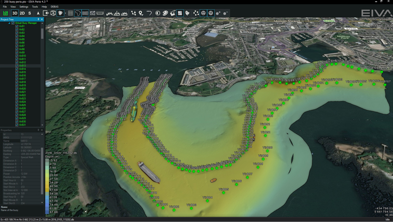
250 buoys (pictured) now transmitted from a single transponder
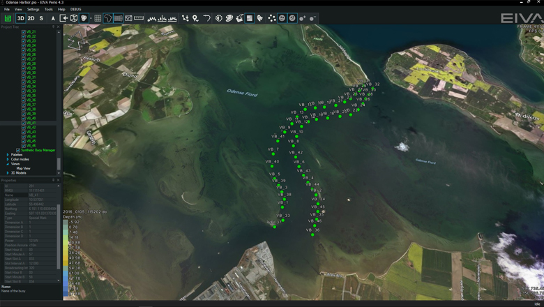
Each virtual buoy uses its own ID number issued by the national maritime authorities for the region in question. Designed in accordance with IALA recommendation A-126, NaviSuite Perio supports all types of AtoN markings, thereby allowing the user to decide which markings to use, such as red/green channel markings, compass markings, etc.
Moreover, the firmware update that has made this upgrade possible also makes it a possibility to implement the tracking and displaying of 20 moving targets into the software on request, for instance to track towed systems.
NaviSuite Perio employs AtoN technology in an alternative manner to its customary use in marker buoys where a built-in AIS transmitter provides its position and thereby makes it appear in nearby AIS-enabled navigation systems.
The NaviSuite Perio AIS transmitter is placed on land and broadcasts a number of virtual AtoN markers. In other words, it sends out signals containing ID, position, type, etc, just as if it was located at the position of the markers it simulates. Thus, to AIS users the signals look identical to those of physical buoys.
NaviSuite Perio's AtoN markers are seen by AIS users as identical to those of physical buoys
NaviSuite Perio addresses the problem that physical navigation or marking buoys are costly to deploy, service and recover, in addition to needing regular repositioning especially in harbour areas. Moreover, it possesses the added advantage of greater positioning precision as the buoys’ position will not be affected by wind or currents.
Consequently, harbour and other waterway authorities can replace physical marker buoys with virtual buoys that are managed via a software user interface and never actually deployed – yet, they are still displayed to AIS users as actual buoys at a given location in the water.
Therefore, NaviSuite Perio serves as a far easier and more cost-effective way of ‘deploying’ a large number of virtual buoys at desired locations – permanently or for specific periods of time.
Typical uses of NaviSuite Perio would therefore be to mark:
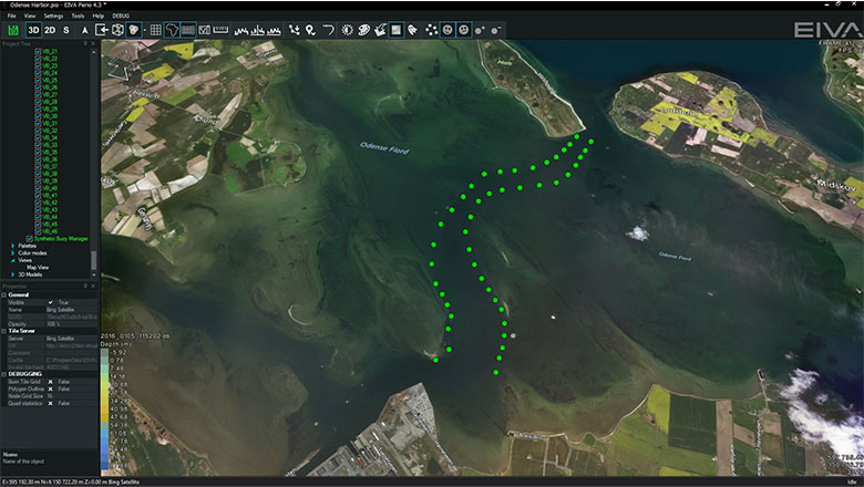
Waterway marking in NaviSuite Perio
The locations of the virtual buoys are defined in the NaviSuite Perio software through a map display. The map also allows the user to choose if the position signals are activated or not, that is, whether the virtual buoys are ‘deployed’.
The map display is based on EIVA NaviPac Helmsman’s Display, making it able to display existing navigation charts and aerial photo backgrounds. Most importantly, the 3D bathymetry data recorded by the relevant harbour authority during its latest survey is available. As a result, the position of the buoys is defined with the highest possible accuracy, as opposed to relying on older official navigation charts. It also means that buoys can easily be moved as new surveys are made, unlike physical buoys.