


Key features and benefits

Cutting a long navigation story short: What you get
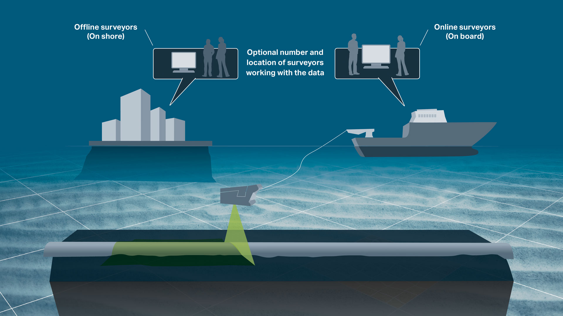
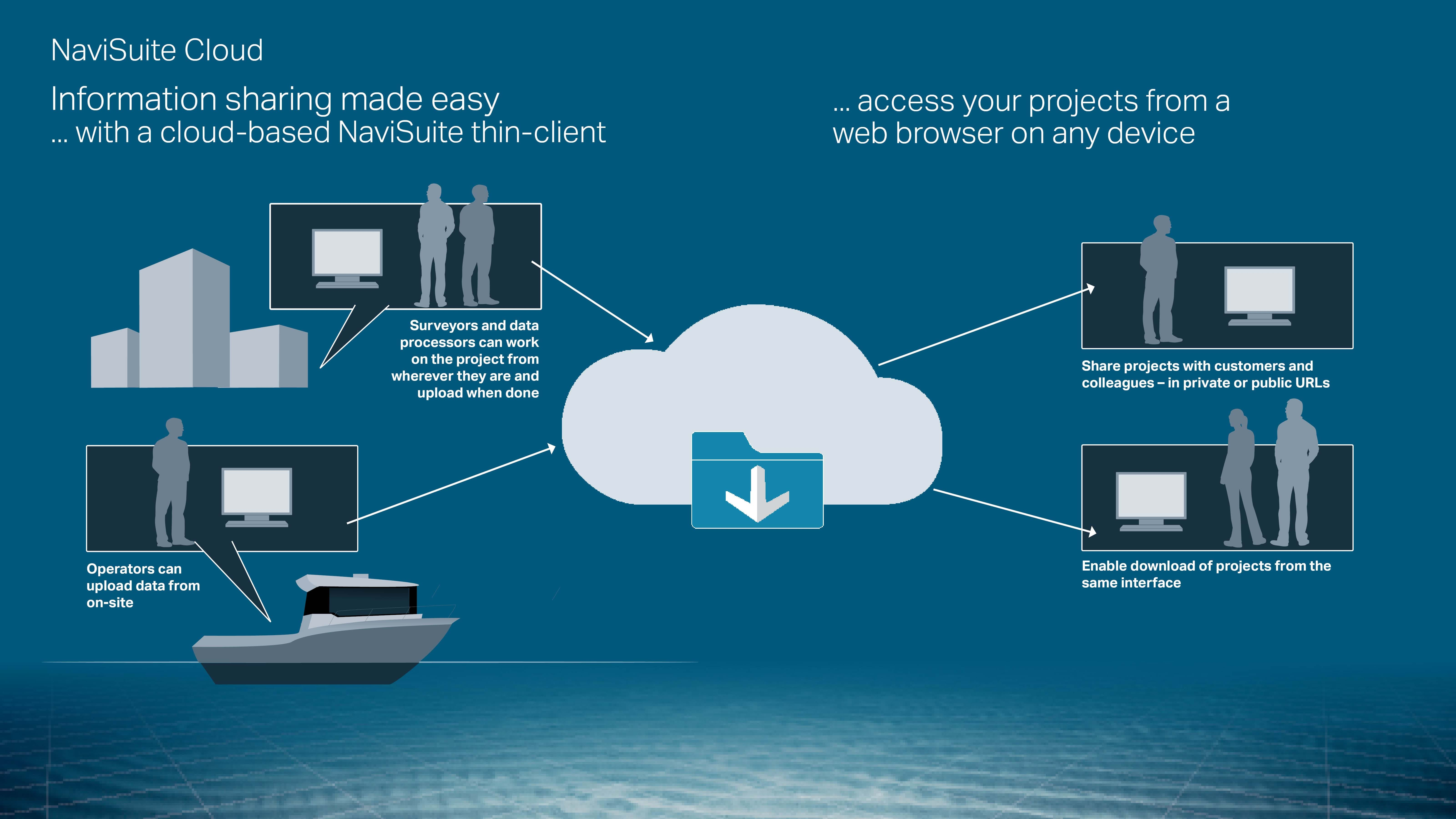
Navigate 3D visualisations from a web browser and share data easily, efficiently providing extensive data deliverables to end clients.
Cutting a long project sharing story short: What you get...
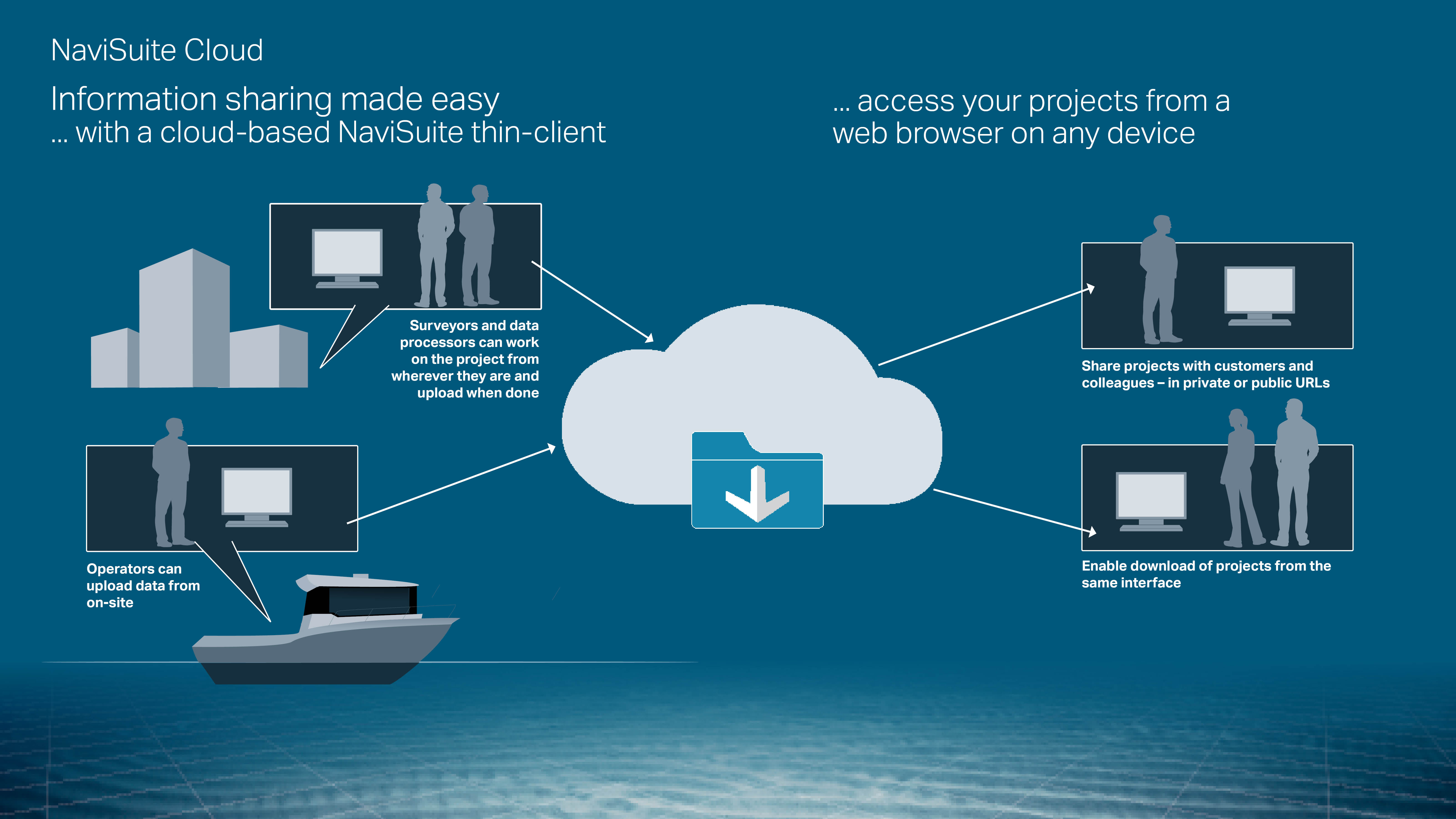
Diving further into the details of how the NaviSuite Cloud will provide fast, secure and low-cost data sharing for your NaviSuite projects:
Cost savings on your computer and local storage requirements
… by using NaviSuite Cloud to share data, there are no special the requirements to computer/OS, software installation and storage capacity of the device you, your colleagues or your end clients view the results onTime-efficient data handling with no need for copying over data
…. by uploading and managing projects within the My EIVA front end you can quickly get an overview of projects and manage who can view themHigh performance 3D rendering from virtually any device
… by uploading and viewing large 3D models rendered in NaviSuite Cloud, the quality will remain high no matter the restrictions of your own viewing deviceProviding your end clients a great service
… by delivering extensive data sets in an intuitive, high-performing interface that is easy to access and navigate – no matter where they are or what device they’re usingChoose the plan that matches your disk usage
… ranging from 50 to 500 GB-
General visualisation tools
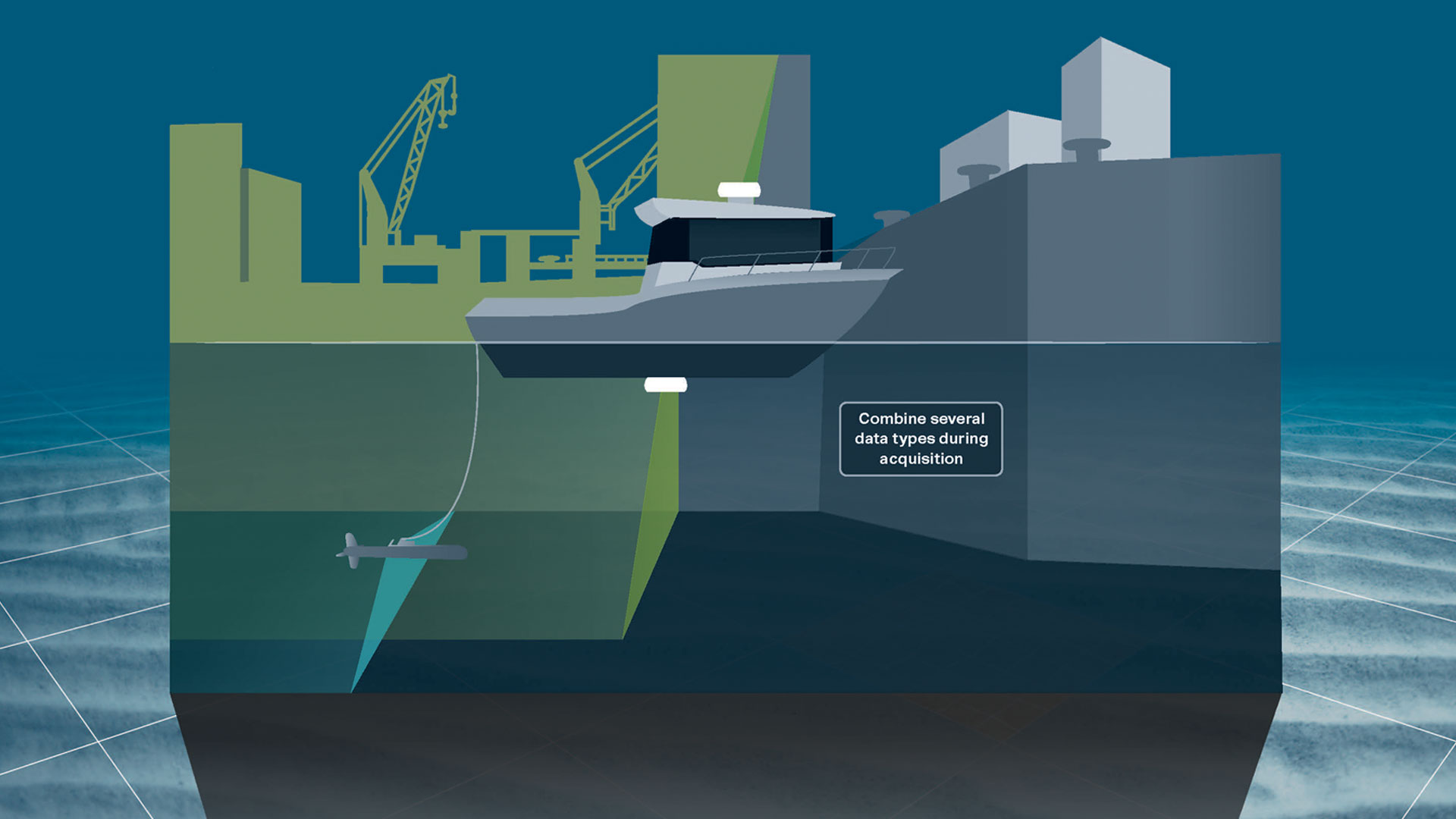
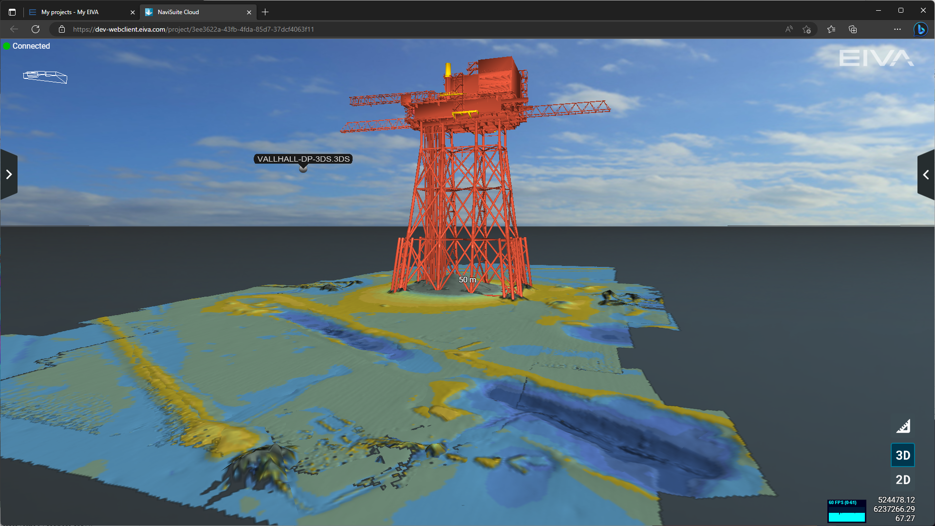
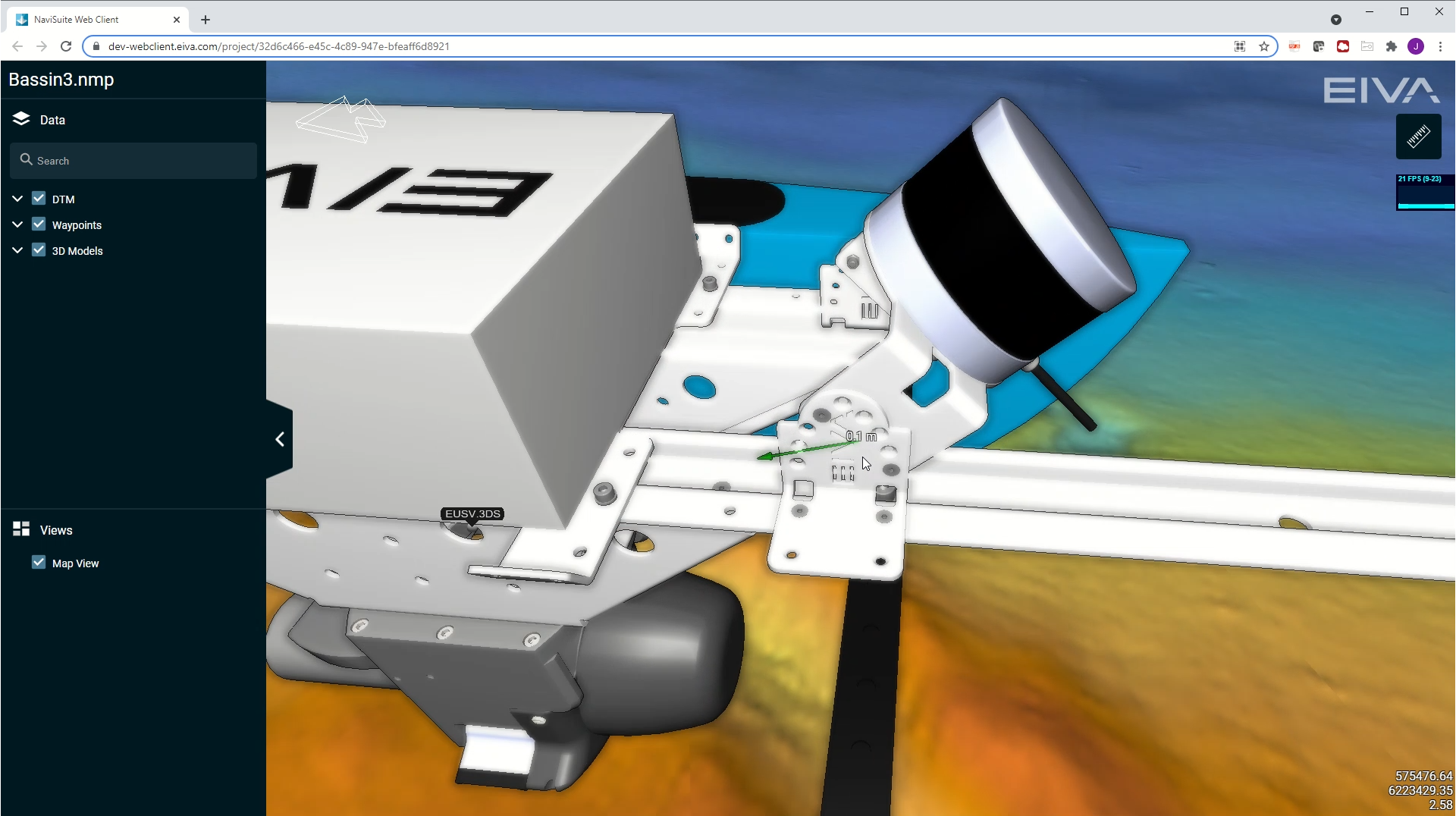
NaviSuite provides powerful 3D visualisation features. Data can be visualised in 2D, 3D, side view or by time, along with observation logs.
General visualisation features
NaviSuite Cloud features the same high-performance 2D/3D visualisation tools as NaviModel Viewer, allowing you and your customers to see results from every angle. See examples below.
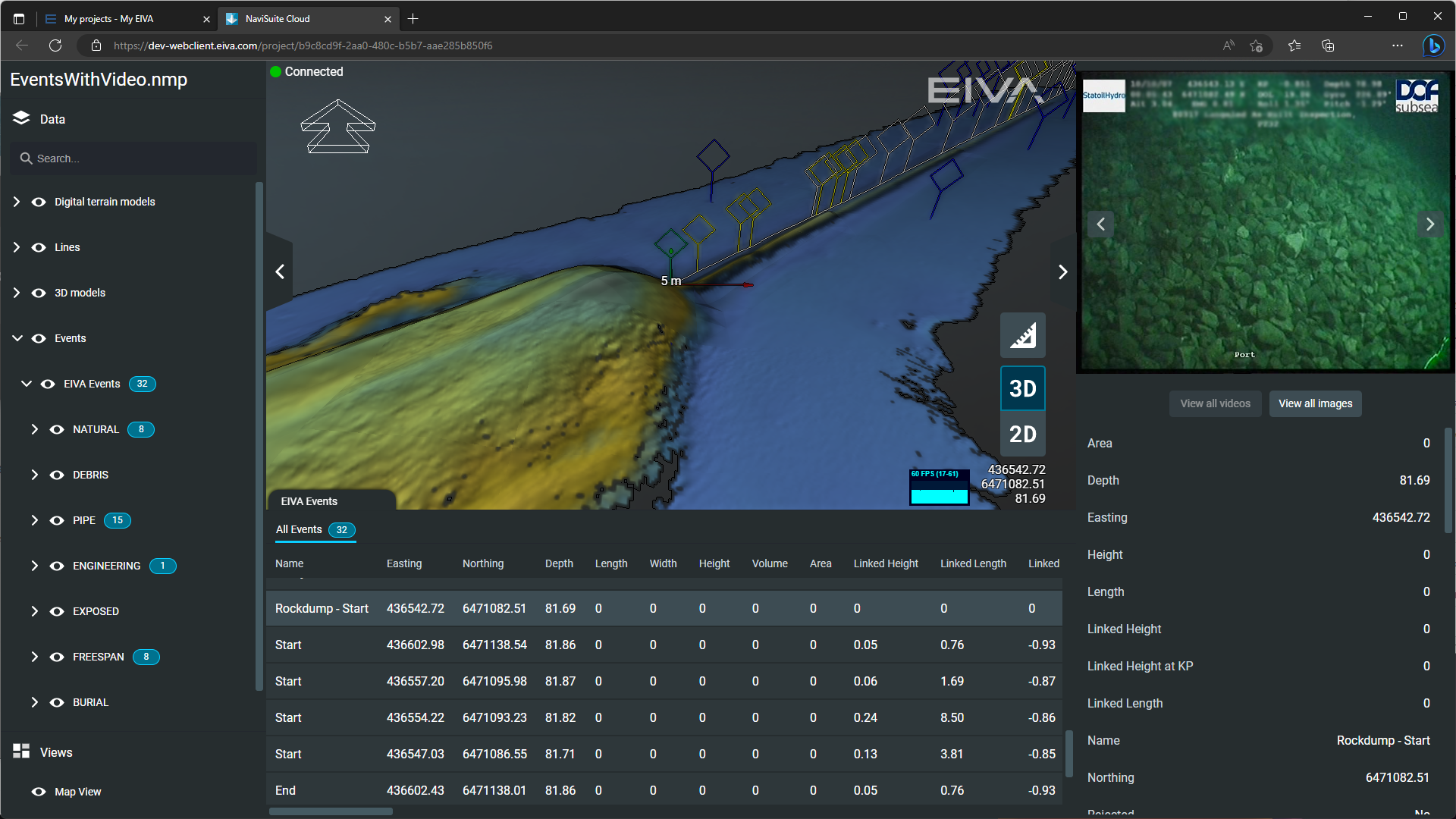
Observation logging
View registered observations with synchronised data displays.
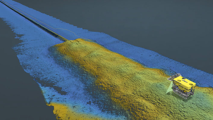
Observations made in a pipe inspection displayed in NaviSuite Cloud Viewer – data courtesy of Equinor and DOF Subsea
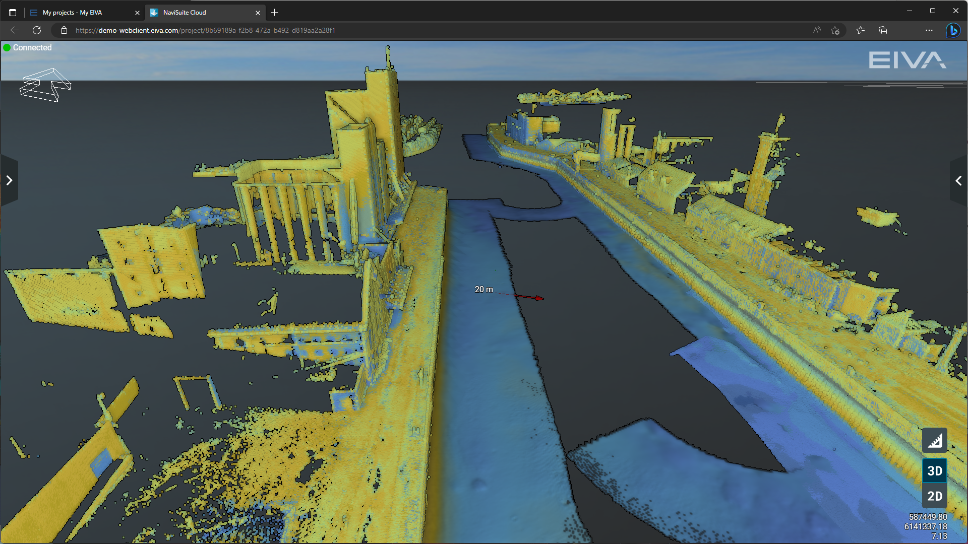
View waypoints
Mark points of interests with waypoints or digitized lines. Viewers can see and toggle this as a layer.
MBES and LiDAR harbour inspection data visualised in 3D in NaviSuite Cloud Viewer – along with waypoints to mark points of interest
-
Project management tools
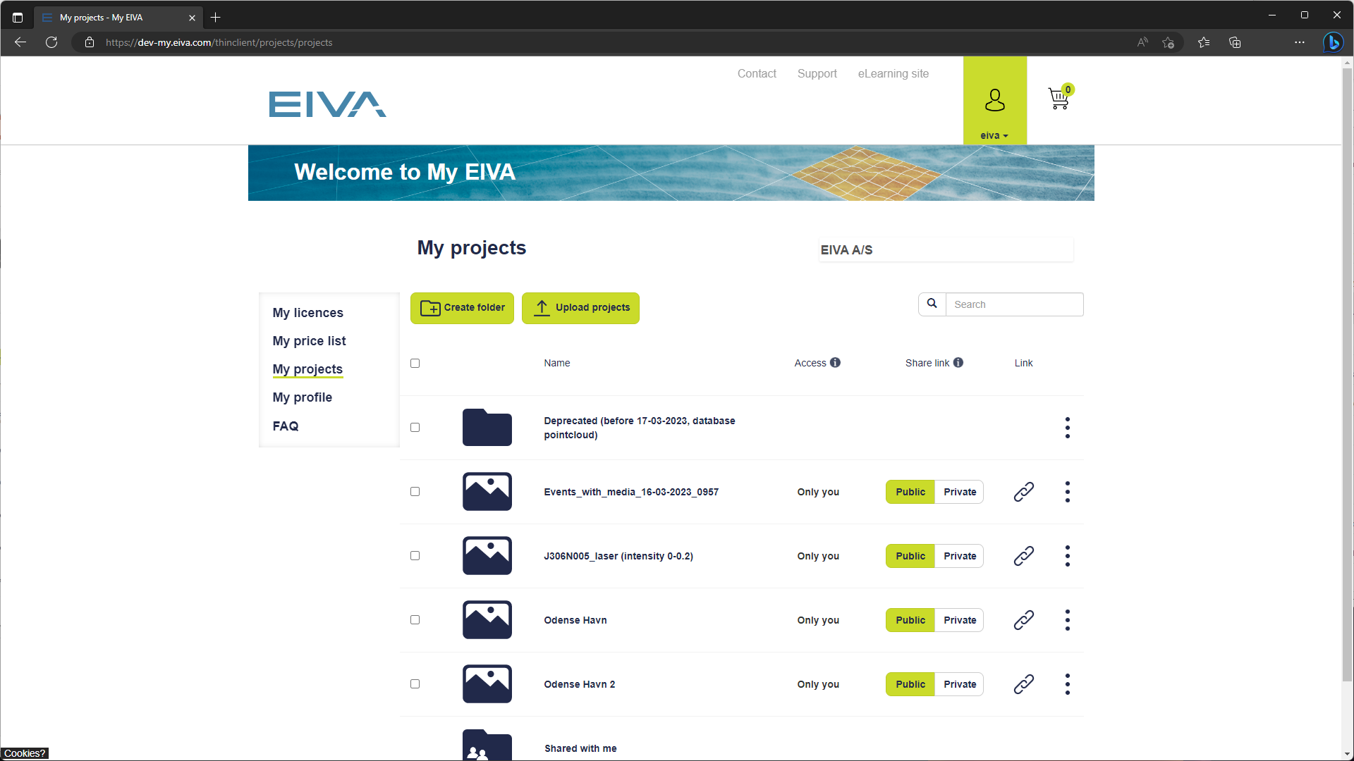
In EIVA’s web portal, My EIVA, you can upload, manage and share your NaviSuite projects easily and quickly.
Project management
In EIVA’s web portal, My EIVA, you can upload, manage and share your NaviSuite projects easily and quickly.
When you upload NaviSuite projects to My EIVA, you can see them in an overview under Projects. Here you can organise them in folders if needed.
Share NaviSuite projects while keeping data secure. You can keep projects private, or you can give access to selected project(s) to your end clients and colleagues. You can define specific people you wish to share it with or make it available to anyone within your organisation. If you have set it to Private, those receiving access to data cannot share it with others without your permission. If you have set it to Public, those with the link can share it with others – and you can change it to private or make a new link to remove access if you need.
In addition to changing who can view your project, you can also choose who can download your NaviSuite project from NaviSuite Cloud Viewer. Letting others download your project from the same link they view it from is handy for your delivery to an end-client, since you can first show it to them, then let them download it once you are ready to hand over the full project. It is also an easy way to let your colleagues download and further work on your results.
-
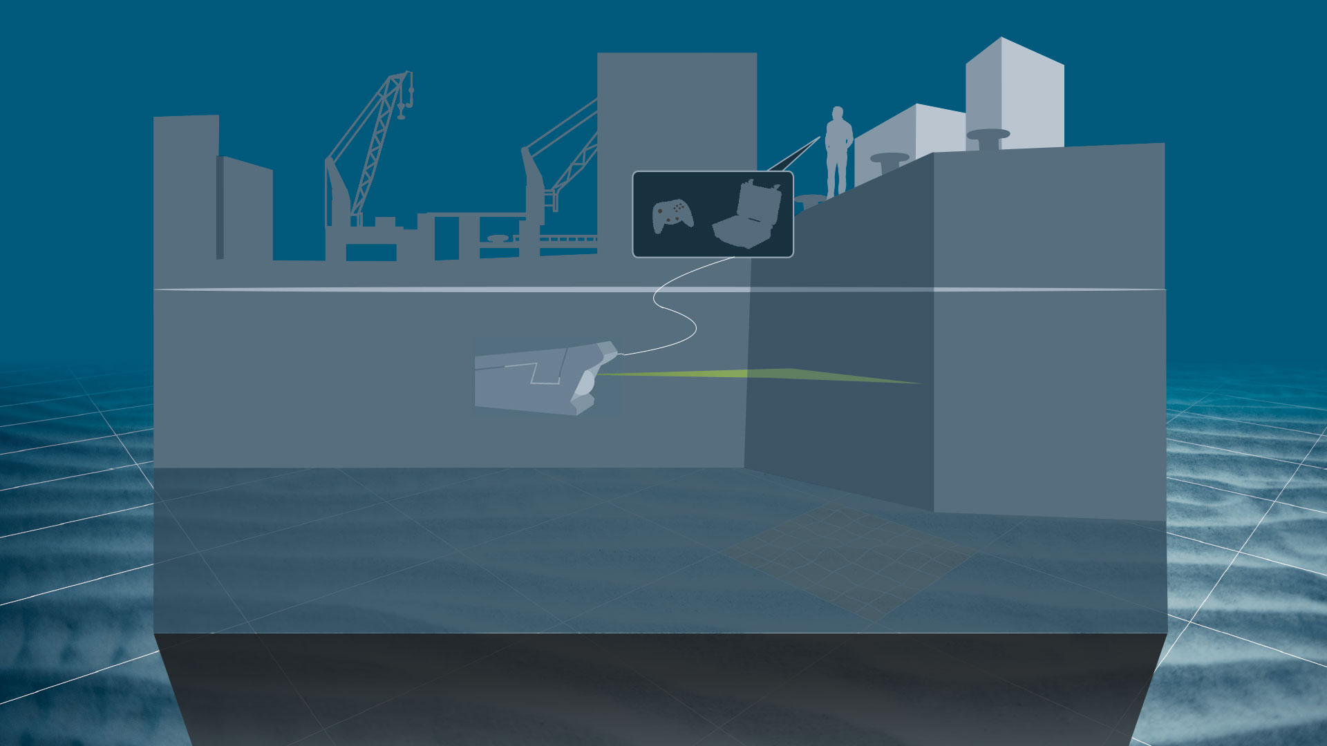
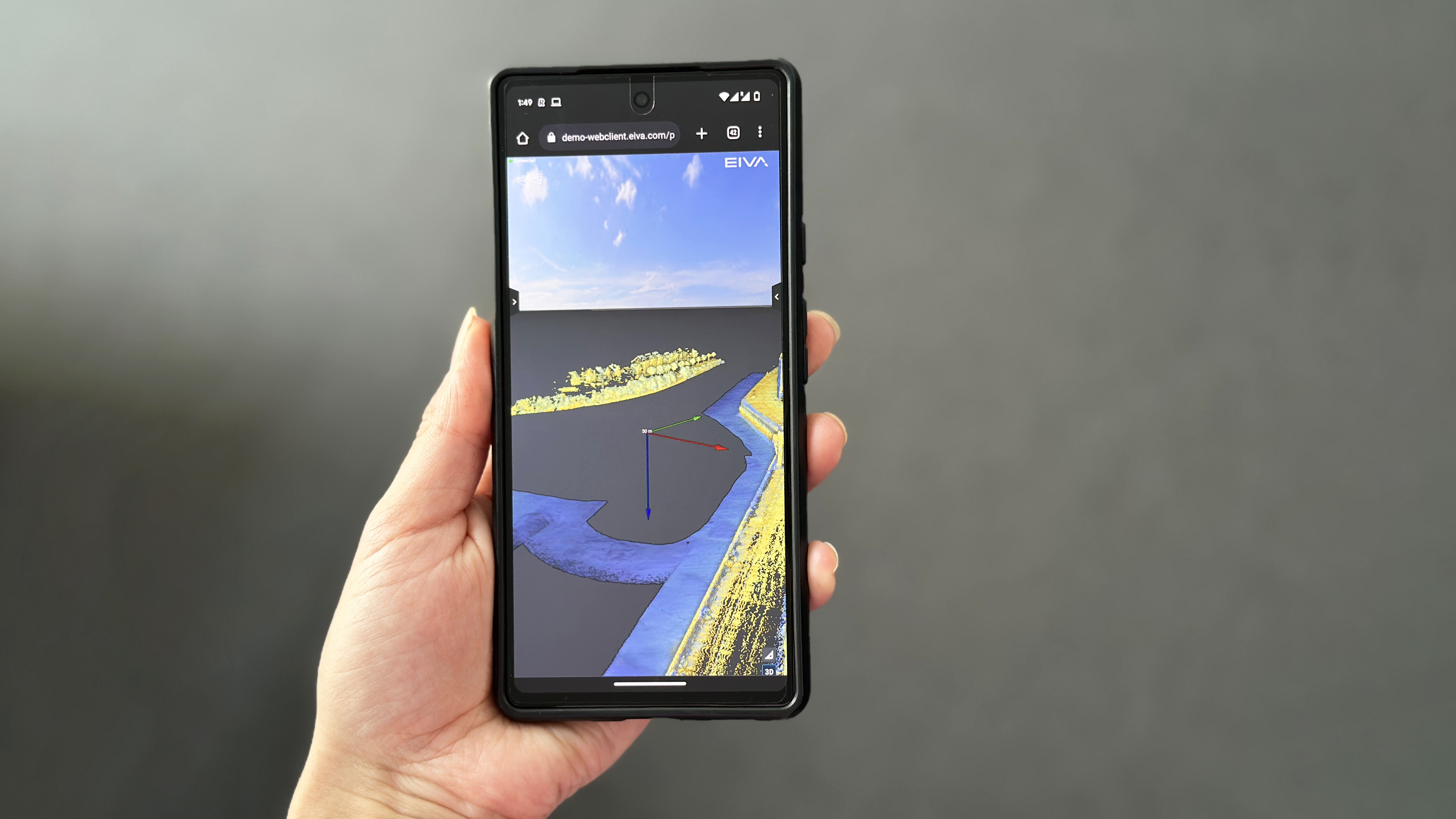
High-performance rendering in a web browser
EIVA’s server does the heavy lifting of rendering for you – and streams it straight to a browser!
High-performance rendering in a web browser
Reducing requirements to devices you, your colleagues or your clients view the results on.
EIVA’s server does the heavy lifting of rendering for you – and streams it straight to your browser! This means you can even access NaviSuite projects from your phone (currently all Android devices are supported).
By uploading and viewing large 3D models rendered in NaviSuite Cloud, the quality will remain high no matter the restrictions of your own viewing device. This means you save on computer and local storage requirements.
In addition, the people you share projects with do not need to download any software to view your results, as they simply open the project in their browser – one benefit being time savings, as your client will not have to acquire permission from their IT department to install third-party software for viewing your results.
Related products
-
NaviSuite Nardoa
Advanced 3D pipeline & cable route inspection software for data acquisition and processing.
€ 291.00/day€ 17,983.00/year€ 53,950.00/permanent -
NaviSuite Kuda Pro + Processing
Unmatched software with deep feature list for shallow water data acquisition & processing – Supports all relevant instruments – Unlimited remote displays – Tracking of a subsea object.
€ 155.00/day€ 9,542.00/year€ 28,625.00/permanent -
NaviModel Analyser
Basic processing, visualisation and analysis of data in 2D, 3D and 4D.
€ 26.00/day€ 1,592.00/year€ 4,775.00/permanent -
NaviModel Producer
Full software solution for data processing, cleaning, modelling and reporting.
€ 81.00/day€ 5,008.00/year€ 15,025.00/permanent -
NaviSuite Mobula Pro + Processing (VideoRay)
Advanced ROV control and inspection software – Excellent control through manual and assisted steering – Automated inspection tools – Supports data fusion of all relevant sensor types – Data processing for comprehensive reporting
€ 155.00/day€ 9,542.00/year€ 28,625.00/permanent