Acquire, process and deliver survey results of the highest quality
Unmatched capabilities saving you time and money
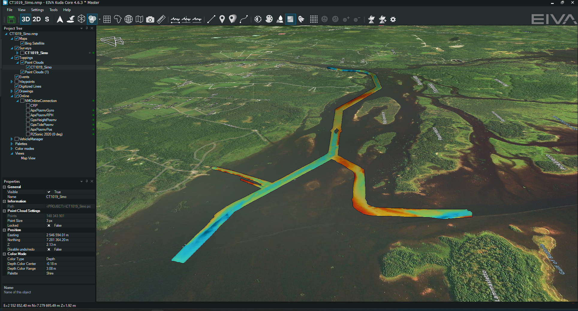
NaviSuite Kuda is the optimal software solution for time-efficient, high-quality hydrographic surveys. This includes harbour and waterway surveys, as well as construction inspections, carried out with USVs or manned vessels.
By bundling the NaviSuite features relevant to these types of operations into several variants that match your survey spread and your budget, you get an affordable toolbox without compromising on the quality of its contents or its capacity. The software provides high-performing features focusing on simplicity, automation and autonomy, while also enabling you to carry out remote operations.
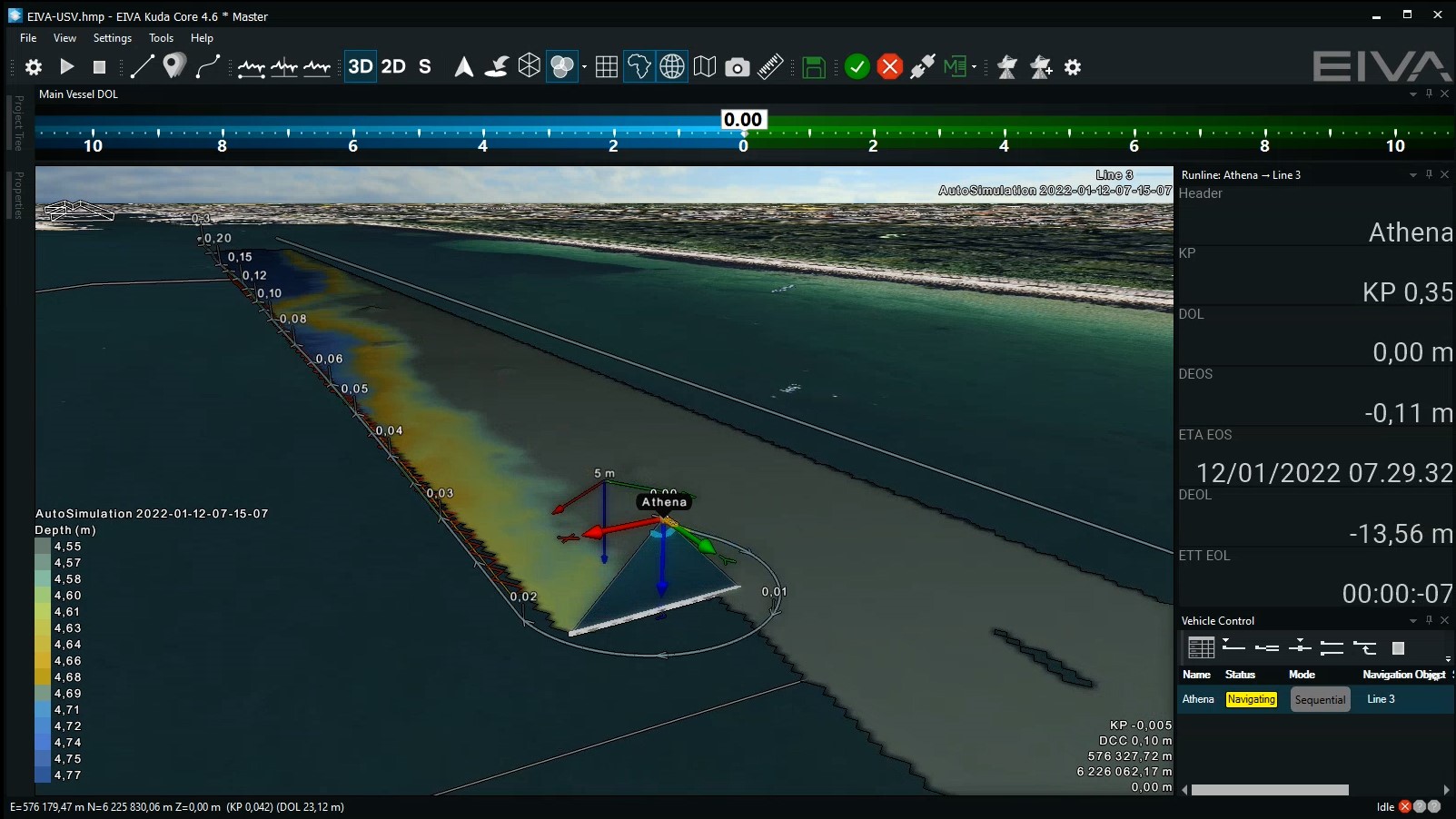
For autonomous USV surveys, this software can be used with standardised NMEA APB autopilots or the NaviSuite Kuda – Autopilot. This autopilot is designed to provide superior steering control, allowing for precise line-keeping even in sharp turns and safe parking.
Want to upgrade your hardware setup to support over-the-horizon operations?
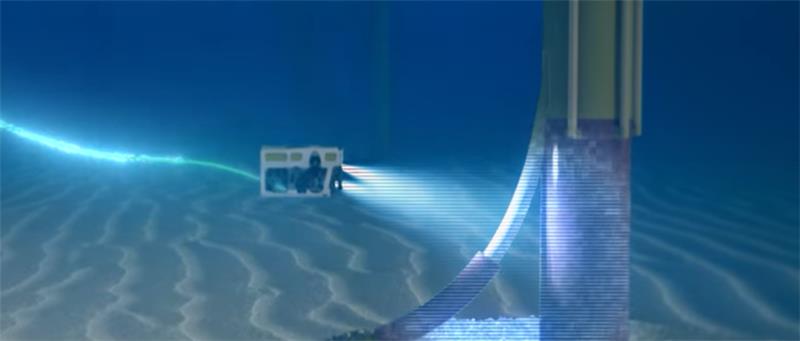
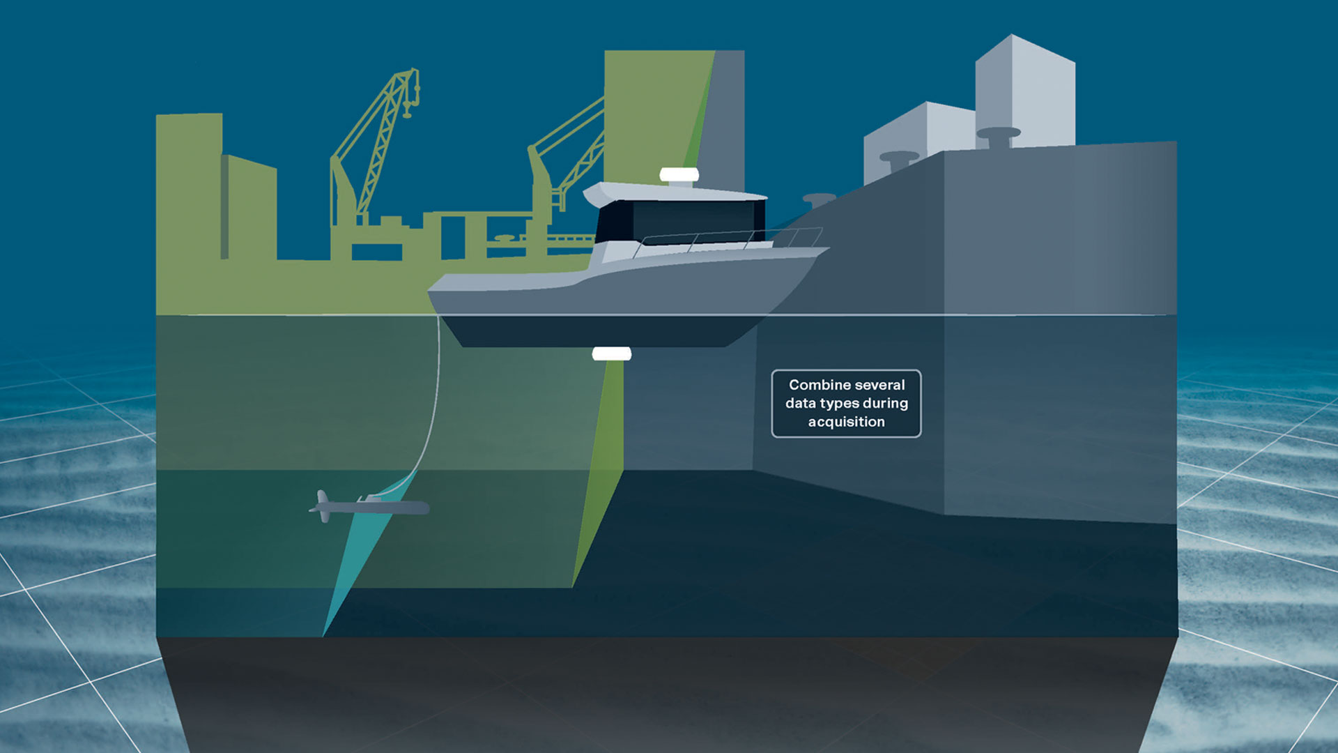
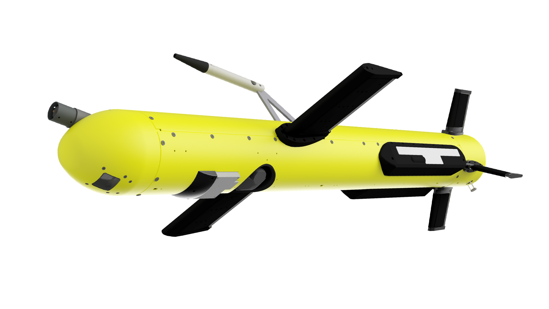
In addition, you can enable high-resolution data collection with sidescan sonar and magnetometers, by equipping your USV or other vessel (sizes down to approximately 8 m long) with the ViperFish ROTV (remotely operated towed vehicle). With its high stability, 3D steering and automation, this all-in-one system is ideal for surveying narrow areas where a precisely steered sensor platform is needed to safely stay close to the seabed.


Highlighted features
Easy configuration
… through an intuitive user interface bringing all relevant features to your monitor, including a patch test tool
Automatic data cleaning
… through a variety of cleaning methods, allowing for customisable configuration, also during acquisition
Bring autonomy onboard your hydrographic operations
… through support of autopilot route planning and control, as well as real-time optimisation of survey area coverage and an optional autopilot with superior vessel control
Let your team join your hydrographic operations remotely
… through the possibility of remote supervision, control and data processing
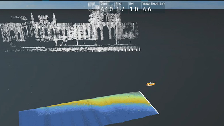
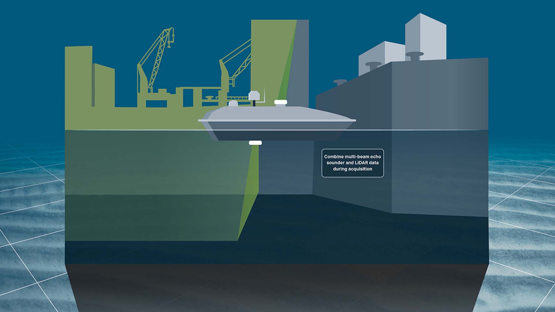
Combination of several hydrographic survey data types
… through interfacing to high-tech sonars, lasers and cameras, thereby reducing cost of survey and the risk of errors
High-quality sensor processing and editing features
… that minimise time spent on post-processing and improve the quality of your survey results
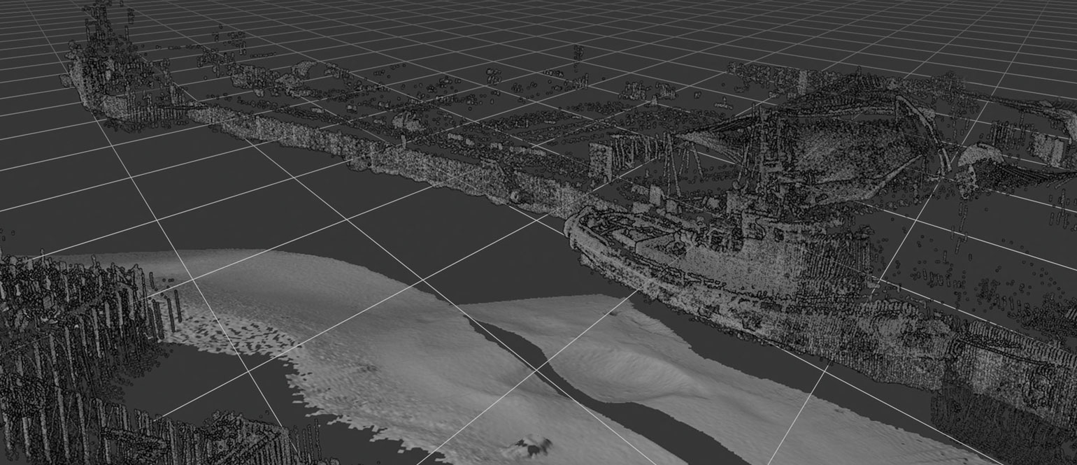
High-performance bathymetric data acquisition and processing in real time
… as the size of data sets is only limited by disc capacity and it is possible to make terrain models on the fly, thereby allowing for better bathymetric survey data quality and fast reporting