To use this site, please enable javascript
To use this site, please enable javascript
The last couple of months, the EIVA R&D team has worked on a new system solution, NaviSuite Perio. It provides harbour and other waterway authorities with the possibility of replacing marker buoys with virtual buoys that are managed via a software user interface and never actually deployed – yet, they are still displayed to AIS users as actual buoys at a given location in the water.
Navigating with virtual marker buoys in NaviSuite Perio software
Buoys are often used to ensure safe navigation by marking channels, shoals, wrecks, etc as well as during harbour expansions and other construction projects.
Deploying a buoy, however, has a number of inconveniences. These include:
Consequently, the EIVA team specialising in buoys recently decided to provide a solution that would save harbour and other waterway authorities significant sums each year by addressing the above points. The solution also ensures more precise marker positioning as opposed to having to accept the buoys’ position being affected by wind and currents.
The result of this mission, NaviSuite Perio, is a system solution enabling an alternative, far easier and more cost-effective way of ‘deploying’ a large number of virtual buoys at desired locations – permanently or for specific periods of time.
Even when taking the purchase price of the solution into consideration, it offers significant savings (an estimated 75%) in the first year alone, as it eliminates the need and thus cost of deploying physical buoys.
We are all used to using AIS (Automatic Identification System) to receive and display information on our navigation maps. And there is nothing new in the fact that larger vessels are required to transmit their positions using AIS. Yet, AIS also includes AtoN (Aid to Navigation) for objects that are not vessels, such as marker buoys.
AtoN allows for marker buoys to make use of a built-in AIS transmitter to provide the position of the marker and thereby make it appear in nearby AIS-enabled navigation systems. Moreover, wave buoys such as the EIVA ToughBoy are typically equipped with such AIS transmitters to reduce the risk of collision with vessels. Consequently, EIVA has experience in working with this technology.
With NaviSuite Perio, we have applied the AtoN technology in a somewhat alternative manner. The AIS transmitter is placed on land and broadcasts a number of virtual AtoN markers. In other words, it sends out signals containing ID, position, type, etc, just as if it was located at the position of the markers it simulates. AIS users cannot see the difference as the signals look like marker buoys at different locations on the navigation map.
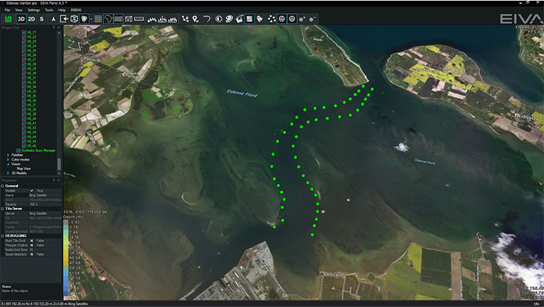
The locations of the virtual buoys are defined in the NaviSuite Perio software through a map display. The map also allows the user to choose if the position signals are activated or not, that is, whether the virtual buoys are ‘deployed’.
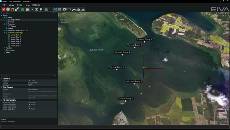
Virtual buoys are placed at exact locations via a map display in the NaviSuite Perio software
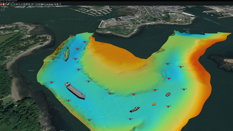
The map display is based on EIVA NaviSuite Helmsman’s Display. This makes it able to display existing navigation charts and aerial photo backgrounds. Most importantly, the 3D depth (bathymetry) data recorded by the relevant harbour authority during its latest survey is available. As a result, the position of the buoys is defined with the highest possible accuracy, as opposed to relying on older official navigation charts. It also means that buoys can easily be moved as new surveys are made.
NaviSuite Perio is designed in accordance with IALA recommendation A-126 and supports all types of AtoN markings, thereby allowing the user to decide which markings to use, such as red/green channel markings, compass markings, etc.
NaviSuite Perio comes standard to support 25 virtual buoys, but 50, 75 and even more buoys can be provided.
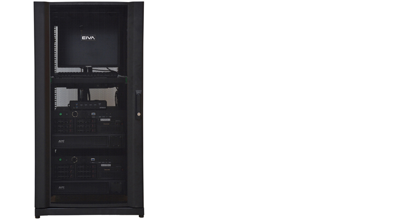
The NaviSuite Perio rack system encompasses dual computers, transmitters and UPS power supplies
NaviSuite Perio is supplied as a plug and play system. It comes fully configured with software, dual computers and a UPS power supply. In other words, it is a fully redundant system, with a reduced risk of downtime.
If on-premises hardware is not desired, we also offer a hosted/cloud-based solution, where only the AIS transmitter and the antennas are physically located at the relevant position on land near the location of the virtual buoys.
If you would like to learn more about the details of the NaviSuite Perio solution, please feel free to reach out to our team.