To use this site, please enable javascript
To use this site, please enable javascript
As we see water column data become an area of greater interest for numerous applications, we are looking at its implementation in EIVA NaviSuite.
Here is a sneak peek of how live water column data is displayed in 3D – in either NaviPac – EIVA’s navigation and positioning package – or NaviModel – our modelling and visualisation software.
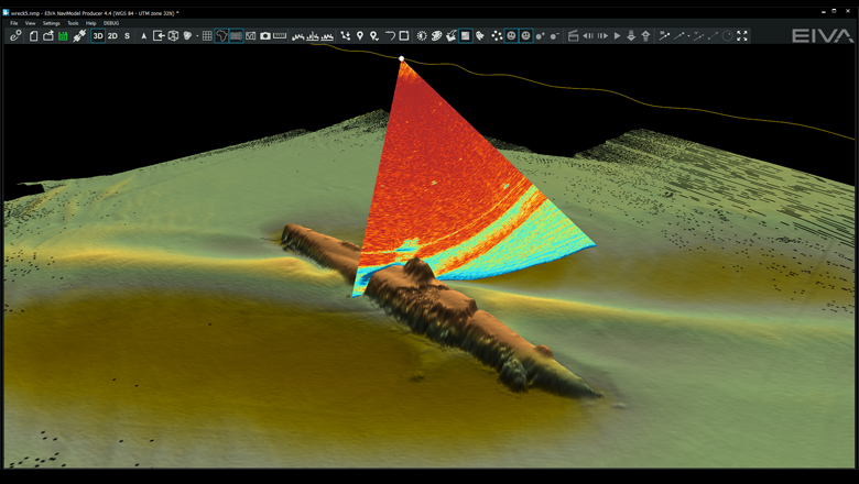
U-boat wreck surveyed with a Kongsberg EM2040 sonar, with the echo intensities displayed in the sonar wedge (Data has been anonymised)
With NaviPac and NaviModel, you can view the full sonar data as a wedge in 3D together with any calculated seabed points from the same data and the live DTM (digital terrain model).
We have made it very simple to pick the parts of the water column data you are interested in, and to then generate points clouds and a 3D mesh from it.
We are looking forward to presenting and demonstrating this at EIVA Days Denmark, 25-26 September.