To use this site, please enable javascript
To use this site, please enable javascript
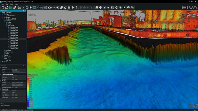
The NaviSuite Kuda software allows for time-efficient harbour inspections, allowing you to combine several different high-quality data types during both acquisition and post-processing. Recently, EIVA participated at a demo where NaviSuite Kuda proved its worth.
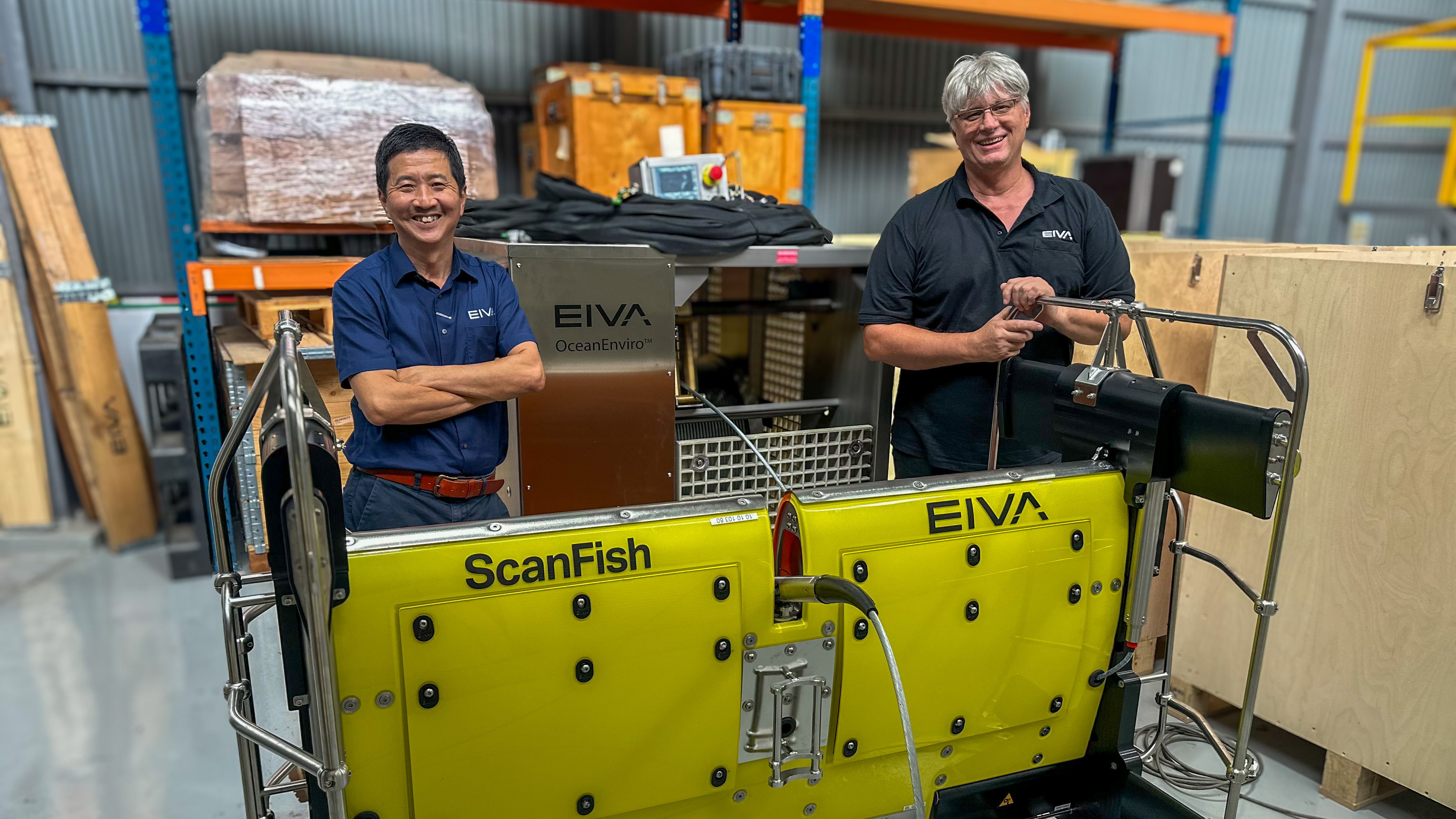
The software was paired up with a remote survey vehicle (RSV) from MarineTech and a NORBIT iWBMS integrated turnkey bathymetry system with a LiDAR module (the NORBIT integration contains OEM versions of the Applanix Wavemaster II and a Velodyne LiDAR).
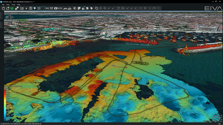
Norbit Velodyne data visualisation in NaviSuite Kuda
During the demo, which took only four hours to mobilise, the operator of the RSV remained on shore where he was able to control the RSV, follow the inspection progress and carry out quality control via real-time data visualisation. Also, had the situation required it, he would have been able to process the data right away. All of which is made possible by the NaviSuite Kuda software.
The RSV was fitted with a NORBIT iWBMS (high-resolution integrated wideband multi-beam sonar), an OEM Velodyne LiDAR VLP-16 above-water laser solution, an OEM Applanix Wavemaster II INS sensor, and a PC with the interfacing and data recording software from NaviSuite Kuda. The multi-beam and LiDAR data were acquired simultaneously, sent to the onshore PC via Wi-Fi for quality control, and the two different data types were combined during processing.
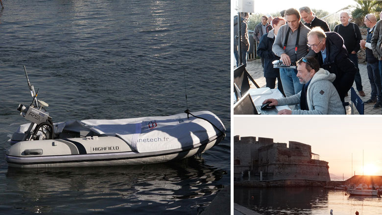
The demo took place in Toulon, France, and was hosted by Marine Tech in collaboration with EIVA’s representative in France, PrimeGPS
By combining different sensor technologies during both data acquisition and processing, you get the best of – in this case – two worlds in one survey. One sweep will get you all the necessary data and high-quality end-results for your customers.
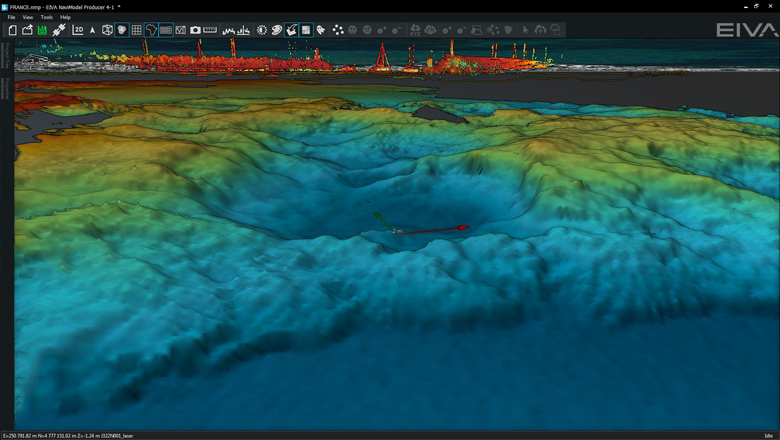
Close-up of the LiDAR and multi-beam sonar data
As the screenshots show, this was also the case at the RSV demo: The result was a highly detailed data set of the harbour both below and above sea level. Moreover, this type of setup, centring on an RSV, is easy to work with due to the limited physical size, which translates into easy and quick deployment. Especially as both the iWBMS and VLP-16 also are compact units that are easily handled and installed, and in this case were fitted on a pole.
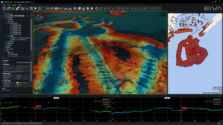
The NaviSuite software allows for real-time quality control of data via views showing for example data density and depth together with cross profiles
In addition to the sensors mentioned above, NaviSuite Kuda interfaces with a long list of high-tech sonar equipment and lasers. These include not only multi-beam echo sounders and LiDAR solutions, but also sidescan sonars and underwater laser scanners. In addition, more simple solutions such as single beam echo sounders and magnetometers are covered by the more than 500 drivers included in the software.
Before the demo in France, EIVA tested the same setup on a regular survey vessel in Denmark. Mobilisation, patch test and survey took less than a day, and the result was equally high quality data for visualisation and analysis in the NaviSuite Kuda software.
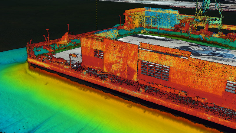
Data from the Denmark test survey, showing the high detail from LiDAR data in EIVA NaviSuite Kuda - even images on buildings stands out