To use this site, please enable javascript
To use this site, please enable javascript
One of the more minor features demonstrated last year at our customer event, EIVA Days Denmark, was the extended support for WMS (Web Map Service) data sources in NaviPac and NaviModel; these two are components of EIVA’s navigation and positioning, and 3D modelling and visualisation software packages.
It is a good example of something small adding great value, judging by the attention it received at the event, so much so that we will be showcasing it again at Oceanology International in March, among many other interesting features and developments.
WMS is a GIS standard from the Open Geospatial Consortium for serving map images over the internet. It belongs to the same family of standards as the Tile Map Service already used in NaviPac/NaviModel for displaying background maps.
WMS is more powerful than a tile map service – the WMS server can provide different layers as well as information about features in the layer using functions such as GetCapabilities (which layers) and GetMap (the map image), and additional features like GetFeatureInfo, DescribeLayer and GetLegendGraphic, which provide extra (optional) information.
Hence, connecting NaviModel or NaviPac to a WMS server gives you the choice of which layers you want to see – and since this is data-source-specific, it gives you a whole realm of possibilities.
For maps, of course, it allows you to toggle various pieces of map information on/off, as defined by the map provider. Here is a couple of examples:
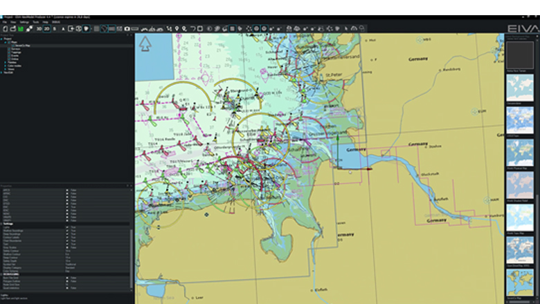
NaviPac/NaviModel utilising SevenC networking chart service
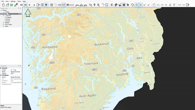
NaviModel with WMS data from Norwegian Mapping Authority
But, perhaps more interestingly than standard maps, a lot of GIS data services available on the internet use WMS, so there is a wide range of GIS data available that may be relevant to a specific operation – which raised the most interest during EIVA Days Denmark.
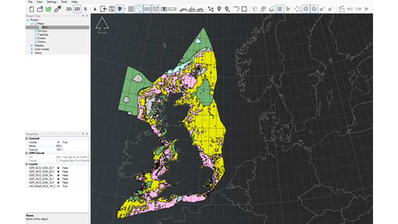
NaviModel with WMS data from British Geological Survey
The examples are courtesy of Equinor, whose Survey and Mapping Specialist Egil Ingebretsen commented:
‘Introducing WMS support in NaviModel bridges the integration gap between traditionally GIS systems. There are hundreds of WMS services available covering infrastructure, geology, environment, etc. This enables the use of in the complete value chains, from desktop studies, survey work planning to integrations of results from GIS databases.’
The new vector map support features have already been introduced to NaviPac 4.2.2, and will be available in NaviModel 4.4 in the next few days. This includes WMS support, as well as S-57 navigation charts from SevenC’s. If you have any questions about the new features, feel free to contact us, or come and see them in action at Oceanology International 2020.