How ViperFish surveyed deep freshwater wrecks and uncovered unexpected magnetic anomalies
Chief Explorer at Promare
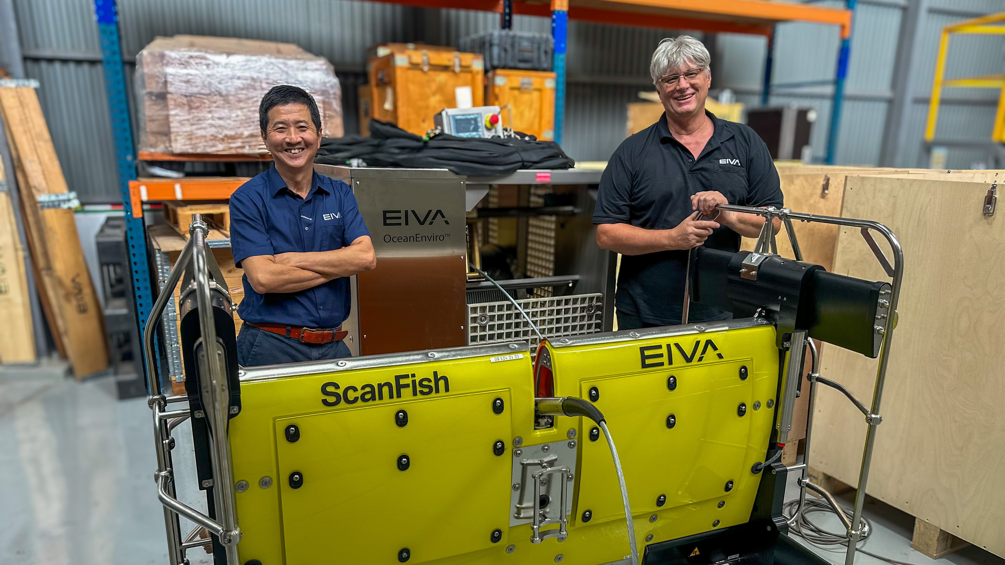
A new lake, a new platform
As part of their ongoing archaeological work in the Telemark Canal in Norway, the team behind the Norsjø project returned to the region to continue their search for historic shipwrecks, believed to date from the late 1800s to early 1900s.
In an earlier phase, they had surveyed one of the canal’s lakes using EIVA’s ScanFish Equinox; this time, they set out to build on those findings by examining a deeper section of the waterway – the Telemark Canal. This canal connects several long, glacial lakes whose freshwater conditions preserve wrecks exceptionally well – making the area ideal for studying the rich history of transported goods transport.
For this next phase, they turned their attention to Norsjø Lake, a deep glacial basin with depths reaching ~170 meters. The team brought in the ViperFish remotely operated towed vehicle (ROTV) as they required:
Multi-sensor capability (multibeam echo sounder, multi-aperture sidescan sonar, magnetometers)
A stable platform for deep or complex subsea environments
The ability to collect high-resolution imagery in steep, complex topography
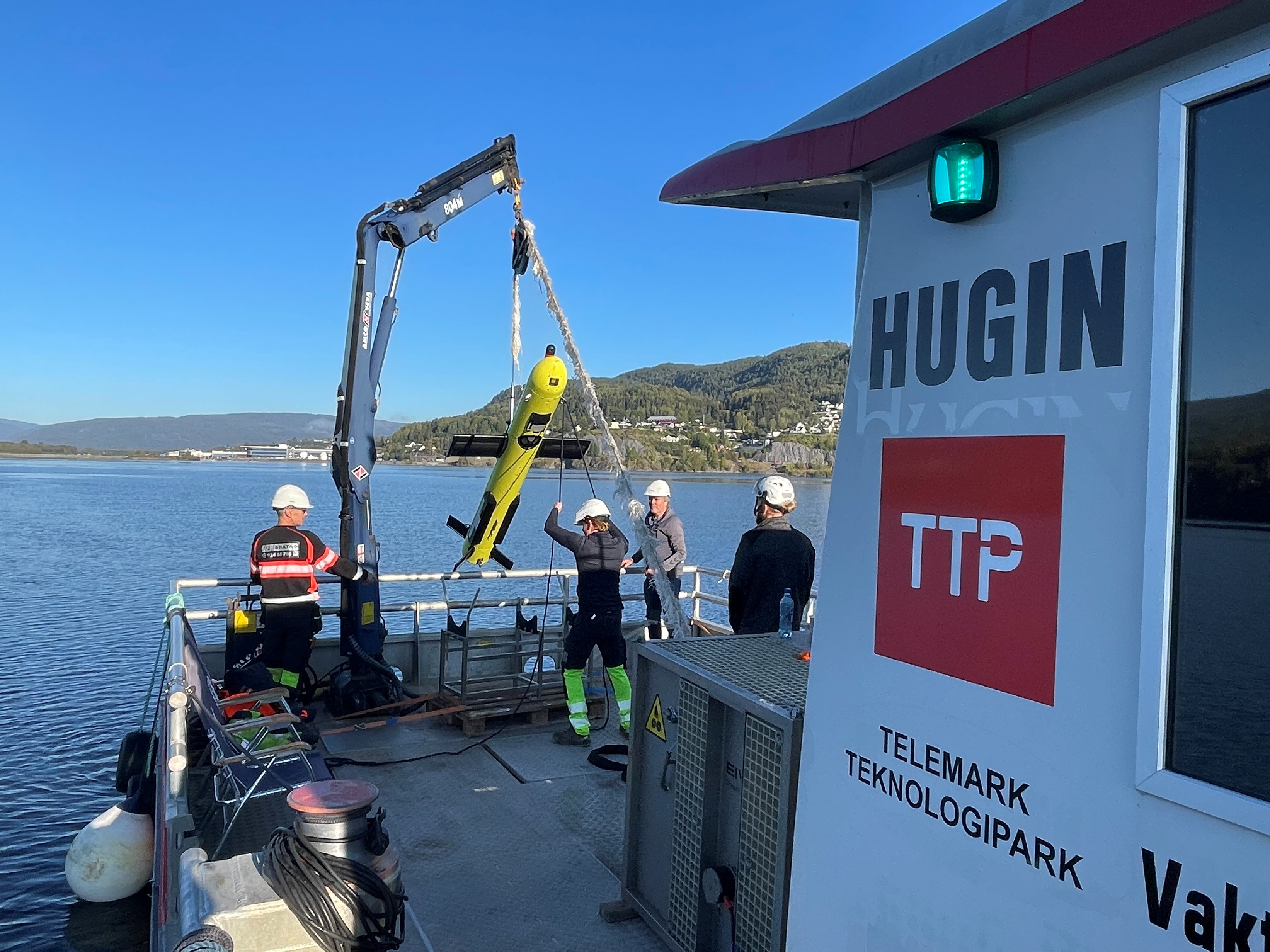
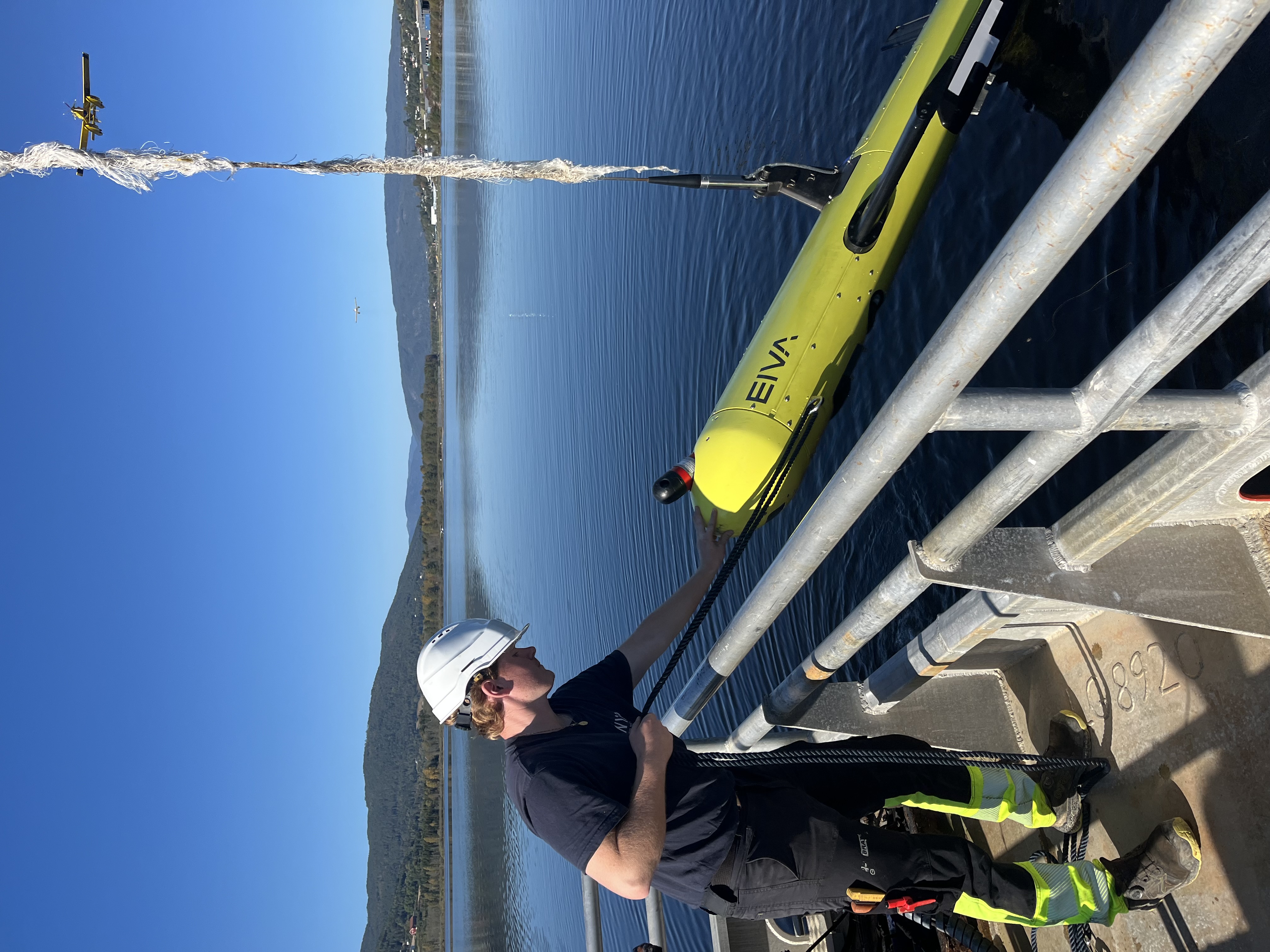
Retrieving the ViperFish from the Hugin vessel
The ViperFish sensor platform: purpose-built for stable, high-accuracy subsea surveys
ViperFish is designed as an all-in-one, high-stability ROTV sensor platform for operations where precise and consistent vehicle control and high-resolution seabed data are essential. With its compact, torpedo-shaped design, minimal drag and fixed attitude, it excels in environments where maintaining a controlled and predictable flight path close to the seabed is critical.
A key capability behind the high-level of precision is the ViperFish’s 3D steering. Unlike traditional towed vehicles that primarily steer horizontally, 3D steering allows the ROTV to adjust its position both horizontally and vertically, actively controlling depth, lateral position and pitch simultaneously. This enables the system to follow complex terrain, maintain a constant altitude above the seabed and execute tight manoeuvres in narrow or obstacle-rich areas – all while keeping its sensor payload at the optimal angle for high-quality data collection.
In other words, its core purpose is to support high-quality data collection in challenging or hard-to-reach areas, whether with a crewed vessel or autonomous USV operations. Integrated with an advanced sensor and positioning suite – including multi-aperture sidescan sonar, a multibeam echo sounder, magnetometers and inertial and USBL systems – it collects a rich, accurately positioned dataset across multiple modalities.
ViperFish brings a high degree of automation – terrain following, obstacle avoidance and automated runline tracking – which reduces operator workload while improving data consistency. Through its tight integration with EIVA’s NaviSuite software, it supports workflows where planning, acquisition and postprocessing are aligned in a single ecosystem.
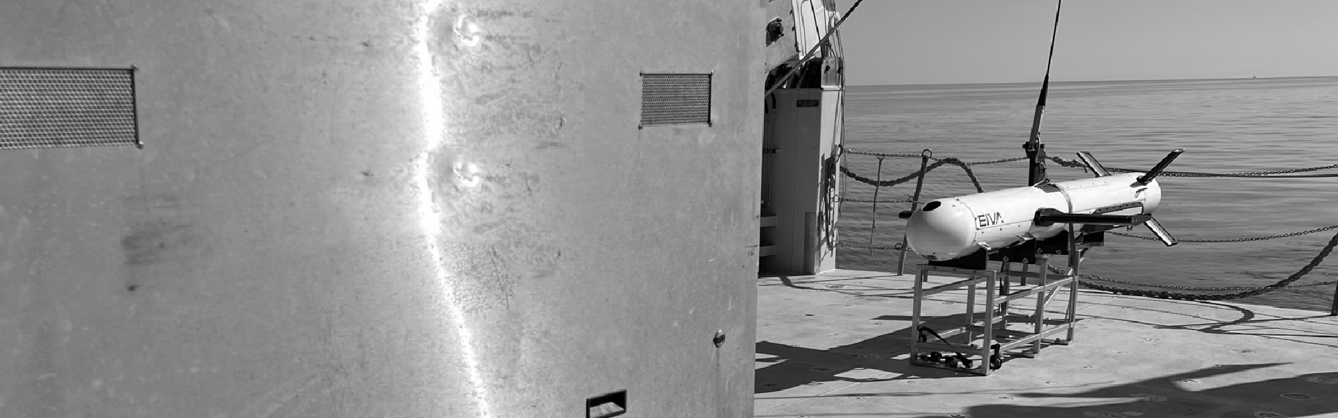
Deploying the ViperFish
Why organisations choose ViperFish over other solutions
Today’s seabed operations increasingly demand a balance of data resolution, endurance, cost control and deployment flexibility. ViperFish is designed to meet these needs:
When high-resolution results matter: The platform’s sensors provide detailed imaging suitable for offshore energy, UXO surveys, cable and pipeline inspections and defence operations.
- When long endurance is essential: Unlike AUVs, ViperFish is not restricted by battery life and can collect data continuously and in real-time.
- When the environment is complex: Operating in narrow, shallow or obstacle‑rich areas is made easier by the platform’s precise 3D steering and stable altitude‑keeping.
- When USV deployment is a priority: ViperFish is designed to be compact and efficient for use on small, crewed vessels as well as fully autonomous platforms – expanding operational windows and reducing costs.
- When buried objects matter: With an integrated magnetometer option, ViperFish adds the ability to detect ferrous targets hidden below the sediment – a capability increasingly relevant for UXO, archaeology and defence.
Together, these advantages make ViperFish a compelling alternative to both AUVs and larger ROTVs, particularly in environments demanding precision and high‑quality data across long survey lines.
Mapping Norway’s largest known boat graveyard
The primary goal of the survey was to locate cultural remains, particularly wooden boat wrecks. Using the ViperFish, the team identified over 30 new wrecks in the Norsjø Lake, adding to the 75 previously discovered in the region. These vessels, typically 4–12 metres long, are believed to date from the late 1800s to early 1900s.
‘We can see even the smallest boat wrecks sitting on the lake floor,’ Fredrik Søreide, Chief Explorer at Promare, explained. ‘The quality of the data was really good, and the positioning was excellent.’
The ViperFish’s high-resolution imagery, precise positioning and real-time data delivery were central to these results, enabling the team to confidently identify targets and assess them immediately during the survey.
It proved easy to handle – particularly when launched from the Hugin vessel, a 12-metre catamaran adapted for survey work. For a small vessel with a limited crew, its straightforward deployment was a significant advantage. Although the team deployed it manually during this project, they noted its strong potential for future autonomous operations.
Sailboat found at a depth of 162 meters in Norsjø with the ViperFish
Magnetic anomalies – showcasing the value of integrated magnetometry
A surprising discovery in a geologically significant area
Beyond the archaeological discoveries, the magnetometer data revealed something unexpected: large negative magnetic anomalies near the centre of the lake. This area corresponds to a submerged caldera – the remnant of an extinct volcano – and lies adjacent to the Fens Field, Europe’s largest known rare earth mineral deposit. ‘Our intention was to look for small cargos of iron ore,’ Fredrik said. ‘But these anomalies are much, much larger than anything like that. I didn’t expect it at all.’
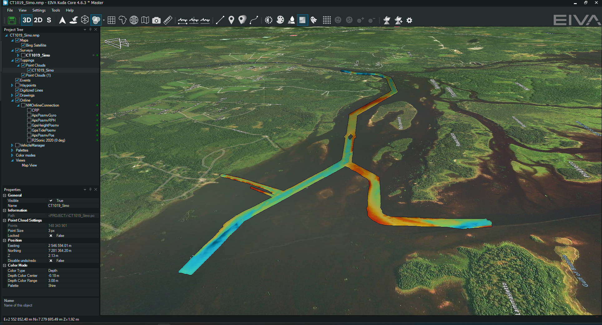
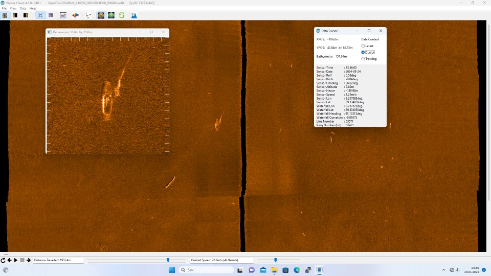
Three anomalies with no corresponding acoustic features
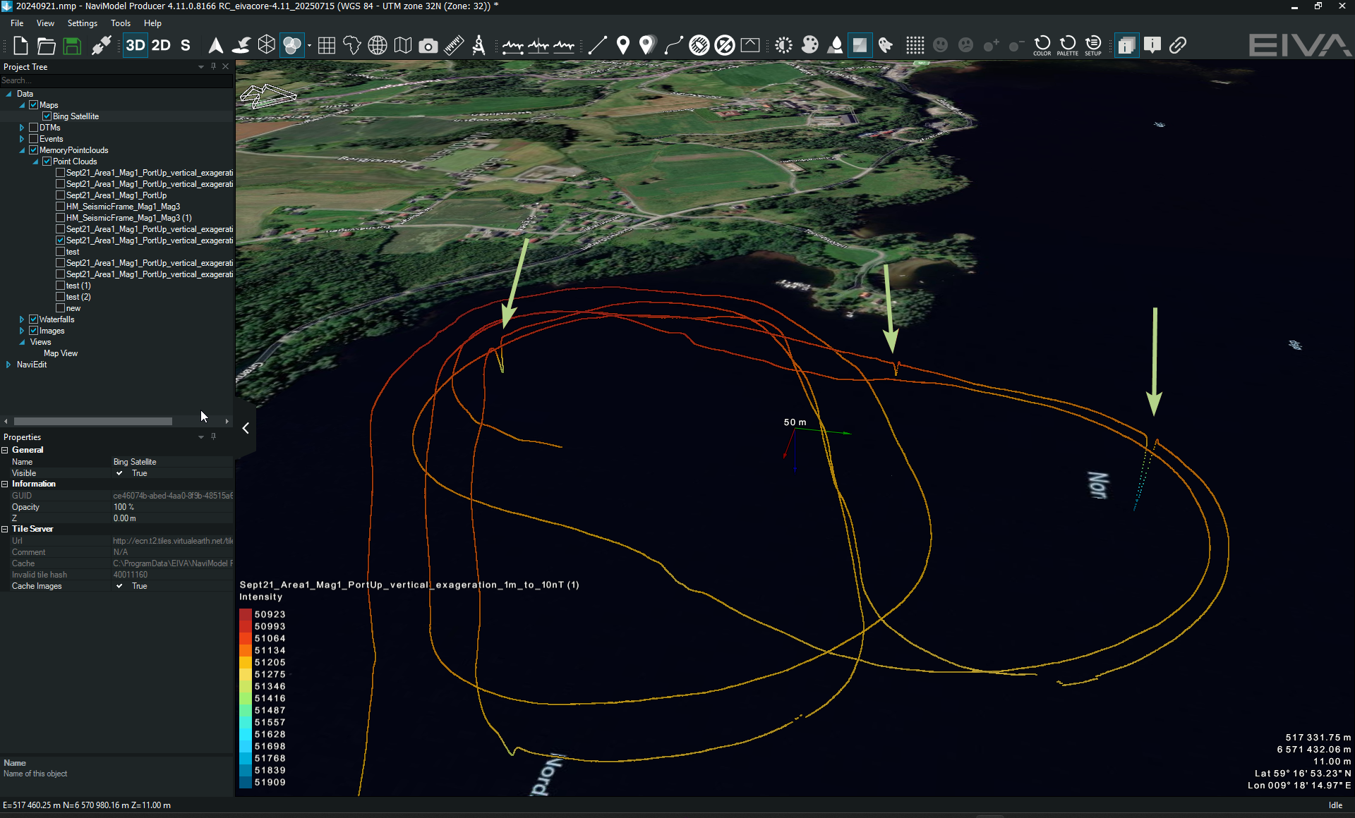
Three distinct magnetic anomalies visualised in NaviModel
During the mission, the ViperFish detected three distinct magnetic anomalies that did not correspond to any visible features in the multibeam or sidescan imagery. Their magnetic signatures suggest they are likely caused by buried iron-rich objects approximately 10 metres or smaller, or by mineralised geological sources beneath the sediment surface. The fact that no seabed features appeared in the acoustic data to explain these readings reinforces the likelihood that these sources lie below the sediment layer.
These findings were unexpected by the survey team, who did not anticipate such clear magnetic responses in this part of the lake. The anomalies illustrate the practical advantage of equipping the ViperFish with magnetometers: submerged or buried targets that are invisible to sonar can still be detected, enabling a deeper understanding of the subsurface environment.
Expanding the role of magnetometry in freshwater surveys
The detection of large negative magnetic anomalies in Norsjø Lake highlights the expanding role of marine magnetometry in freshwater surveys. While typically used to locate ferrous wrecks, advanced sensors can also reveal geological features and mineralised zones. When combined with geological context and expert analysis, magnetometry offers a non-invasive way to identify potential submerged mineral resources – even in complex lake environments.
Together, these results demonstrate the value of ViperFish’s integrated magnetometry suite – not only for identifying ferrous cultural heritage objects or UXO, but also for revealing hidden geological structures that conventional acoustic sensors cannot detect.
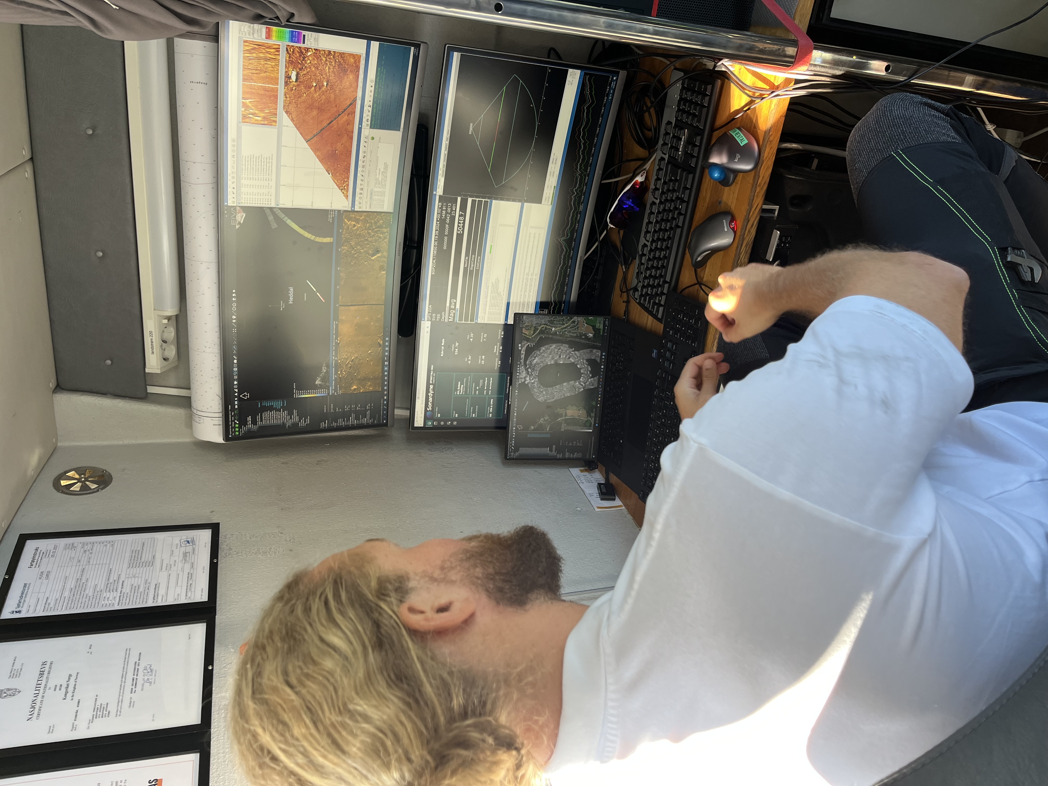
A crew member viewing collected data in NaviModel in real-time
Looking ahead: autonomous potential and future surveys
The findings by the Norsjø Project are being reported to the Norwegian Maritime Museum and the national database of cultural heritage.
With more than 100 wrecks now documented, the Norsjø region is considered Norway’s largest known boat graveyard. The team hopes to continue exploring nearby lakes in future surveys, potentially using autonomous vessels paired with towed systems like ViperFish to extend survey duration and reduce operational costs.
Why ViperFish?
The team gained access to the ViperFish through EIVA’s non-profit partnership programme, and the team expressed strong interest in using it again. Its ability to deliver data in real-time, cover long survey lines, and operate continuously without battery limitations makes it a compelling alternative to AUVs – especially for large-scale, shallow-water surveys.
Products in play
High-resolution payload featuring
Imaging
- Multi-aperture sidescan sonar (MAS) – Wavefront Solstice MAS
- Sound velocity sensor – Valeport miniSVS
- Multibeam echo sounder – R2Sonic 2020
- Magnetometer – OFG RM HyperMag
Positioning
- USBL transponder – Sonardyne WSM 6+ 1K MF Omni Directional Assembly
- INS (inertial navigation system), AHRS (attitude and heading reference system), DVL (doppler velocity log), pressure sensor – all in one – Sonardyne SPRINT-Nav Mini