


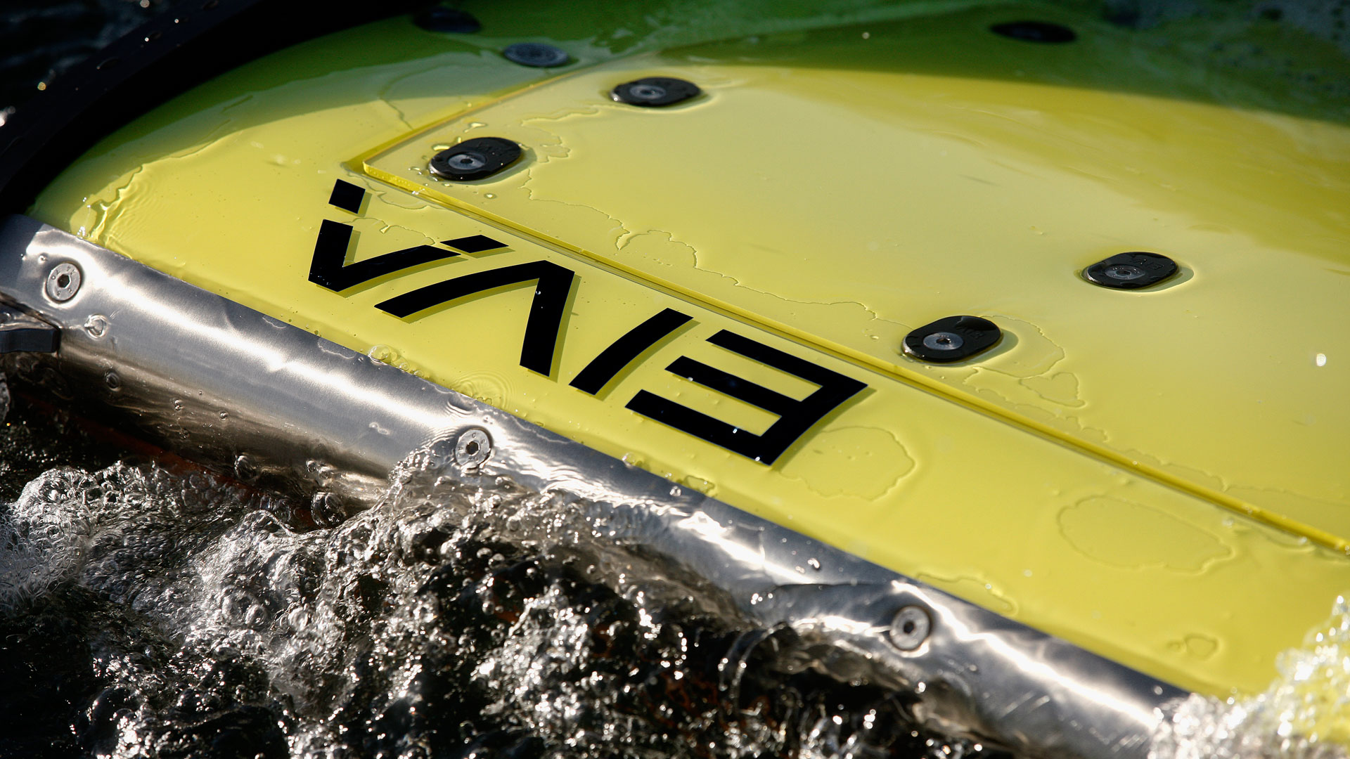
Key features

Cutting a long survey story short: What you get
Diving further into the details of how Equinox will improve your UXO (unexploded ordnance) surveys, MCM (mine-countermeasures) and hydrographic operations.
Cutting a long survey story short: What you get
Diving further into the details of how Equinox will improve your UXO (unexploded ordnance) surveys, MCM (mine-countermeasures) and hydrographic operations
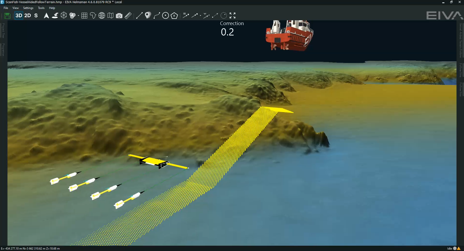
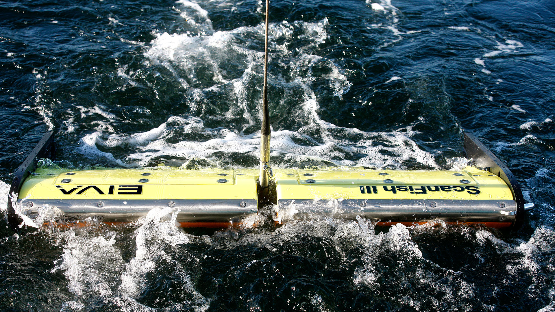
Keep sensors at the sweet spot
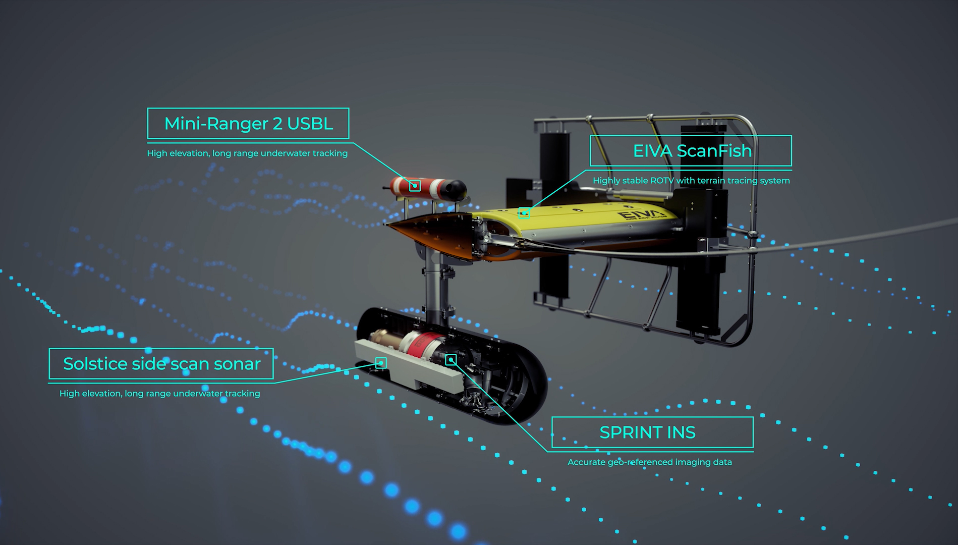
… with the robust, stable ScanFish ROTV platform’s 3D steering capability keeping your ROTV at a fixed height from the seafloor – this trusted ROTV is used for UXO surveys around the world
Easy mobilisation and maintenance
… thanks to a total weight of 220 kg in air. This solution uses proven components that can be easily maintained.
Training opportunities
… through existing training programmes EIVA provides for the community of existing users, such as ScanFish operator courses
Afford stunningly accurate visualisations
… since unlike towed Synthetic Aperture Sonar (SAS) systems, Equinox offers an affordable lower-logistics alternative still capable of providing high area coverage rates
Accurate geo-referencing
… by combining leading navigation and positioning using Sonardyne’s Mini-Ranger 2 USBL and SPRINT INS, imaging data is geo-referenced with an accuracy that’s unrivalled for these types of applications at this price
Easy survey planning
… by using NaviSuite Kuda software to define your sailing route and runlines – which is as simple as selecting the area you would like to survey
Review data while it is being gathered (so it can be used in the next stage of the survey)
… by monitoring NaviSuite Kuda’s real-time data displays during operations – the software continuously updates the vessel and ScanFish 3D position data, as well as processing and visualising Solstice data
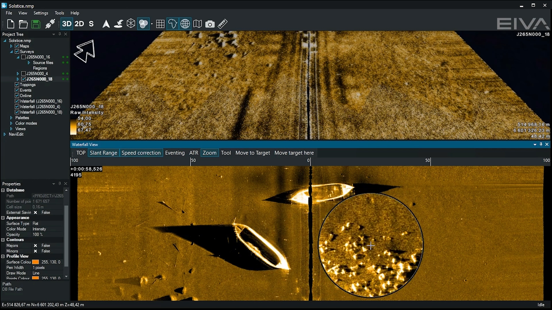
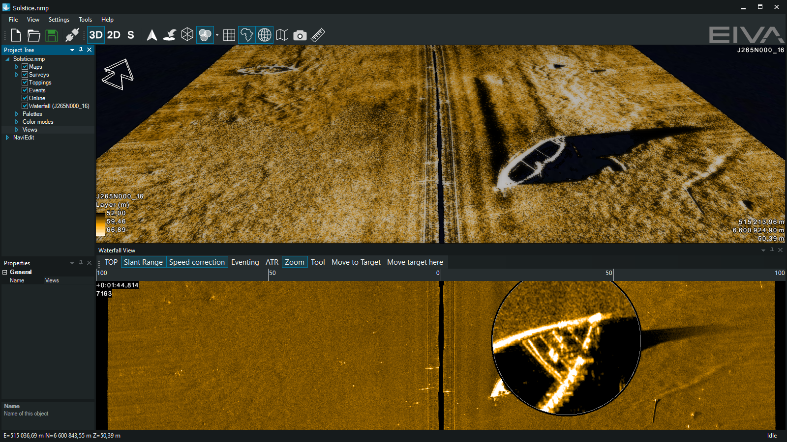
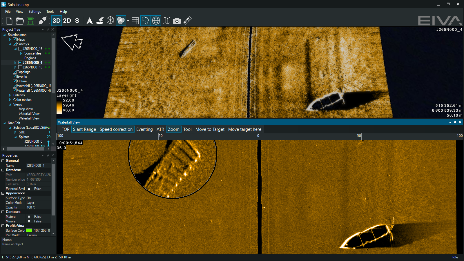
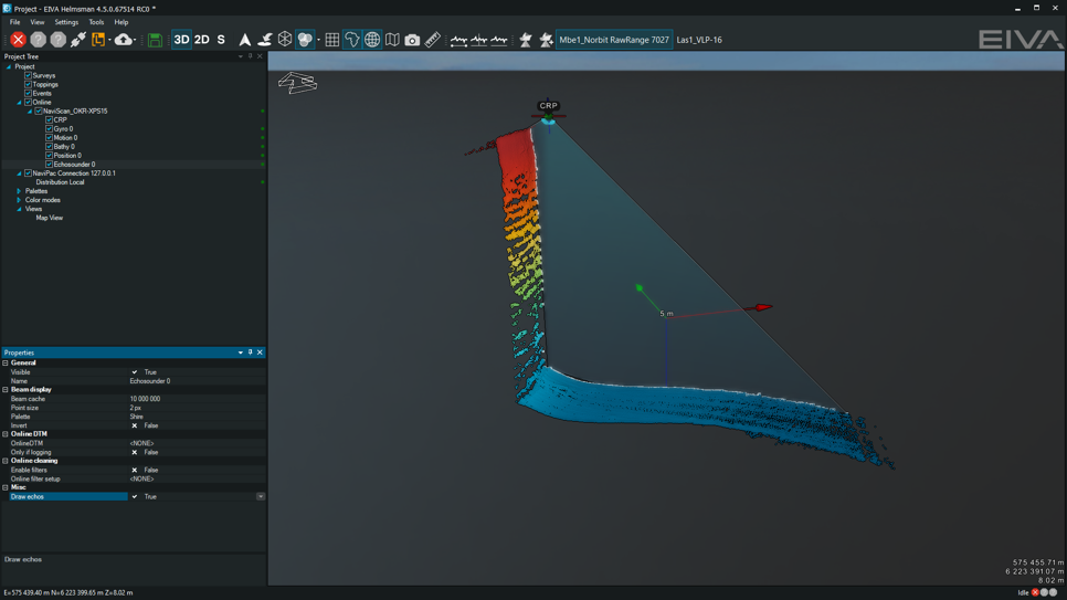
Visualise and analyse data
… with real-time geo-rectified waterfalls, mosaics and DTM maps – as well as user interface tools to mark and process objects, including automatic target recognition (ATR) using AI
Significant payload capacity
… with the large capacity of the ScanFish ROTV, as well as room in the fibre cable to include additional payload sensors such as gap fillers
-
Optional extras
ScanFish ROTV platform integrated with industry-leading commercial off-the-shelf components.
Optional extras of the Equinox system solution
Optional extras – according to daily rates
ScanFish & NaviSuite mobilisation support & onsite training
Solstice mobilisation support & onsite training
Extra subsea MUX for ScanFish
incl cablesMini-Ranger 2 with WSM 6+ and charger
-
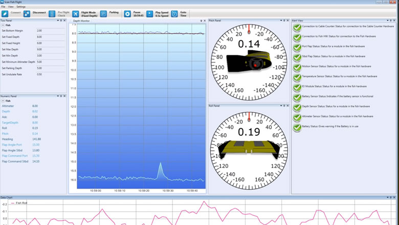
User-friendly control and monitoring software solution
All ScanFish models come with the ScanFish Flight software, which is an easy-to-use software system allowing for control and monitoring of the ROTV.
User-friendly control and monitoring software solution
All ScanFish models come with the ScanFish Flight software, which is an easy-to-use software system allowing for control and monitoring of the ROTV.
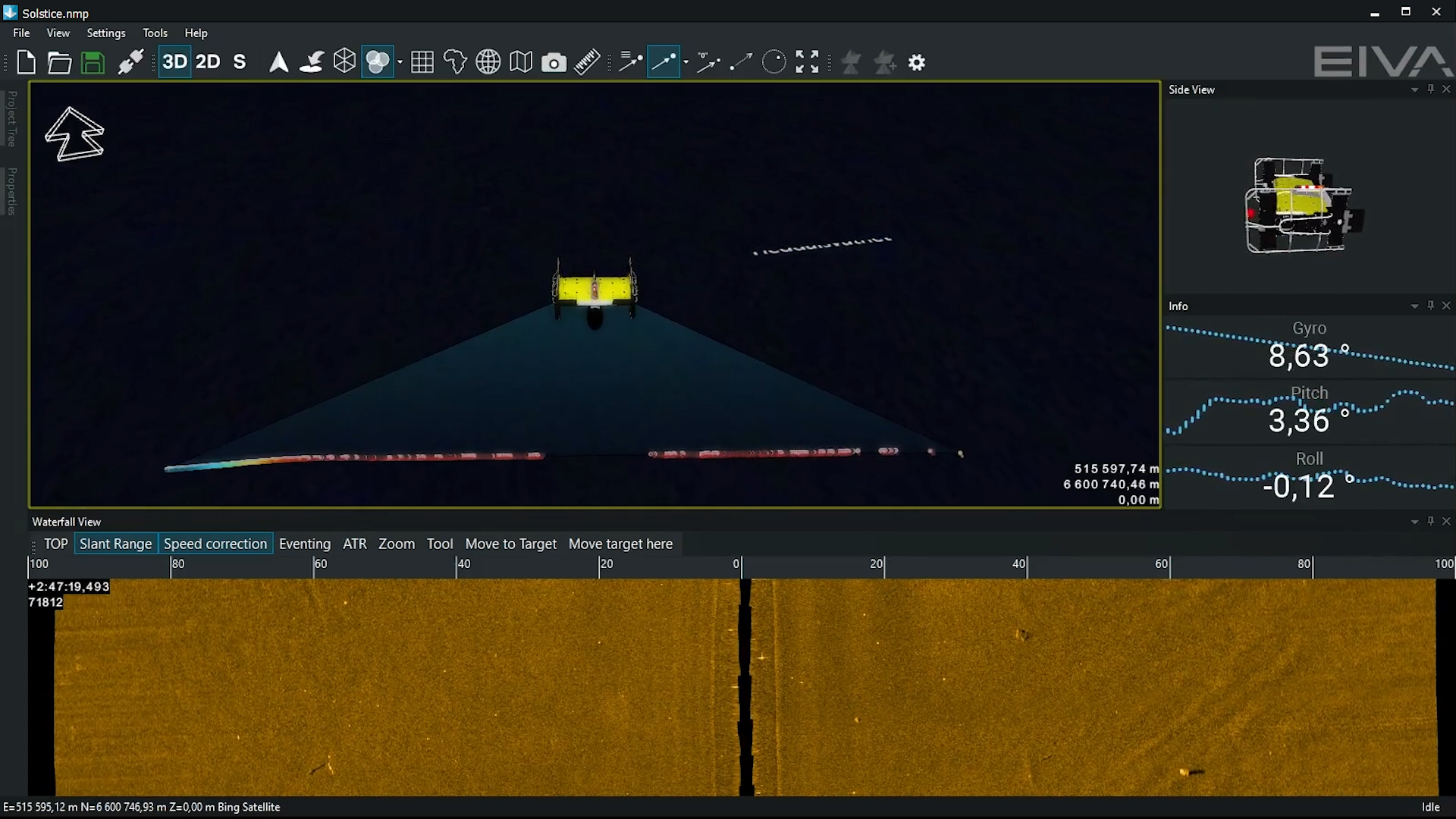
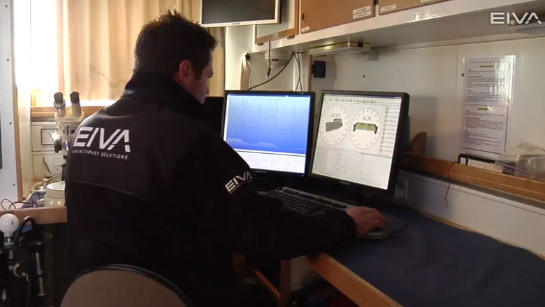
Controlling the ROTV's movements in ScanFish III Flight software
Only a minimum of training is required to prepare the crew to operate the ROTV, which means you will be ready to set sail within a short period of time. Moreover, there is no risk of wasting time on difficulties resulting from a complicated software user interface.
Via the intuitive interface of ScanFish Flight, you are in complete control of the position of the ROTV by defining its height compared to the seabed. At the same time, you can monitor its position in the water, and an alert panel will warn you of any irregularities.
ScanFish III Flight in action
On-site calibration
A pre-flight feature allows for testing and calibration of the ScanFish ROTV on-site prior to deployment, promising you the highest possible performance and data quality.
Recording of flight data
Acquired ROTV data can be analysed by means of a flight recording feature. It enables you to play back all flights and, for example, quickly locate the cause of any irregularities, thus enhancing the quality of your results and saving survey time.
Automatic control of winch
ScanFish Flight can be set up to control the winch towing the ScanFish ROTV, thereby ensuring an optimal cable length adjusted to the movements of the ROTV. This is especially relevant for the ScanFish Rocio models.
-
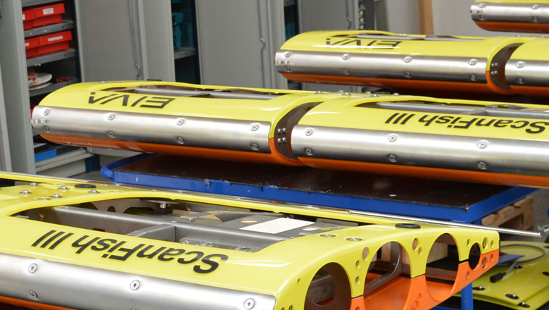
Robust product with a long service life
The practical design of the ScanFish models makes them so robust that they can be deployed in rough weather.
Robust product with a long service life
Quality materials and easily replaced wear parts characterise the ScanFish range and contribute to a high ROI through a long service life
The practical design of the ScanFish models makes them so robust that they can be deployed in rough weather. This saves time as the risk of downtime is vastly reduced. Two side plates with bars, which also function as handles, protect the body and facilitate handling, thus reducing the risks posed to the ROTV in the water and ensuring the safety of the crew during deployment and recovery.
-
Autonomy tools
Perform autonomous operations with tools to automate your survey every step of the way – from survey route planning to remote controlled, autopilot operations.
Features enabling autonomous operations
NaviSuite Kuda enables autonomous operations with tools to automate your survey every step of the way – from survey route planning to remote controlled, autopilot operations. Dive into how…
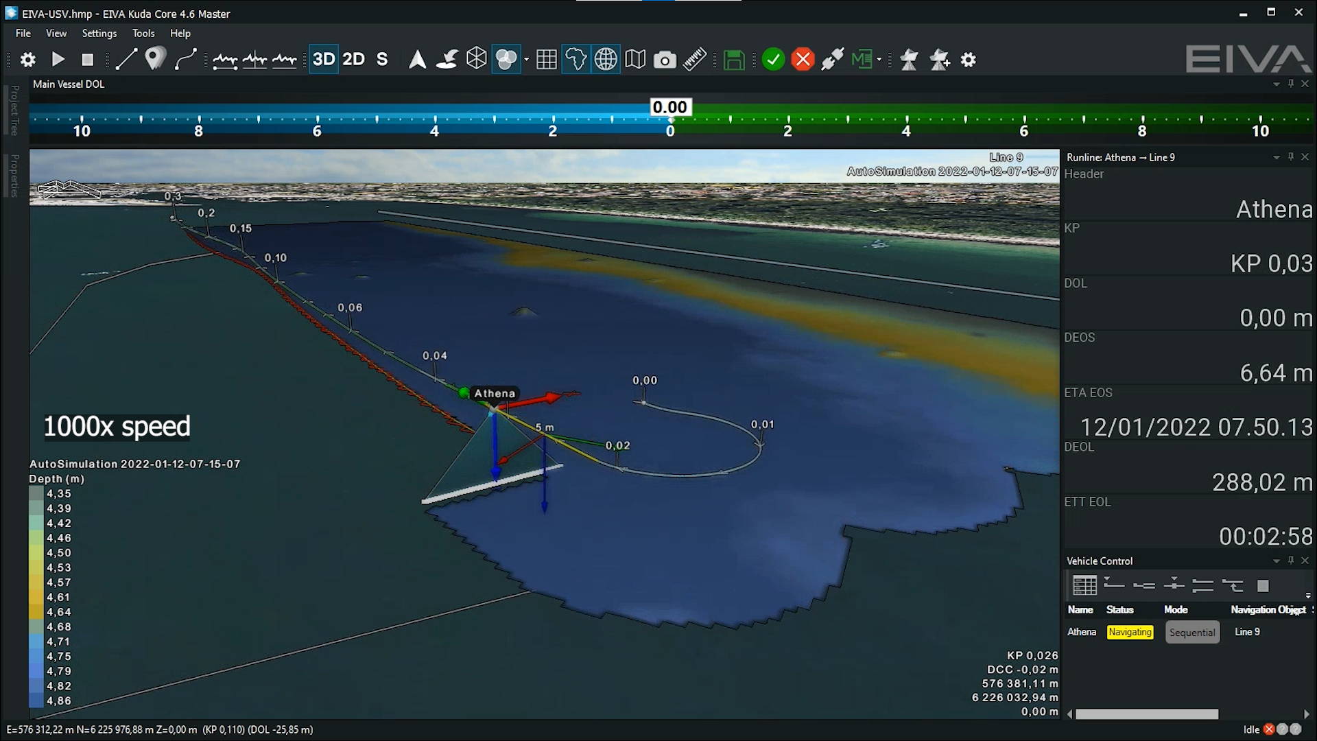
Automatic survey route planning tools
Ensure efficient coverage during surveys with tools for survey route planning. These intuitive tools help ensure your survey is performed optimally – through highly customisable and automated route planning.
Onboard automatic route planning during surveys
Conditions such as the weather can influence your coverage during a survey. In order to adapt to such factors, you can use the Coverage Assist tool, which plans runlines in real-time during the survey. Each time it creates a runline, it considers the previous surveyed line, as well as the optimal route for turning. This saves you time as it makes decisions onboard the vessel in real-time.
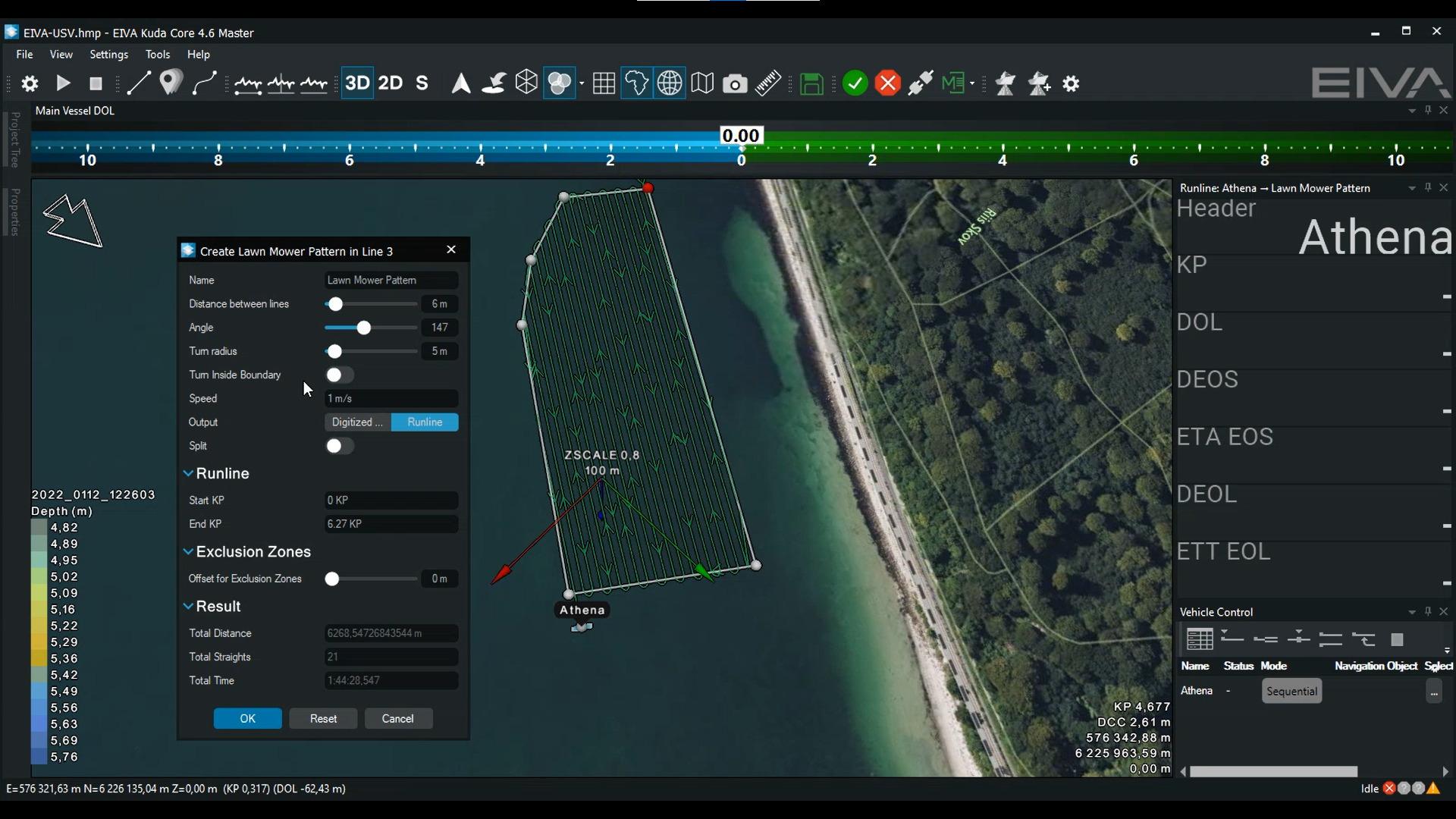
Autopilot route planning by defining a boundary
The vehicle route can be automatically created before a survey, based on a boundary. If your vessel has an NMEA autopilot, you can export route plans from NaviSuite to the onboard piloting system.
You can design the lawn mower type pattern depending on the desired spacing and orientation. You can also create an exclusion zone within the boundary.
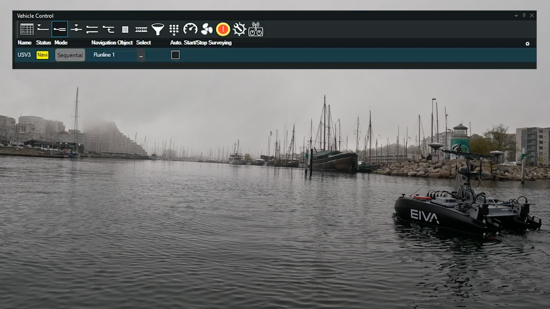
Autopilot total solution for safe and optimised surveys
To ensure centimetre precision line-keeping and safer operations, you can equip your vessel with the NaviSuite Kuda – Autopilot. This autopilot enables extensive USV control in NaviSuite Kuda, for example precise line-keeping in sharp turns and a hold position capability, as well as allowing you to monitor your thrusters and easily switch between manual and automated steering.
In addition, this total solution provides many precise vehicle control features. Users can for example increase safety of autopilot operations – by defining emergency stop settings, as well as quickly taking manual control. Users can also improve the quality of data by adjusting the vehicle’s speed (while the survey is running on autopilot) if real-time collected data shows that the speed should be changed, for example decreasing the speed due to seeing holes in the real-time QC displays of collected data.
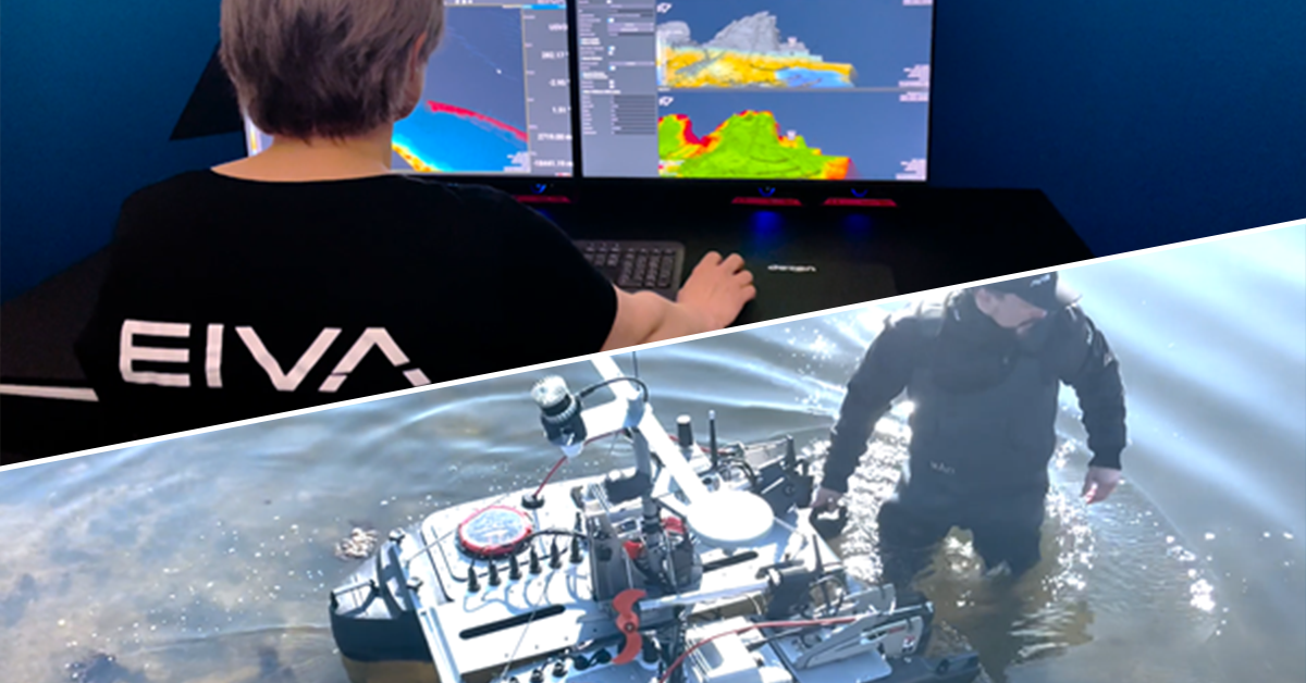
Remote control from anywhere in the world
NaviSuite software enables you to operate control systems from anywhere in the world.
Remote control even at low bandwidth
One of the challenges to remote control is low data bandwidth. With NaviSuite you can overcome this in several ways…
Live data compression
You can compress survey data in many ways to ensure uninterrupted signal. NaviSuite compression tools work on multi-beam echosounder, sidescan, laser and forward-looking sonar data.
The settings you can adjust include Along, which allows you to skip scans. As well as Across, which reduces the points across the scan, and analyses points with respect to depth change to then keep more points where there are areas of change.
Pre-plan autonomous underwater vehicle (AUV) operations
NaviSuite lets you remotely control an AUV without requiring constant connection. You can send small mission updates to your AUV, requiring only one good link moment to input your instructions – for example to go at a certain depth, pitch and heading. This capability means that no matter if the connection fails, the AUV will follow the directions you input in your latest mission update.

Specifications
- Operational depth rating
- 300 m
- Swath
- 200 m
- Bathymetry
- Yes
- Output formats
- .SWF8 and .XTF
- Target position accuracy
- Better than 1 m (DRMS)
- Pitch and roll stabilisation
- Auto
- Altitude following
- Auto (Fixed 7.5 metres from seafloor)
- Survey speeds
- 3-6 Knots
- Typical tether out
- Constant at 3-5 x depth (depending on the environment)
- Fibre telemetry
- 1 Gb/s
- Payload
- Other sensors can also be mounted
- Software
- NaviSuite Kuda Pro + Processing
- CAD/CAC
- NaviSuite Deep Learning
- Dimensions (length x width x height)
- 1210 x 1858 x 1049 mm
- Weight in air/water
- 220/73 kg
Related products
-
ViperFish
ViperFish is an ROTV total solution for high-resolution imaging – Autonomous USV operations – Survey narrow, hard to reach areas
-
ScanFish Tropheus 3D
The ScanFish Tropheus 3D is a terrain-following ROTV specially designed for UXO detection with EdgeTech 4205 sidescan sonar. 3D steering lets you precisely control the flight path both vertically and horizontally.
-
OceanEnviro 10.4
The OceanEnviroTM 10.4 is a high-quality and cost-effective electrical winch for deployment of oceanographic and hydrographic equipment.
-
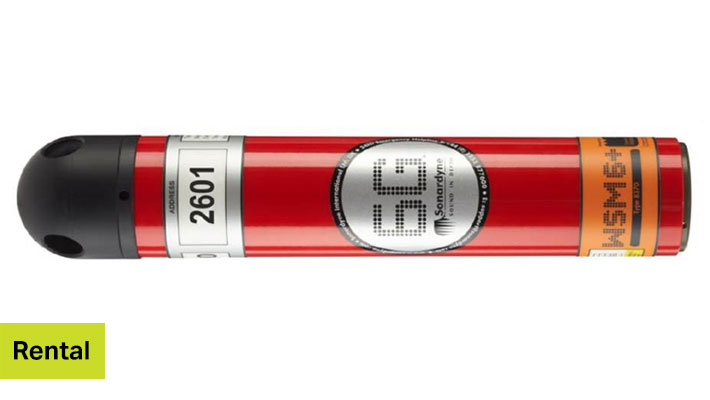
WSM6+ 1k Omni transponder
The Wideband Sub-Mini 6 Plus (WSM 6+) is Sonardyne’s latest generation of versatile USBL transponders/responders that support Wideband®2 signals.


How to rent equipment from EIVA
We would be happy to help you – reach out if you have any questions about our rental products.