To use this site, please enable javascript
To use this site, please enable javascript
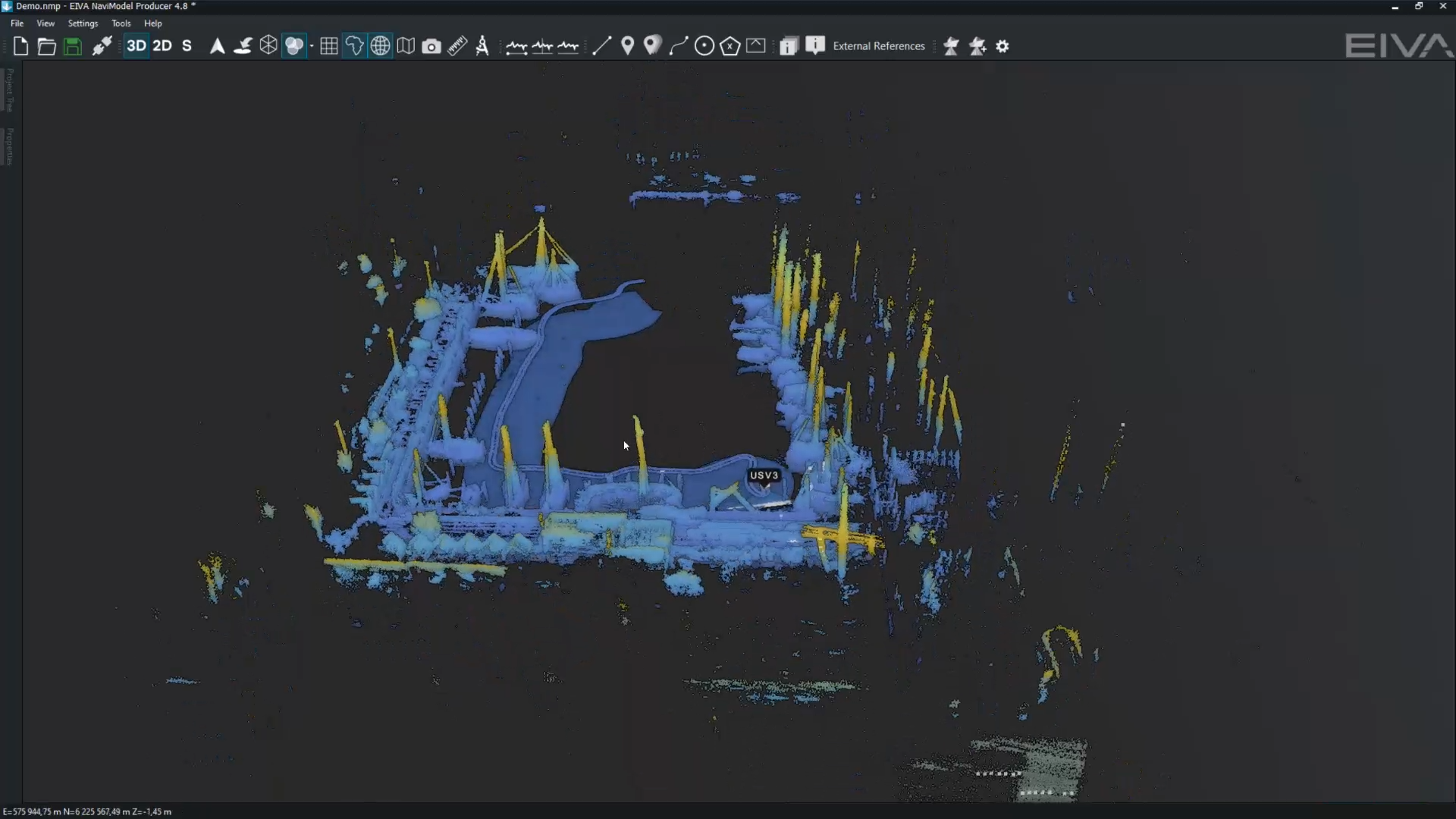
We are thrilled to report that our free NaviModel Viewer software has been downloaded over 1,000 times from our website in just the last two years!
NaviModel Viewer enables users to easily produce intuitive and functional visualisations of any type of laser or sonar XYZ terrain data. It was made freely available for eiva.com visitors in order to bring the multitude of benefits provided by this tool to as many maritime professionals as possible.
With the ability to flexibly adjust visualisation settings over multiple parameters, display models with external data from a variety of sources including 3D models, CAD objects, GIS and LAS datasets, maps and much more, EIVA’s NaviModel Viewer empowers you to create engaging and highly dynamic fly-through videos of your 3D data.
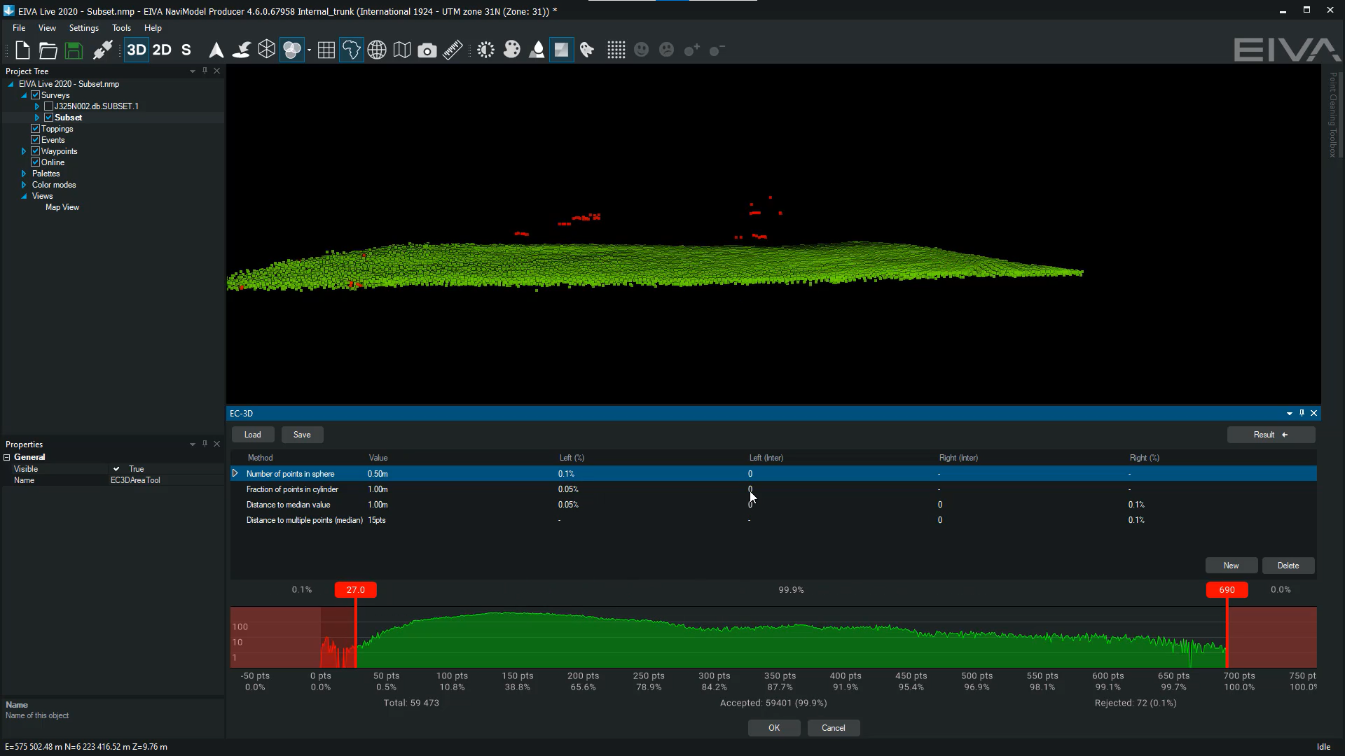
Beyond visualisation, NaviModel Viewer also offers a selection of tools for analysis, including distance measurement.
Of course NaviModel Viewer provides only a sample of the features found in the complete, and far more powerful, NaviModel package via the NaviModel Analyser and NaviModel Producer products. These offer a full range of possibilities — including modelling, manipulation and analyses of high-performance digital terrain data in 2D, 3D and 4D.
At this milestone, we’re proud to say that the NaviModel Viewer remains available without charge. So if you’re curious about what it could do for you, your colleagues and your work, then head over to the NaviModel Viewer page at eiva.com to learn more and download the software.
Don’t forget that NaviModel Free Viewer isn’t the only tool that EIVA provides without charge.
We’re also pleased to offer the NaviPlot Free Chart Production module at no cost — enabling easy and professional display of offshore and shallow-water survey data on paper charts. With NaviPlot, users can look forward to more efficient production of printed charts without compromise.
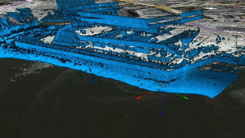
Before you go, take a look at the waterfront developments of Aarhus using NaviModel Viewer in the video below.
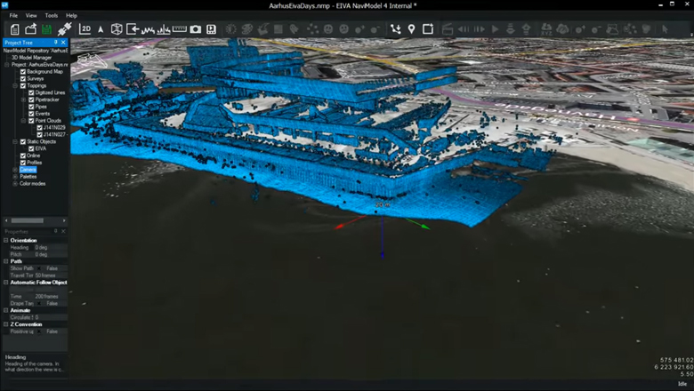
Waterfront developments of Aarhus visualised in NaviModel Viewer